Area Overview for SO16 8AL
Photos of SO16 8AL
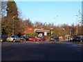
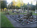
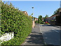
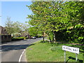
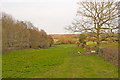
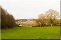
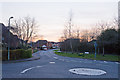
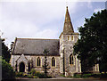
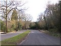
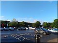

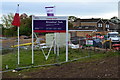
68 photos from this area
Area Information
Key information about the SO16 8AL including its size, population, and administrative classification.
- Area Type
- Postcode
- Area Size
- 28.4 hectares
- Population
- 1474
- Population Density
- 1429 people/km²
House Prices in SO16 8AL
59
Properties
£302,500
Average Sold Price
£185,000
Lowest Price
£420,000
Highest Price
Showing 59 properties
| Address | Type | Beds | Baths | Last Sale Price | Last Sale Date | |
|---|---|---|---|---|---|---|
| Ivydene Cottage, Upper Toothill Road, Rownhams, SO16 8AL | Detached | 4 | 1 | £420,000 | Feb 2021 | |
| The Paddock, Upper Toothill Road, Rownhams, SO16 8AL | Detached | - | - | £185,000 | Oct 1996 | |
| 21, Rownhams Park, Upper Toothill Road, Rownhams, SO16 8AL | Mobile Home | 1 | 1 | - | - | |
| 38, Rownhams Park, Upper Toothill Road, Rownhams, SO16 8AL | Mobile Home | 2 | 1 | - | - | |
| 19, Rownhams Park, Upper Toothill Road, Rownhams, SO16 8AL | Mobile Home | 2 | 1 | - | - | |
| 42, Rownhams Park, Upper Toothill Road, Rownhams, SO16 8AL | Mobile Home | 2 | 1 | - | - | |
| 16, Rownhams Park, Upper Toothill Road, Rownhams, SO16 8AL | Mobile Home | 2 | 1 | - | - | |
| 40, The Den, Rownhams Park, Upper Toothill Road, Rownhams, SO16 8AL | Mobile Home | 1 | 1 | - | - | |
| 55, Rownhams Park, Upper Toothill Road, Rownhams, SO16 8AL | Mobile Home | 2 | 1 | - | - | |
| Heatherdene, Upper Toothill Road, Rownhams, SO16 8AL | Retail | 1 | 1 | - | - |
Page 1 of 6
Energy Efficiency in SO16 8AL
Amenities
Schools
| Rank | School | Type | Entry gender | Ages |
|---|
Explore more schools in this area
Go to Schools tabDemographics
Household Size
Two person
most common
Accommodation Type
Houses
most common
Tenure
91
majority
Ethnic Group
White
most common
Religion
N/A
most common
Household Composition
N/A
most common
Age
47
median
Adults (30-64 years)
most common
Household Deprivation
N/A
with no deprivation
NS-SEC
42
in Lower managerial occupations
Explore more demographic insights in this area
Go to Demographics tabPlanning
Planning Constraints
- Flood RiskPremium
- Ramsar Wetland SitesPremium
- Area of Outstanding Natural BeautyPremium
- Protected Nature ReservePremium
- Protected WoodlandPremium