Area Overview for SO16 8AG
Photos of SO16 8AG
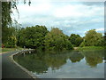
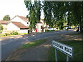
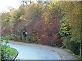
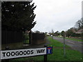
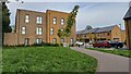
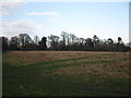
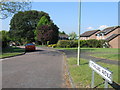
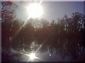
32 photos from this area
Area Information
Key information about the SO16 8AG including its size, population, and administrative classification.
- Area Type
- Postcode
- Area Size
- 1.8 hectares
- Population
- 1416
- Population Density
- 4103 people/km²
House Prices in SO16 8AG
13
Properties
£359,389
Average Sold Price
£135,000
Lowest Price
£600,000
Highest Price
Showing 13 properties
| Address | Type | Beds | Baths | Last Sale Price | Last Sale Date | |
|---|---|---|---|---|---|---|
| 55 Horns Drove, Rownhams, SO16 8AG | Detached | 3 | - | £600,000 | Oct 2017 | |
| 57 Horns Drove, Rownhams, SO16 8AG | Detached | 4 | - | £520,000 | Feb 2017 | |
| 43 Horns Drove, Rownhams, SO16 8AG | Detached | 3 | 1 | £485,000 | Jul 2016 | |
| 35 Horns Drove, Rownhams, SO16 8AG | Detached | - | - | £308,500 | Oct 2005 | |
| 37 Horns Drove, Rownhams, SO16 8AG | Detached | 4 | 2 | £295,000 | Oct 2005 | |
| 41 Horns Drove, Rownhams, SO16 8AG | Detached | - | - | £310,000 | Sep 2005 | |
| Squirrels, 33 Horns Drove, Rownhams, SO16 8AG | Detached | - | - | £411,000 | Aug 2004 | |
| Pygmalion, 51 Horns Drove, Rownhams, SO16 8AG | Bungalow | - | - | £170,000 | May 2001 | |
| 53 Horns Drove, Rownhams, SO16 8AG | Detached | 3 | 2 | £135,000 | Mar 1998 | |
| 49 Horns Drove, Rownhams, SO16 8AG | Detached | 3 | 2 | - | - |
Page 1 of 2
Energy Efficiency in SO16 8AG
Amenities
Schools
| Rank | School | Type | Entry gender | Ages |
|---|
Explore more schools in this area
Go to Schools tabDemographics
Household Size
Two person
most common
Accommodation Type
Houses
most common
Tenure
91
majority
Ethnic Group
White
most common
Religion
N/A
most common
Household Composition
N/A
most common
Age
47
median
Adults (30-64 years)
most common
Household Deprivation
N/A
with no deprivation
NS-SEC
45
in Lower managerial occupations
Explore more demographic insights in this area
Go to Demographics tabPlanning
Planning Constraints
- Flood RiskPremium
- Ramsar Wetland SitesPremium
- Area of Outstanding Natural BeautyPremium
- Protected Nature ReservePremium
- Protected WoodlandPremium