Area Overview for SO16 8AY
Photos of SO16 8AY
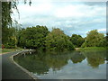
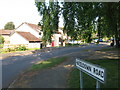
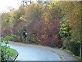
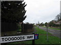
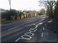
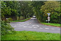
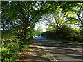
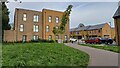
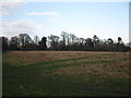
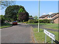
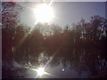
32 photos from this area
Area Information
Key information about the SO16 8AY including its size, population, and administrative classification.
- Area Type
- Postcode
- Area Size
- 4.7 hectares
- Population
- 1416
- Population Density
- 4103 people/km²
House Prices in SO16 8AY
79
Properties
£276,017
Average Sold Price
£84,000
Lowest Price
£728,000
Highest Price
Showing 79 properties
| Address | Type | Beds | Baths | Last Sale Price | Last Sale Date | |
|---|---|---|---|---|---|---|
| 61 Nutshalling Avenue, Rownhams, SO16 8AY | Detached | 5 | 3 | £728,000 | Jun 2025 | |
| 52 Nutshalling Avenue, Rownhams, SO16 8AY | house | 3 | - | £275,000 | Apr 2025 | |
| 52A Nutshalling Avenue, Rownhams, SO16 8AY | house | 3 | 2 | £330,000 | Jan 2025 | |
| 56 Nutshalling Avenue, Rownhams, SO16 8AY | house | 2 | 1 | £295,000 | Nov 2024 | |
| 57 Nutshalling Avenue, Rownhams, SO16 8AY | house | 3 | - | £356,000 | Aug 2024 | |
| 99 Nutshalling Avenue, Rownhams, SO16 8AY | house | - | - | £540,000 | Jun 2023 | |
| 71 Nutshalling Avenue, Rownhams, SO16 8AY | house | - | - | £470,000 | Jun 2023 | |
| 22 Nutshalling Avenue, Rownhams, SO16 8AY | Semi-detached | 3 | 1 | £310,000 | Apr 2021 | |
| 81 Nutshalling Avenue, Rownhams, SO16 8AY | Semi-detached | 3 | 1 | £280,000 | Sep 2020 | |
| 11 Nutshalling Avenue, Rownhams, SO16 8AY | house | 4 | - | £335,000 | Aug 2020 |
Page 1 of 8
Energy Efficiency in SO16 8AY
Amenities
Schools
| Rank | School | Type | Entry gender | Ages |
|---|
Explore more schools in this area
Go to Schools tabDemographics
Household Size
Two person
most common
Accommodation Type
Houses
most common
Tenure
91
majority
Ethnic Group
White
most common
Religion
N/A
most common
Household Composition
N/A
most common
Age
47
median
Adults (30-64 years)
most common
Household Deprivation
N/A
with no deprivation
NS-SEC
45
in Lower managerial occupations
Explore more demographic insights in this area
Go to Demographics tabPlanning
Planning Constraints
- Flood RiskPremium
- Ramsar Wetland SitesPremium
- Area of Outstanding Natural BeautyPremium
- Protected Nature ReservePremium
- Protected WoodlandPremium