Area Overview for SM7 1EB
Photos of SM7 1EB
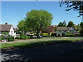
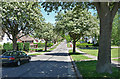
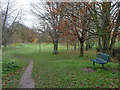
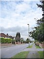
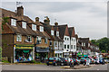
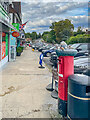


27 photos from this area
Area Information
Key information about the SM7 1EB including its size, population, and administrative classification.
- Area Type
- Postcode
- Area Size
- 9023 m²
- Population
- 1611
- Population Density
- 1622 people/km²
House Prices in SM7 1EB
8
Properties
£640,690
Average Sold Price
£404,000
Lowest Price
£925,000
Highest Price
Showing 8 properties
| Address | Type | Beds | Baths | Last Sale Price | Last Sale Date | |
|---|---|---|---|---|---|---|
| 32 Beacon Way, Banstead, SM7 1EB | Bungalow | 4 | 2 | £743,000 | Feb 2019 | |
| 24 Beacon Way, Banstead, SM7 1EB | Detached | 4 | 2 | £925,000 | Sep 2018 | |
| 30 Beacon Way, Banstead, SM7 1EB | Bungalow | 3 | 2 | £676,450 | Feb 2016 | |
| Sheraton Lodge, 22B Beacon Way, Banstead, SM7 1EB | Detached | - | - | £455,000 | Feb 2004 | |
| 34 Beacon Way, Banstead, SM7 1EB | Detached | - | - | £404,000 | Feb 2004 | |
| 26 Beacon Way, Banstead, SM7 1EB | Detached | 5 | - | - | - | |
| 36 Beacon Way, Banstead, SM7 1EB | Detached | - | - | - | - | |
| 28 Beacon Way, Banstead, SM7 1EB | Detached | - | - | - | - |
Energy Efficiency in SM7 1EB
Amenities
Schools
| Rank | School | Type | Entry gender | Ages |
|---|
Explore more schools in this area
Go to Schools tabDemographics
Household Size
Family (3-5 people)
most common
Accommodation Type
Houses
most common
Tenure
77
majority
Ethnic Group
White
most common
Religion
N/A
most common
Household Composition
N/A
most common
Age
47
median
Adults (30-64 years)
most common
Household Deprivation
N/A
with no deprivation
NS-SEC
47
in Lower managerial occupations
Explore more demographic insights in this area
Go to Demographics tabPlanning
Planning Constraints
- Flood RiskPremium
- Ramsar Wetland SitesPremium
- Area of Outstanding Natural BeautyPremium
- Protected Nature ReservePremium
- Protected WoodlandPremium