Area Overview for SL7 3DJ
Photos of SL7 3DJ


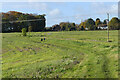

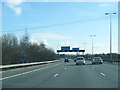

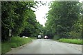
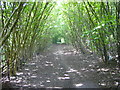

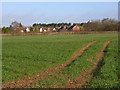
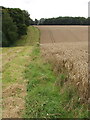
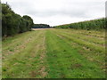
22 photos from this area
Area Information
Key information about the SL7 3DJ including its size, population, and administrative classification.
- Area Type
- Postcode
- Area Size
- 62.6 hectares
- Population
- 1576
- Population Density
- 321 people/km²
House Prices in SL7 3DJ
12
Properties
£545,800
Average Sold Price
£375,000
Lowest Price
£810,000
Highest Price
Showing 12 properties
| Address | Type | Beds | Baths | Last Sale Price | Last Sale Date | |
|---|---|---|---|---|---|---|
| Revola, Clay Lane, Booker, SL7 3DJ | Bungalow | - | - | £810,000 | May 2022 | |
| Bay Tree Cottage, Clay Lane, Booker, SL7 3DJ | house | - | - | £645,000 | Apr 2021 | |
| Apple Orchard Cottage, Clay Lane, Booker, SL7 3DJ | Detached | - | - | £375,000 | Jan 2013 | |
| Oakley, Clay Lane, Booker, SL7 3DJ | house | 4 | - | £430,000 | Aug 2007 | |
| Bethel, Clay Lane, Booker, SL7 3DJ | Detached | - | - | £469,000 | Oct 2005 | |
| Clay Lodge, Clay Lane, Booker, SL7 3DJ | Detached | 4 | - | - | - | |
| Novera Generation No2 Limited, Electricity Generating Station, High Heavens Household Waste Site, Clay Lane, Booker, SL7 3DJ | Industrial | - | - | - | - | |
| High Heavens Landfill Site, Clay Lane, Booker, SL7 3DJ | commercial | - | - | - | - | |
| Waste Transfer Station, High Heavens Household Waste Site, Clay Lane, Booker, SL7 3DJ | Industrial | - | - | - | - | |
| Flat, Revola, Clay Lane, Booker, SL7 3DJ | Bungalow | - | - | - | - |
Page 1 of 2
Energy Efficiency in SL7 3DJ
Amenities
Schools
| Rank | School | Type | Entry gender | Ages |
|---|
Explore more schools in this area
Go to Schools tabDemographics
Household Size
Family (3-5 people)
most common
Accommodation Type
Houses
most common
Tenure
76
majority
Ethnic Group
White
most common
Religion
N/A
most common
Household Composition
N/A
most common
Age
47
median
Adults (30-64 years)
most common
Household Deprivation
N/A
with no deprivation
NS-SEC
52
in Lower managerial occupations
Explore more demographic insights in this area
Go to Demographics tabPlanning
Planning Constraints
- Flood RiskPremium
- Ramsar Wetland SitesPremium
- Area of Outstanding Natural BeautyPremium
- Protected Nature ReservePremium
- Protected WoodlandPremium