Area Overview for SL7 3QE
Photos of SL7 3QE
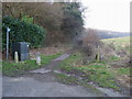
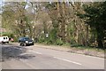
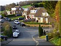
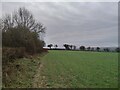
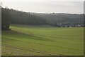
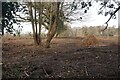
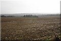
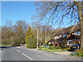
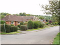
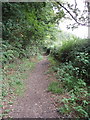
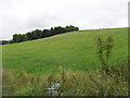
11 photos from this area
Area Information
Key information about the SL7 3QE including its size, population, and administrative classification.
- Area Type
- Postcode
- Area Size
- 15.4 hectares
- Population
- 1576
- Population Density
- 321 people/km²
House Prices in SL7 3QE
30
Properties
£515,124
Average Sold Price
£149,950
Lowest Price
£845,000
Highest Price
Showing 30 properties
| Address | Type | Beds | Baths | Last Sale Price | Last Sale Date | |
|---|---|---|---|---|---|---|
| Long Reach, Goodwood Rise, Marlow Bottom, SL7 3QE | Detached | 4 | 2 | £720,000 | Jul 2025 | |
| 5 Goodwood Rise, Marlow Bottom, SL7 3QE | Detached | 3 | 1 | £655,000 | Mar 2025 | |
| 14 Goodwood Rise, Marlow Bottom, SL7 3QE | Detached | 4 | 1 | £845,000 | Jul 2024 | |
| 20 Goodwood Rise, Marlow Bottom, SL7 3QE | Detached | 3 | 2 | £633,000 | Jun 2024 | |
| 16 Goodwood Rise, Marlow Bottom, SL7 3QE | house | 4 | 1 | £784,500 | Sep 2023 | |
| 12 Goodwood Rise, Marlow Bottom, SL7 3QE | Retail | 3 | 1 | £604,000 | Jul 2022 | |
| 10 Goodwood Rise, Marlow Bottom, SL7 3QE | Detached | 4 | 2 | £690,000 | Jun 2021 | |
| 2 Goodwood Rise, Marlow Bottom, SL7 3QE | Detached | 4 | 2 | £659,950 | Jul 2017 | |
| 21 Goodwood Rise, Marlow Bottom, SL7 3QE | Detached | 4 | 2 | £725,000 | Dec 2016 | |
| 13 Goodwood Rise, Marlow Bottom, SL7 3QE | house | - | - | £592,500 | May 2016 |
Page 1 of 3
Energy Efficiency in SL7 3QE
Amenities
Schools
| Rank | School | Type | Entry gender | Ages |
|---|
Explore more schools in this area
Go to Schools tabDemographics
Household Size
Family (3-5 people)
most common
Accommodation Type
Houses
most common
Tenure
76
majority
Ethnic Group
White
most common
Religion
N/A
most common
Household Composition
N/A
most common
Age
47
median
Adults (30-64 years)
most common
Household Deprivation
N/A
with no deprivation
NS-SEC
52
in Lower managerial occupations
Explore more demographic insights in this area
Go to Demographics tabPlanning
Planning Constraints
- Flood RiskPremium
- Ramsar Wetland SitesPremium
- Area of Outstanding Natural BeautyPremium
- Protected Nature ReservePremium
- Protected WoodlandPremium