Area Overview for SL7 3DL
Photos of SL7 3DL

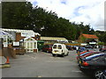


20 photos from this area
Area Information
Key information about the SL7 3DL including its size, population, and administrative classification.
- Area Type
- Postcode
- Area Size
- 8.4 hectares
- Population
- 1576
- Population Density
- 321 people/km²
House Prices in SL7 3DL
35
Properties
£495,965
Average Sold Price
£69,650
Lowest Price
£862,500
Highest Price
Showing 35 properties
| Address | Type | Beds | Baths | Last Sale Price | Last Sale Date | |
|---|---|---|---|---|---|---|
| 18 Claymoor Park, High Wycombe, SL7 3DL | Detached | 4 | 2 | £800,000 | Oct 2025 | |
| 33 Claymoor Park, High Wycombe, SL7 3DL | Semi-detached | 4 | 1 | £665,000 | Oct 2023 | |
| 8 Claymoor Park, High Wycombe, SL7 3DL | Detached | 4 | 2 | £755,000 | May 2023 | |
| 16 Claymoor Park, High Wycombe, SL7 3DL | Semi-detached | 4 | 2 | £672,000 | Aug 2022 | |
| 4 Claymoor Park, High Wycombe, SL7 3DL | Semi-detached | 4 | 2 | £625,000 | Jul 2022 | |
| 31 Claymoor Park, High Wycombe, SL7 3DL | house | - | - | £862,500 | Sep 2021 | |
| 34 Claymoor Park, High Wycombe, SL7 3DL | house | - | - | £600,000 | Mar 2021 | |
| 28 Claymoor Park, High Wycombe, SL7 3DL | Semi-detached | 4 | 3 | £624,500 | Mar 2021 | |
| 12 Claymoor Park, High Wycombe, SL7 3DL | house | - | - | £620,000 | Feb 2021 | |
| 1 Claymoor Park, High Wycombe, SL7 3DL | Semi-detached | 4 | 1 | £580,000 | Jul 2019 |
Page 1 of 4
Energy Efficiency in SL7 3DL
Amenities
Schools
| Rank | School | Type | Entry gender | Ages |
|---|
Explore more schools in this area
Go to Schools tabDemographics
Household Size
Family (3-5 people)
most common
Accommodation Type
Houses
most common
Tenure
76
majority
Ethnic Group
White
most common
Religion
N/A
most common
Household Composition
N/A
most common
Age
47
median
Adults (30-64 years)
most common
Household Deprivation
N/A
with no deprivation
NS-SEC
52
in Lower managerial occupations
Explore more demographic insights in this area
Go to Demographics tabPlanning
Planning Constraints
- Flood RiskPremium
- Ramsar Wetland SitesPremium
- Area of Outstanding Natural BeautyPremium
- Protected Nature ReservePremium
- Protected WoodlandPremium