Area Overview for RH6 7JH
Photos of RH6 7JH

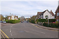
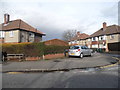

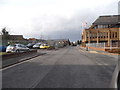

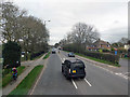
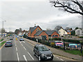
89 photos from this area
Area Information
Key information about the RH6 7JH including its size, population, and administrative classification.
- Area Type
- Postcode
- Area Size
- 1.5 hectares
- Population
- 1422
- Population Density
- 6031 people/km²
House Prices in RH6 7JH
32
Properties
£165,206
Average Sold Price
£54,000
Lowest Price
£284,000
Highest Price
Showing 32 properties
| Address | Type | Beds | Baths | Last Sale Price | Last Sale Date | |
|---|---|---|---|---|---|---|
| 13 Le May Close, Horley, RH6 7JH | Flat | 3 | 1 | £210,000 | Mar 2024 | |
| 19 Le May Close, Horley, RH6 7JH | Flat | - | - | £220,000 | Oct 2020 | |
| 23 Le May Close, Horley, RH6 7JH | Flat | 2 | 1 | £232,000 | May 2020 | |
| 25 Le May Close, Horley, RH6 7JH | Flat | 2 | 1 | £240,000 | Dec 2018 | |
| 27 Le May Close, Horley, RH6 7JH | Flat | - | - | £284,000 | Dec 2018 | |
| 21 Le May Close, Horley, RH6 7JH | Flat | - | - | £192,000 | Mar 2014 | |
| 10 Le May Close, Horley, RH6 7JH | Flat | 2 | - | £172,000 | May 2013 | |
| 32 Le May Close, Horley, RH6 7JH | Flat | - | - | £180,000 | Aug 2012 | |
| 31 Le May Close, Horley, RH6 7JH | Flat | 2 | 1 | £171,500 | Nov 2011 | |
| 14 Le May Close, Horley, RH6 7JH | Flat | - | - | £153,000 | Aug 2010 |
Page 1 of 4
Energy Efficiency in RH6 7JH
Amenities
Schools
| Rank | School | Type | Entry gender | Ages |
|---|
Explore more schools in this area
Go to Schools tabDemographics
Household Size
Two person
most common
Accommodation Type
Houses
most common
Tenure
62
majority
Ethnic Group
White
most common
Religion
N/A
most common
Household Composition
N/A
most common
Age
47
median
Adults (30-64 years)
most common
Household Deprivation
N/A
with no deprivation
NS-SEC
36
in Lower managerial occupations
Explore more demographic insights in this area
Go to Demographics tabPlanning
Planning Constraints
- Flood RiskPremium
- Ramsar Wetland SitesPremium
- Area of Outstanding Natural BeautyPremium
- Protected Nature ReservePremium
- Protected WoodlandPremium