Area Overview for RH19 3GD
Photos of RH19 3GD


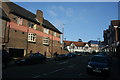
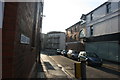


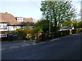
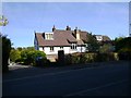
100 photos from this area
Area Information
Key information about the RH19 3GD including its size, population, and administrative classification.
- Area Type
- Postcode
- Area Size
- 8901 m²
- Population
- 1167
- Population Density
- 3724 people/km²
House Prices in RH19 3GD
8
Properties
£453,417
Average Sold Price
£158,000
Lowest Price
£757,500
Highest Price
Showing 8 properties
| Address | Type | Beds | Baths | Last Sale Price | Last Sale Date | |
|---|---|---|---|---|---|---|
| Jesmond Dene, 7 Laurel Dene, East Grinstead, RH19 3GD | Detached | 4 | 2 | £580,000 | Mar 2025 | |
| Laurel Dene House, Laurel Dene, East Grinstead, RH19 3GD | Detached | 4 | 2 | £625,000 | Sep 2019 | |
| Southdown House, 5 Laurel Dene, East Grinstead, RH19 3GD | Detached | 4 | - | £757,500 | Sep 2018 | |
| Kingscote, Laurel Dene, East Grinstead, RH19 3GD | Detached | - | - | £420,000 | Aug 2010 | |
| Lomond House, 8 Laurel Dene, East Grinstead, RH19 3GD | Detached | - | - | £158,000 | Nov 1997 | |
| Rivendell, Laurel Dene, East Grinstead, RH19 3GD | Detached | - | - | £180,000 | Aug 1997 | |
| Dene View, 6 Laurel Dene, East Grinstead, RH19 3GD | Detached | 4 | - | - | - | |
| The Firs, 4 Laurel Dene, East Grinstead, RH19 3GD | Detached | - | - | - | - |
Energy Efficiency in RH19 3GD
Amenities
Schools
| Rank | School | Type | Entry gender | Ages |
|---|
Explore more schools in this area
Go to Schools tabDemographics
Household Size
One person
most common
Accommodation Type
Houses
most common
Tenure
78
majority
Ethnic Group
White
most common
Religion
N/A
most common
Household Composition
N/A
most common
Age
47
median
Adults (30-64 years)
most common
Household Deprivation
N/A
with no deprivation
NS-SEC
44
in Lower managerial occupations
Explore more demographic insights in this area
Go to Demographics tabPlanning
Planning Constraints
- Flood RiskPremium
- Ramsar Wetland SitesPremium
- Area of Outstanding Natural BeautyPremium
- Protected Nature ReservePremium
- Protected WoodlandPremium