Area Overview for RH19 4HG
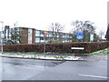
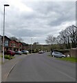
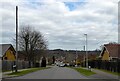
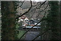
Photos of RH19 4HG


Area Information
Living in RH19 4HG offers a specific and compact residential experience within East Sussex. This postcode covers a small cluster of just 1.1 hectares, housing a total population of 1,167 people. The high population density of 105,984 per square kilometre reflects the concentrated nature of this residential zone. You will find yourself in an area where households are close together, creating an immediate sense of proximity to neighbours and local services. The location sits near major transport links, specifically Killigrew Lane, which connects directly to the East Croydon to Tunbridge Wells railway line. This convenient location means you are a short distance from East Grinstead and Tunbridge Wells, offering rapid access to larger towns and cities while maintaining a secluded, village-style footprint. The area avoids major planning constraints, with no designation as an Area of Outstanding Natural Beauty or protected wetland site. This status allows for a straightforward residential character without the restrictions often found in more designated green spaces. Your daily life here is defined by practical accessibility rather than expansive open space, making it ideal for those who prioritise connectivity and convenience over vast new build developments.
- Area Type
- Postcode
- Area Size
- 1.1 hectares
- Population
- 1167
- Population Density
- 3724 people/km²
The housing market in RH19 4HG is overwhelmingly characterised by owner-occupiers, with 78 per cent of residents owning their homes. This high proportion signals that the area functions as a settled family market rather than a student let or investment haven. The predominant accommodation type consists of houses, reinforcing the nature of the residential stock as single-family dwellings rather than flats or high-density blocks. Because 78 per cent of the 1,167 residents own their property, you will encounter a significant number of motivated owners looking to move or upgrade, potentially creating interesting opportunities in the local market. The low rental implication of these figures means sourcing a temporary property might require more effort if you are looking specifically in this immediate cluster. The property stock is private and self-contained, typical of the British suburban fringe found near East Grinstead. You can expect a range of traditional house layouts rather than modern apartment complexes. The market here reflects a stable neighbourhood where value is often tied to the quality of the home and its immediate setting rather than high-volume turnover.
House Prices in RH19 4HG
Showing 13 properties
| Address | Type | Beds | Baths | Last Sale Price | Last Sale Date | |
|---|---|---|---|---|---|---|
| 4, Aspen Court, Fairfield Road, East Grinstead, RH19 4HG | Semi-detached | 4 | 4 | £615,000 | Nov 2024 | |
| 7, Aspen Court, Fairfield Road, East Grinstead, RH19 4HG | Terraced | 4 | 4 | £490,000 | Sep 2024 | |
| 5, Aspen Court, Fairfield Road, East Grinstead, RH19 4HG | Semi-detached | 4 | 4 | £540,000 | Feb 2024 | |
| 9, Aspen Court, Fairfield Road, East Grinstead, RH19 4HG | Terraced | 3 | 3 | £500,000 | Jan 2024 | |
| 10, Aspen Court, Fairfield Road, East Grinstead, RH19 4HG | Terraced | 3 | - | £505,000 | Jun 2021 | |
| 8, Aspen Court, Fairfield Road, East Grinstead, RH19 4HG | house | - | - | £550,000 | Jun 2021 | |
| 1, Aspen Court, Fairfield Road, East Grinstead, RH19 4HG | Terraced | 3 | 3 | £490,000 | Dec 2020 | |
| 12, Aspen Court, Fairfield Road, East Grinstead, RH19 4HG | house | 3 | - | £275,000 | Dec 2009 | |
| 6, Aspen Court, Fairfield Road, East Grinstead, RH19 4HG | Semi-detached | 4 | 4 | £417,500 | Nov 2005 | |
| 14, Aspen Court, Fairfield Road, East Grinstead, RH19 4HG | Terraced | 2 | 1 | £249,950 | Sep 2005 |
Energy Efficiency in RH19 4HG
Daily life in RH19 4HG is supported by a ring of essential amenities within practical reach of the residents. Your nearest retail options include Cook East, Iceland East, and Waitrose East, ensuring you have access to essential groceries and everyday goods without needing to travel far. For those who prefer a premium shopping experience, Waitrose East provides high-quality provisions close to your door. Public transport links are equally robust, with five nearby railway stations including East Grinstead Railway Station, Dormans Railway Station, and Lingfield Railway Station. You can choose between several rail options depending on your daily commute or leisure plans. Additionally, two Metro stations are located at Kingscote and Horsted Keynes, offering direct overground services to London and the south coast. This network means you hold significant travel power from your home in RH19 4HG. You do not need a car for all journeys, as the rail and metro connections provide reliable public transit to major employment and leisure centres. The blend of quality retail and diverse transport choices creates a convenient and independent living environment.
Amenities
Schools
Families living in RH19 4HG have access to established educational facilities within a practical commute. The nearest primary establishment is Estcots Primary School, which holds a 'good' rating under Ofsted standards. This rating confirms the school meets the required regulatory benchmarks for education and safety. The school serves as the main educational option for younger children in the immediate vicinity. Because the local school is rated 'good', residents can expect a standard of education that meets or exceeds national expectations for primary learning. While the data focuses solely on this primary facility, the location near East Grinsted and Tunbridge Wells also provides access to further institutions outside this specific postcode boundary. The presence of a well-rated primary school is a significant asset for anyone moving here with school-age children. It offers a stable, no-frills option for primary education without the volatility of lower-rated institutions. For young families, the proximity of this 'good' rated school to the residential cluster of 1.1 hectares makes it a central consideration when choosing your home.
| Rank | School | Type | Entry gender | Ages |
|---|
Explore more schools in this area
Go to Schools tabDemographics
The community in RH19 4HG is heavily dominated by long-term residents, as evidenced by a home ownership rate of 78 per cent. This figure indicates that the vast majority of occupants live in their own properties rather than renting. The prevailing accommodation type is houses, which aligns with the high rate of ownership and the typical profile of the local residents. The demographic median age is 47 years, and the most common age range falls between 30 and 64 years. This age structure confirms the area appeals primarily to working families and established adults rather than students or the under-thirty demographic. The predominant ethnic group in the neighbourhood is White. The consistent data points toward a stable, established community where people have likely been living for many years. The high concentration of adult homeowners suggests a neighbourhood focused on settlement and stability. When evaluating the quality of life, the community composition points to a mature environment. You are looking at an area where the character is shaped by established families and individuals who have rooted themselves in the local housing stock.
Household Size
Accommodation Type
Tenure
Ethnic Group
Religion
Household Composition
Age
Household Deprivation
NS-SEC
Explore more demographic insights in this area
Go to Demographics tabPlanning
Planning Constraints
- Flood RiskPremium
- Ramsar Wetland SitesPremium
- Area of Outstanding Natural BeautyPremium
- Protected Nature ReservePremium
- Protected WoodlandPremium