Area Overview for RH12 3PU
Photos of RH12 3PU
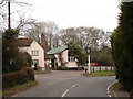
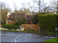
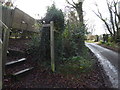
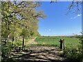
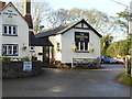
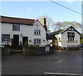
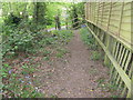
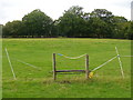
42 photos from this area
Area Information
Key information about the RH12 3PU including its size, population, and administrative classification.
- Area Type
- Postcode
- Area Size
- 44.9 hectares
- Population
- 2050
- Population Density
- 104 people/km²
House Prices in RH12 3PU
11
Properties
£800,000
Average Sold Price
£495,000
Lowest Price
£1,150,000
Highest Price
Showing 11 properties
| Address | Type | Beds | Baths | Last Sale Price | Last Sale Date | |
|---|---|---|---|---|---|---|
| Rivendell, Rowhook Hill, Rowhook, RH12 3PU | house | - | - | £550,000 | Apr 2022 | |
| The Cottage, Rowhook Hill, Rowhook, RH12 3PU | Detached | 2 | 2 | £755,000 | Sep 2021 | |
| Colts Bushes, Rowhook Hill, Rowhook, RH12 3PU | Detached | 6 | 2 | £1,020,000 | Jan 2017 | |
| Mulberry House, Rowhook Hill, Rowhook, RH12 3PU | house | - | - | £1,150,000 | Nov 2014 | |
| 1, Rowhook Hill House, Rowhook Hill, Rowhook, RH12 3PU | Detached | 5 | 2 | £845,000 | Nov 2007 | |
| Manor Farm, Rowhook Hill, Rowhook, RH12 3PU | Detached | - | - | £785,000 | Jul 2003 | |
| Old Pheasantry, Rowhook Hill, Rowhook, RH12 3PU | Detached | - | - | £495,000 | May 1996 | |
| Deerhouse Farm, Rowhook Road, Rowhook, RH12 3PU | undefined | - | - | - | - | |
| Tennis 171M From Manor Farm, Rowhook Hill 58M From Rowhook Road, Rowhook Road, Rowhook, RH12 3PU | Leisure | - | - | - | - | |
| Maplewood House, Rowhook Hill, Rowhook, RH12 3PU | house | - | - | - | - |
Page 1 of 2
Energy Efficiency in RH12 3PU
Amenities
Schools
| Rank | School | Type | Entry gender | Ages |
|---|
Explore more schools in this area
Go to Schools tabDemographics
Household Size
Two person
most common
Accommodation Type
Houses
most common
Tenure
72
majority
Ethnic Group
White
most common
Religion
N/A
most common
Household Composition
N/A
most common
Age
47
median
Adults (30-64 years)
most common
Household Deprivation
N/A
with no deprivation
NS-SEC
41
in Lower managerial occupations
Explore more demographic insights in this area
Go to Demographics tabPlanning
Planning Constraints
- Flood RiskPremium
- Ramsar Wetland SitesPremium
- Area of Outstanding Natural BeautyPremium
- Protected Nature ReservePremium
- Protected WoodlandPremium