Area Overview for RH12 3AT
Photos of RH12 3AT
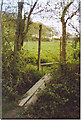
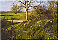
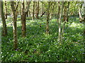
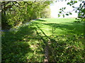
11 photos from this area
Area Information
Key information about the RH12 3AT including its size, population, and administrative classification.
- Area Type
- Postcode
- Area Size
- 1.0 km²
- Population
- 1968
- Population Density
- 63 people/km²
House Prices in RH12 3AT
11
Properties
£1,218,240
Average Sold Price
£403,000
Lowest Price
£3,000,000
Highest Price
Showing 11 properties
| Address | Type | Beds | Baths | Last Sale Price | Last Sale Date | |
|---|---|---|---|---|---|---|
| Somersbury Lodge, Somersbury Lane, Rudgwick, Horsham, RH12 3AT | Land | 4 | - | £1,200,000 | Jul 2023 | |
| Arranhurst, Somersbury Lane, Rudgwick, Horsham, RH12 3AT | Detached | 3 | 2 | £765,000 | May 2014 | |
| Hill House Farm, Somersbury Lane, Rudgwick, Horsham, RH12 3AT | Detached | - | - | £3,000,000 | Jul 2007 | |
| Wayside Cottage, Somersbury Lane, Rudgwick, Horsham, RH12 3AT | Detached | - | - | £723,200 | Nov 2004 | |
| Fairlands, Somersbury Lane, Rudgwick, Horsham, RH12 3AT | house | - | - | £403,000 | Sep 2004 | |
| Hill House, Somersbury Lane, Rudgwick, Horsham, RH12 3AT | Detached | 5 | 2 | - | - | |
| Longwood Ranch, Somersbury Lane, Rudgwick, Horsham, RH12 3AT | Detached | 5 | 2 | - | - | |
| Old Oast, Somersbury Lane, Rudgwick, Horsham, RH12 3AT | Detached | - | - | - | - | |
| Nagswood Bungalow, Somersbury Lane, Rudgwick, Horsham, RH12 3AT | Detached | - | - | - | - | |
| Clare Cottage, Somersbury Lane, Rudgwick, Horsham, RH12 3AT | house | - | - | - | - |
Page 1 of 2
Energy Efficiency in RH12 3AT
Amenities
Schools
| Rank | School | Type | Entry gender | Ages |
|---|
Explore more schools in this area
Go to Schools tabDemographics
Household Size
One person
most common
Accommodation Type
Houses
most common
Tenure
76
majority
Ethnic Group
White
most common
Religion
N/A
most common
Household Composition
N/A
most common
Age
47
median
Elderly (65+ years)
most common
Household Deprivation
N/A
with no deprivation
NS-SEC
39
in Lower managerial occupations
Explore more demographic insights in this area
Go to Demographics tabPlanning
Planning Constraints
- Flood RiskPremium
- Ramsar Wetland SitesPremium
- Area of Outstanding Natural BeautyPremium
- Protected Nature ReservePremium
- Protected WoodlandPremium