Area Overview for RG6 1PB
Photos of RG6 1PB
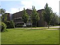
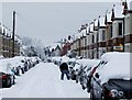
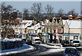
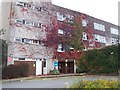
88 photos from this area
Area Information
Key information about the RG6 1PB including its size, population, and administrative classification.
- Area Type
- Postcode
- Area Size
- 6093 m²
- Population
- 1887
- Population Density
- 15116 people/km²
House Prices in RG6 1PB
51
Properties
£218,544
Average Sold Price
£54,500
Lowest Price
£350,000
Highest Price
Showing 51 properties
| Address | Type | Beds | Baths | Last Sale Price | Last Sale Date | |
|---|---|---|---|---|---|---|
| 30 Clarendon Road, Reading, RG6 1PB | Terraced | 2 | 2 | £330,000 | Oct 2025 | |
| 23 Clarendon Road, Reading, RG6 1PB | Terraced | 4 | 2 | £340,000 | Jul 2024 | |
| 13 Clarendon Road, Reading, RG6 1PB | Terraced | 2 | 1 | £245,000 | Mar 2024 | |
| 11 Clarendon Road, Reading, RG6 1PB | Terraced | 3 | 1 | £270,000 | Oct 2023 | |
| 51 Clarendon Road, Reading, RG6 1PB | Flat | 1 | 1 | £285,000 | Sep 2023 | |
| 20 Clarendon Road, Reading, RG6 1PB | house | - | - | £350,000 | Dec 2022 | |
| 33 Clarendon Road, Reading, RG6 1PB | Terraced | 2 | 1 | £265,000 | Jun 2022 | |
| 42 Clarendon Road, Reading, RG6 1PB | Terraced | 2 | 1 | £275,000 | Dec 2021 | |
| 35 Clarendon Road, Reading, RG6 1PB | Terraced | 2 | 1 | £256,750 | Jul 2021 | |
| 44 Clarendon Road, Reading, RG6 1PB | Terraced | 3 | 1 | £290,000 | Mar 2021 |
Page 1 of 6
Energy Efficiency in RG6 1PB
Amenities
Schools
| Rank | School | Type | Entry gender | Ages |
|---|
Explore more schools in this area
Go to Schools tabDemographics
Household Size
Family (3-5 people)
most common
Accommodation Type
Houses
most common
Tenure
36
majority
Ethnic Group
White
most common
Religion
N/A
most common
Household Composition
N/A
most common
Age
22
median
Young Adults (15-29 years)
most common
Household Deprivation
N/A
with no deprivation
NS-SEC
23
in Lower managerial occupations
Explore more demographic insights in this area
Go to Demographics tabPlanning
Planning Constraints
- Flood RiskPremium
- Ramsar Wetland SitesPremium
- Area of Outstanding Natural BeautyPremium
- Protected Nature ReservePremium
- Protected WoodlandPremium