Area Overview for RG6 1PA
Photos of RG6 1PA
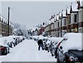
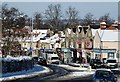
88 photos from this area
Area Information
Key information about the RG6 1PA including its size, population, and administrative classification.
- Area Type
- Postcode
- Area Size
- 4902 m²
- Population
- 2139
- Population Density
- 6418 people/km²
House Prices in RG6 1PA
19
Properties
£245,665
Average Sold Price
£64,750
Lowest Price
£330,000
Highest Price
Showing 19 properties
| Address | Type | Beds | Baths | Last Sale Price | Last Sale Date | |
|---|---|---|---|---|---|---|
| 32 St Peters Road, Reading, RG6 1PA | Semi-detached | 7 | 7 | £300,000 | Mar 2021 | |
| 57 St Peters Road, Reading, RG6 1PA | Terraced | 4 | 1 | £320,000 | Oct 2017 | |
| 53 St Peters Road, Reading, RG6 1PA | Terraced | 5 | 2 | £330,000 | Oct 2015 | |
| 40 St Peters Road, Reading, RG6 1PA | Semi-detached | 3 | 1 | £299,950 | Dec 2014 | |
| 26 St Peters Road, Reading, RG6 1PA | Semi-detached | 6 | 1 | £306,000 | Mar 2014 | |
| 61 St Peters Road, Reading, RG6 1PA | Terraced | 5 | 2 | £190,000 | Dec 2004 | |
| 30 St Peters Road, Reading, RG6 1PA | Semi-detached | 4 | 1 | £235,000 | Oct 2004 | |
| 28 St Peters Road, Reading, RG6 1PA | Semi-detached | 6 | 2 | £231,000 | Jul 2004 | |
| 34 St Peters Road, Reading, RG6 1PA | Terraced | - | - | £179,950 | May 2001 | |
| 63 St Peters Road, Reading, RG6 1PA | Terraced | 5 | 2 | £64,750 | Sep 1996 |
Page 1 of 2
Energy Efficiency in RG6 1PA
Amenities
Schools
| Rank | School | Type | Entry gender | Ages |
|---|
Explore more schools in this area
Go to Schools tabDemographics
Household Size
Family (3-5 people)
most common
Accommodation Type
Houses
most common
Tenure
65
majority
Ethnic Group
White
most common
Religion
N/A
most common
Household Composition
N/A
most common
Age
47
median
Adults (30-64 years)
most common
Household Deprivation
N/A
with no deprivation
NS-SEC
44
in Lower managerial occupations
Explore more demographic insights in this area
Go to Demographics tabPlanning
Planning Constraints
- Flood RiskPremium
- Ramsar Wetland SitesPremium
- Area of Outstanding Natural BeautyPremium
- Protected Nature ReservePremium
- Protected WoodlandPremium