Area Overview for RG6 1JS
Photos of RG6 1JS
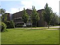
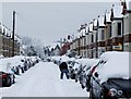
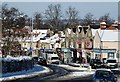
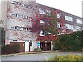
88 photos from this area
Area Information
Key information about the RG6 1JS including its size, population, and administrative classification.
- Area Type
- Postcode
- Area Size
- 1.9 hectares
- Population
- 2139
- Population Density
- 6418 people/km²
House Prices in RG6 1JS
30
Properties
£463,955
Average Sold Price
£135,000
Lowest Price
£760,000
Highest Price
Showing 30 properties
| Address | Type | Beds | Baths | Last Sale Price | Last Sale Date | |
|---|---|---|---|---|---|---|
| 244 Wokingham Road, Reading, RG6 1JS | house | - | - | £470,000 | Sep 2021 | |
| 230 Wokingham Road, Reading, RG6 1JS | house | - | - | £760,000 | Feb 2021 | |
| 240 Wokingham Road, Reading, RG6 1JS | Detached | 11 | 4 | £675,000 | Aug 2017 | |
| 226 Wokingham Road, Reading, RG6 1JS | house | - | - | £625,000 | Jan 2017 | |
| 266 Wokingham Road, Reading, RG6 1JS | Detached | 1 | 3 | £625,000 | Jul 2013 | |
| 264 Wokingham Road, Reading, RG6 1JS | Detached | 4 | - | £500,000 | Oct 2012 | |
| 250 Wokingham Road, Reading, RG6 1JS | house | - | - | £275,000 | Oct 2010 | |
| 242 Wokingham Road, Reading, RG6 1JS | Semi-detached | 9 | 3 | £607,000 | May 2010 | |
| 270 Wokingham Road, Reading, RG6 1JS | Semi-detached | 11 | 4 | £249,000 | Nov 2000 | |
| 246 Wokingham Road, Reading, RG6 1JS | Semi-detached | - | - | £135,000 | Apr 1999 |
Page 1 of 3
Energy Efficiency in RG6 1JS
Amenities
Schools
| Rank | School | Type | Entry gender | Ages |
|---|
Explore more schools in this area
Go to Schools tabDemographics
Household Size
Family (3-5 people)
most common
Accommodation Type
Houses
most common
Tenure
65
majority
Ethnic Group
White
most common
Religion
N/A
most common
Household Composition
N/A
most common
Age
47
median
Adults (30-64 years)
most common
Household Deprivation
N/A
with no deprivation
NS-SEC
44
in Lower managerial occupations
Explore more demographic insights in this area
Go to Demographics tabPlanning
Planning Constraints
- Flood RiskPremium
- Ramsar Wetland SitesPremium
- Area of Outstanding Natural BeautyPremium
- Protected Nature ReservePremium
- Protected WoodlandPremium