Area Overview for RG2 9RW
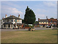
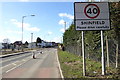
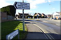
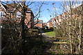
Photos of RG2 9RW

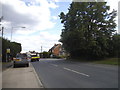
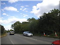
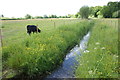
Area Information
RG2 9RW represents a specific residential cluster in England, defined by a precise footprint and a defined population. This postcode covers an area of 1830 square metres, housing 1716 residents within a compact living environment. The location is situated in a part of the country where land values and housing density interact within a small geographic boundary, creating a distinctly localised community feel. Living in RG2 9RW means relying on a concentrated network of homes rather than sprawling suburbs, which often dictates a car-dependent routine for longer journeys while keeping local travel close. This specific area functions as a tight-knit residential zone where daily life revolves around immediate neighbours and shared local infrastructure. The small size of the land footprint relative to the number of people suggests a high concentration of dwellings, contributing to a neighbourhood character that feels immediate and accessible. You will find yourself part of a community where distance to local amenities is minimal, and the sense of place is driven by proximity rather than vast open spaces.
- Area Type
- Postcode
- Area Size
- 1830 m²
- Population
- 1716
- Population Density
- 3770 people/km²
Homes in RG2 9RW are almost entirely detached or semi-detached houses, driven by the fact that houses are the only listed accommodation type for this postcode. The area is clearly owner-occupied, with 81% of residents owning their properties outright or with a mortgage, which fundamentally changes the transaction landscape for new buyers. You are not entering a市场 dominated by buy-to-let landlords or short-term rentals, but rather joining a stable cohort of individuals who have settled locally. This high ownership percentage typically correlates with more stable neighbourhood conditions, as owners are generally less likely to move frequently than tenants. The small land area of 1830 square metres packed with 1716 people suggests that while house sizes might be standard for the region, the surrounding greenspaces or shared communal land within the immediate cluster are limited. When you look for properties here, you are looking at a mature stock of residential units where the market is driven by local demand from the working-age population. Buyers should expect a market where competition is healthy but driven by genuine residency needs rather than speculative investment.
House Prices in RG2 9RW
Showing 6 properties
| Address | Type | Beds | Baths | Last Sale Price | Last Sale Date | |
|---|---|---|---|---|---|---|
| 4 Leaver Mews, Shinfield, RG2 9RW | house | - | - | £520,000 | Aug 2025 | |
| 5 Leaver Mews, Shinfield, RG2 9RW | house | - | - | £390,000 | Aug 2021 | |
| 1 Leaver Mews, Shinfield, RG2 9RW | house | - | - | £549,950 | Dec 2018 | |
| 6 Leaver Mews, Shinfield, RG2 9RW | house | - | - | £449,950 | Sep 2018 | |
| 3 Leaver Mews, Shinfield, RG2 9RW | house | - | - | £360,000 | Oct 2017 | |
| 2 Leaver Mews, Shinfield, RG2 9RW | house | - | - | £504,950 | Oct 2017 |
Energy Efficiency in RG2 9RW
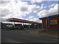
Your daily life in RG2 9RW revolves around access to key amenities that are within practical reach, removing the friction from errands and shopping. You have five retail options nearby, including Co-op Former, Lidl Beke, and Asda Shinfield. These supermarkets offer everything from bulk groceries to weekly essentials, meaning you can stock up without needing a long drive to larger towns. In terms of travel, there are five rail connections identified in the immediate vicinity, including Earley Railway Station, Winnersh Triangle Railway Station, and Winnersh Railway Station. These stations provide a direct transport link for those who do not wish to rely on their cars for work commutes to London or other business hubs. The presence of these major retailers and railway stations defines the character of the area as convenient and self-contained. You can walk or drive short distances to complete your most common household tasks, making life in RG2 9RW efficient and straightforward. This mix of retail and rail infrastructure ensures that you do not feel isolated, even within a small, dense residential cluster.
Amenities
Schools
There is one primary school listed in the immediate vicinity of RG2 9RW, which you should factor into your decision if you have children. Alder Grove Church of England Primary School serves as the nearest educational facility, and it holds a good rating from Ofsted. This rating indicates that the school meets the required standards for education and care in the setting. For families living in RG2 9RW, this means there is a designated educational option nearby without needing to commute to schools further away. The presence of a single primary school in the data covers the specific educational landscape provided for this postcode, though you may find secondary schools or other private options in the wider shoulder of the RG2 region or nearby towns. The good rating suggests a baseline of quality for early education in the area, which is a practical consideration for parents evaluating the livability of this specific residential cluster. You must verify current catchment areas and admission criteria with the school directly, as local education authority boundaries can shift or have specific priority rules not listed in general area data.
| Rank | School | Type | Entry gender | Ages |
|---|
Explore more schools in this area
Go to Schools tabDemographics
The community within RG2 9RW is dominated by residents in the 30 to 64 age range, which aligns with a median age of 47 years. This demographic profile indicates a neighbourhood populated primarily by adults who are likely established in their careers and family lives rather than students or retirees. Eighty-one per cent of households in this postcode own their homes, reflecting a market heavily skewed towards owner-occupiers rather than the private rental sector. The population is predominantly White, which shapes the cultural fabric and social dynamics of the residential cluster. You are looking at an area where accommodation consists almost exclusively of houses, meaning terrace units, flats, or high-rise apartments are not a feature of this specific cluster. The high level of home ownership combined with the concentration of adult homeowners suggests a stable community where long-term residents have a significant stake in the local environment. This demographic consistency often leads to established neighbourhood networks where property values and community standards remain relatively uniform across the estate.
Household Size
Accommodation Type
Tenure
Ethnic Group
Religion
Household Composition
Age
Household Deprivation
NS-SEC
Explore more demographic insights in this area
Go to Demographics tabPlanning
Planning Constraints
- Flood RiskPremium
- Ramsar Wetland SitesPremium
- Area of Outstanding Natural BeautyPremium
- Protected Nature ReservePremium
- Protected WoodlandPremium