Area Overview for RG2 9RN
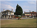
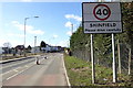
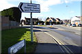
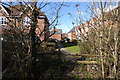
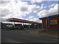
Photos of RG2 9RN

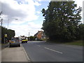
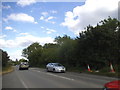
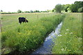
Area Information
Living in RG2 9RN means residing within a specific residential cluster of just four hectares. This compact postcode area, located in England, holds a population of 1,716 people. The high population density of 43,282 people per square kilometre reflects a concentrated community rather than a sprawling suburb. Daily life here is characterised by close proximity to neighbours and a focus on established housing. The area functions as a settled part of the wider local network, offering residents a defined living space with clear boundaries. You will find yourself part of a tight-knit group where the surrounding environment is immediately accessible. The small physical size means that local services and green spaces are largely within a short distance. Residents value the direct connection to nearby transport links and shopping options that define the immediate vicinity. This postcode represents a functional choice for those seeking a defined neighbourhood within the RG2 region. The area provides a stable setting for families and individuals who prefer a contained community over large, dispersed estates.
- Area Type
- Postcode
- Area Size
- 4.0 hectares
- Population
- 1716
- Population Density
- 3770 people/km²
The property market in RG2 9RN is distinctly characterised by owner occupation. With home ownership at 81 per cent, the area functions primarily as an established residential zone rather than a student or rental hub. The vast majority of transactions involve existing homeowners selling to other buyers who intend to live there permanently. This high level of tenure indicates a stable market where value is often retained through long-term residence rather than short-term letting. The accommodation type is strictly houses, which shapes the availability of properties for sale or rent. You are not looking for flats or urban apartments here; every property is a standalone house. This structure appeals to those who value garden space and a traditional suburban setting. The four-hectare footprint limits the sheer volume of available homes compared to larger towns, making specific properties potentially easier to locate once you set your criteria. As a buyer, you are entering an environment where ownership is the norm. The lack of rental stock means competition often comes from families and investors seeking permanent homes rather than short-term lodgers. Prices in this postcode reflect the utility of a house-based lifestyle within a densely populated but manageable area. The market behaviour mirrors the community itself, prioritising stability and long-term settlement over the flexibility of a rental sector.
House Prices in RG2 9RN
Showing 40 properties
| Address | Type | Beds | Baths | Last Sale Price | Last Sale Date | |
|---|---|---|---|---|---|---|
| 3 Appleton Way, Shinfield, RG2 9RN | Semi-detached | 4 | 3 | £638,000 | Dec 2025 | |
| 7 Appleton Way, Shinfield, RG2 9RN | Semi-detached | 4 | 3 | £550,000 | Jul 2024 | |
| 35 Appleton Way, Shinfield, RG2 9RN | Semi-detached | 4 | 3 | £550,000 | Dec 2022 | |
| 26 Appleton Way, Shinfield, RG2 9RN | Retail | 4 | 2 | £537,000 | Oct 2022 | |
| 21 Appleton Way, Shinfield, RG2 9RN | house | - | - | £590,000 | Jan 2022 | |
| 4 Appleton Way, Shinfield, RG2 9RN | house | 5 | 3 | £650,000 | Jun 2021 | |
| 41 Appleton Way, Shinfield, RG2 9RN | house | - | - | £575,000 | Mar 2021 | |
| 10 Appleton Way, Shinfield, RG2 9RN | Semi-detached | 3 | 2 | £450,000 | Sep 2019 | |
| 36 Appleton Way, Shinfield, RG2 9RN | house | - | - | £485,000 | May 2019 | |
| 34 Appleton Way, Shinfield, RG2 9RN | house | - | - | £448,039 | Dec 2018 |
Energy Efficiency in RG2 9RN
Daily life in RG2 9RN benefits from a cluster of retail and transport amenities within practical reach. For shopping needs, you have five retail options nearby, including notable locations such as Co-op Former, Lidl Beke, and Asda Shinfield. These supermarkets provide weekly provisioning for the entire household, eliminating the need for long drives to stock the fridge. The variety of these specific outlets means you can combine essential shopping with other daily errands efficiently. Transport links are integrated directly into your weekly routine. Five rail stations serve the area, with Earley Railway Station, Winnersh Triangle Railway Station, and Winnersh Railway Station offering regular departures. This network connects you to wider employment hubs and leisure destinations. You do not rely solely on a car for travel, as the rail infrastructure provides a reliable alternative for commuting or weekend trips. The combination of these specific retail names and station points creates a convenient lifestyle. You can visit Co-op Former for groceries, then catch a train from a nearby station to a friend's house or the city. The amenities are not abstract; they are named venues you can locate and use immediately. This practical accessibility defines the convenience of living in this postcode, ensuring that day-to-day tasks require minimal effort and planning.
Amenities
Schools
Families living in RG2 9RN have access to specific educational facilities nearby. The nearest institution is Alder Grove Church of England Primary School, which is rated good by Ofsted. This designation confirms a standard of education that meets departmental expectations for primary learning. As a primary school, it caters to children aged four to eleven, providing early years education for the local cohort. With only one primary school listed in the immediate vicinity, families may need to look slightly further afield for secondary education or secondary phase schooling. The presence of a single designated primary option with a good rating suggests a consistent local provision for early childhood development. You do not have multiple primary choices within this specific postcode boundary, so the selection process begins with this established institution. The school type is primary, focusing on foundational subjects and social development before children sit the eleven-plus or transition to secondary colleges. A good Ofsted rating offers reassurance for parents preocupied about academic standards. While the data does not list secondary schools, the primary option serves the immediate residential cluster effectively. This single data point highlights a key entry-level school for families relocating to this area.
| Rank | School | Type | Entry gender | Ages |
|---|
Explore more schools in this area
Go to Schools tabDemographics
The community in RG2 9RN is defined by a mature population profile. The median age is 47 years, and the most common age range comprises adults between 30 and 64 years old. This indicates a neighbourhood dominated by working professionals and families, rather than a mix of young students or retirees. Home ownership stands at 81 per cent, reflecting a strong tradition of stability. The majority of locals have paid off their mortgages or remain on long-term possession agreements. Eighty-one per cent of the households own their homes, compared to just 19 per cent who rent. This high ownership rate creates an environment where residents often stay in their properties for many years. The accommodation type in this postcode is exclusively houses, meaning there are no flats or apartments within this specific four-hectare boundary. You will not find high-rise living here; instead, the built environment consists of ground or upper floor detached and semi-detached dwellings. The predominant ethnic group is White, aligning with the broader demographic patterns often found in this sector. This homogeneity contributes to a consistent cultural identity within the streets. With an average age of 47, local institutions tend to cater to the needs of established families and mature individuals. The demographics suggest a quiet, settled atmosphere where priorities centre on security and community stability rather than rapid turnover or transient living arrangements.
Household Size
Accommodation Type
Tenure
Ethnic Group
Religion
Household Composition
Age
Household Deprivation
NS-SEC
Explore more demographic insights in this area
Go to Demographics tabPlanning
Planning Constraints
- Flood RiskPremium
- Ramsar Wetland SitesPremium
- Area of Outstanding Natural BeautyPremium
- Protected Nature ReservePremium
- Protected WoodlandPremium