Area Overview for RG2 9RR
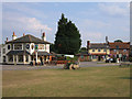
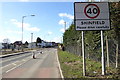
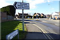
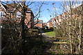
Photos of RG2 9RR

Area Information
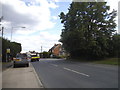
Living in RG2 9RR offers a quiet existence within a compact residential cluster spanning 2.2 hectares. This specific postcode area holds a population of 1,716 people, creating a dense yet intimate neighbourhood feel. The high population density of 79,513 people per square kilometre suggests a compact living environment where residents are within close reach of one another. You will find this area is primarily a small-scale residential zone rather than a mixed-use commercial district. Daily life here revolves around local便利ities, with a clear focus on domestic stability. The layout supports a community where neighbours know each other, fitting for those who value privacy alongside proximity to services. While the area is small, it functions as a cohesive unit with defined boundaries. Buyers considering homes in RG2 9RR should expect a traditional suburban setting focused on residential comfort. There is no indication of significant commercial intrusion or industrial activity within these specific hectares. The environment is static and predictable, offering a stable home for families seeking a settled lifestyle away from larger town centres.
- Area Type
- Postcode
- Area Size
- 2.2 hectares
- Population
- 1716
- Population Density
- 3770 people/km²
The housing market in RG2 9RR is dominated by owner-occupiers, with 81% of households owning their homes outright or with a mortgage. This high ownership figure signals a stable, settled community where residents are less likely to move frequently. The predominant accommodation type consists of houses, meaning you will not encounter large blocks of flats or purpose-built social housing within this postcode. This preference for detached or semi-detached properties aligns with the area's classification as a residential cluster. Buyers looking at homes in RG2 9RR are entering a market driven by long-term residents rather than short-term renters. The lack of rental data in the provided records suggests the rental sector is minimal compared to the buying market. Investors may find limited opportunity here for high-turnover rental yields, as most properties serve personal families. The consistent housing stock implies uniformity in property age and style across the cluster. When viewing properties, expect a range of family homes suitable for the local median age of 47 years.
House Prices in RG2 9RR
Showing 40 properties
| Address | Type | Beds | Baths | Last Sale Price | Last Sale Date | |
|---|---|---|---|---|---|---|
| 58 Lailey Path, Shinfield, RG2 9RR | Detached | 4 | 2 | £595,000 | Jun 2025 | |
| 46 Lailey Path, Shinfield, RG2 9RR | Detached | 5 | 3 | £640,000 | Mar 2025 | |
| 38 Lailey Path, Shinfield, RG2 9RR | Terraced | 3 | 2 | £442,500 | Nov 2024 | |
| 52 Lailey Path, Shinfield, RG2 9RR | Semi-detached | 3 | 2 | £490,000 | Mar 2023 | |
| 56 Lailey Path, Shinfield, RG2 9RR | Detached | 3 | 2 | £525,000 | Mar 2023 | |
| 42 Lailey Path, Shinfield, RG2 9RR | Detached | 4 | 2 | £540,000 | Jul 2020 | |
| 4 Lailey Path, Shinfield, RG2 9RR | house | - | - | £380,000 | Dec 2019 | |
| 36 Lailey Path, Shinfield, RG2 9RR | house | - | - | £417,000 | Dec 2019 | |
| 2 Lailey Path, Shinfield, RG2 9RR | house | - | - | £390,000 | Sep 2019 | |
| 34 Lailey Path, Shinfield, RG2 9RR | house | - | - | £435,000 | Aug 2019 |
Energy Efficiency in RG2 9RR
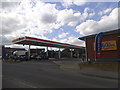
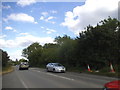
Residents of RG2 9RR enjoy convenient access to major retail and transport hubs within practical reach. There are five notable retail venues nearby, including Co-op Former, Lidl Beke, and Asda Shinfield. These shopping locations offer essential groceries, household items, and daily necessities without requiring a long journey. For daily errands, you can rely on these specific stores to meet most of your shopping requirements. Transport links are equally accessible, with five railway stations in the vicinity such as Earley Railway Station, Winnersh Triangle Railway Station, and Winnersh Railway Station. This rail network provides easy access to broader travel networks and commuting routes. While parks and leisure facilities are not listed in the specific data, the concentration of retail and rail options creates a convenient lifestyle. You can handle most weekly tasks without leaving the immediate catchment area.
Amenities
Schools
Families living in RG2 9RR have access to specific educational institutions, with Alder Grove Church of England Primary School serving the immediate area. This primary school holds a Good rating from Ofsted, indicating a standard of education that meets national expectations. The presence of this rated school confirms that local families have convenient access to primary education without needing to travel far. Secondary education options are not listed in the specific data for this postcode, suggesting families often draw on schools beyond the immediate neighbourhood boundaries. The single primary school mentioned provides a stable educational choice for young children in their early years. Living in RG2 9RR means your children can attend a recognised school with a positive inspection record. This school choice adds value to the local housing market and supports the area's reputation as a family-friendly zone.
| Rank | School | Type | Entry gender | Ages |
|---|
Explore more schools in this area
Go to Schools tabDemographics
The community in RG2 9RR is heavily skewed towards established residents, with a median age of 47 years. Most residents fall into the adult age range between 30 and 64 years old. This demographic profile indicates an area populated by working families and mature couples rather than young professionals or students. Home ownership stands at 81%, confirming that the vast majority of households plan to stay in this neighbourhood long term. Homes in RG2 9RR are predominantly houses rather than flats, catering to families with space requirements. The predominant ethnic group is White, reflecting the broad demographic makeup common across many parts of rural England. You will not find significant pockets of deprivation or transient populations here. The high ownership rate suggests residents have invested in their homes and plan to remain. This stability creates a predictable neighbourhood environment where street life is consistent. The age profile means local services and community groups likely cater to working adults and families with children in education.
Household Size
Accommodation Type
Tenure
Ethnic Group
Religion
Household Composition
Age
Household Deprivation
NS-SEC
Explore more demographic insights in this area
Go to Demographics tabPlanning
Planning Constraints
- Flood RiskPremium
- Ramsar Wetland SitesPremium
- Area of Outstanding Natural BeautyPremium
- Protected Nature ReservePremium
- Protected WoodlandPremium