Area Overview for RG2 9EA
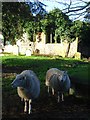
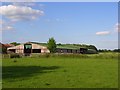
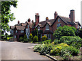
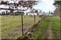
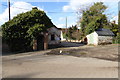
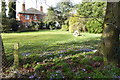
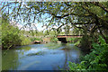
Photos of RG2 9EA

Area Information
RG2 9EA is a specific residential cluster in Berkshire, centred between Slough and Reading. This postcode covers 33.3 hectares and supports a population of 1,993. It consists primarily of houses within a defined boundary. The area density stands at 480 people per square kilometre. Living in RG2 9EA means residing in a small, private residential zone. The community is largely settled, with a median age of 47 years. Most households fall into the 30 to 64 years bracket. You will find a high rate of home ownership at 83 per cent. The predominant ethnic group is white. This demographic profile suggests a neighbourhood where families and established residents have put down roots. You get immediate access to services in nearby towns. Major rail links to major cities lie just outside your immediate gate. The area functions as a quiet, functional part of the wider Berkshire corridor. It is a place where daily life revolves around local routes and practical connectivity rather than grand landscaping or commercial hubs. The postcode identity is tied directly to the postcode sector RG2 9EA. Buyers focus on solid stability over novelty. The physical footprint is compact, ensuring a close-knit feel. Access to green spaces or large developments is not a feature of this specific cluster. The character is defined by tenure and age rather than architectural diversity or low density planning.
- Area Type
- Postcode
- Area Size
- 33.3 hectares
- Population
- 1993
- Population Density
- 480 people/km²
The property market in RG2 9EA is dominated by owner-occupied housing. Eighty-three per cent of homes are owned outright or with a mortgage. This high ownership rate indicates a community where residents have made a significant long-term commitment. The accommodation type is entirely houses. You will not find flats or apartments in this specific cluster. The housing stock supports a solid property market focused on detached or semi-detached family living. Prices and values typically reflect the age of the owners and the quality of the specific house. Because 83 per cent of residents own their homes, the market sees fewer short-term sales compared to rental-heavy zones. This stability can benefit potential buyers looking for settled neighbourhoods. However, the market may be less liquid due to higher ownership lock-in. Prospective buyers looking at RG2 9EA should expect standard mortgages and traditional swapping cycles rather than buy-to-let investments. The lack of flats suggests a market geared towards families or retirees. Capital growth here often tracks the wider Berkshire market rather than local surges. The 33.3 hectares constraint means land values are utilised efficiently within the existing suburban grid.
House Prices in RG2 9EA
Showing 2 properties
| Address | Type | Beds | Baths | Last Sale Price | Last Sale Date | |
|---|---|---|---|---|---|---|
| Magpie And Parrot, Arborfield Road, Shinfield, RG2 9EA | Semi-detached | 3 | 2 | - | - | |
| Dimensions, Parrot Farm, Arborfield Road, Shinfield, RG2 9EA | Semi-detached | 3 | 2 | - | - |
Energy Efficiency in RG2 9EA
Living in RG2 9EA offers convenient access to local shopping and transport hubs. You have five retail stores within practical walking or driving distance. Asda Shinfield, Co-op Former, and Lidl Beke provide the necessary supermarkets and goods for daily needs. Public transport is well supported with five railway stations nearby. Earley Railway Station, Winnersh Triangle Railway Station, and Winnersh Railway Station are the key access points. You can reach Campfred and Winslow easily without a private car. The area is best served by driving to these larger commercial centres since immediate local parks or leisure centres are not listed. Dining options are concentrated in the nearby towns rather than the residential cluster itself. The lifestyle feels functional and efficient rather than leisure-focused. Residents accept that amenities exist in the surrounding regions like Shinfield or Earley. This arrangement reduces clutter within the immediate residential boundary. The focus remains on utility and ease of access to major stores and stations. You will find a straightforward routine where shopping trips take 10 to 15 minutes to reach a major store. The layout supports a suburban lifestyle where the car or train is the primary mode of reaching entertainment venues.
Amenities
Schools
| Rank | School | Type | Entry gender | Ages |
|---|
Explore more schools in this area
Go to Schools tabDemographics
The community in RG2 9EA is defined by an older population profile and high stability. The median age is 47 years old. This places the demographic centre squarely among adults aged 30 to 64 years. You will find very few young children or teenagers in the immediate vicinity. Home ownership defines the social structure, with 83 per cent of residents owning their property. This figure implies a deeply settled community with low transient rates. The remaining minority likely comprises younger buyers or long-term renters. The accommodation type is exclusively houses. There are no flats or purpose-built rental blocks visible in this specific data set. The predominant ethnic group is white. This aligns with the broader pattern for the region. You do not find significant multi-ethnic clustering within this postcode boundary. Deprivation indicators are not part of the available dataset for this specific area. However, the high home ownership rate usually correlates with long-term wealth accumulation. Residents here tend to be established professionals or retired individuals. The age mix supports a quiet evening environment rather than a bustling nightlife scene. Family life centres around the house rather than communal housing estates. The demographic makeup makes this a stable environment for those seeking permanence over trend.
Household Size
Accommodation Type
Tenure
Ethnic Group
Religion
Household Composition
Age
Household Deprivation
NS-SEC
Explore more demographic insights in this area
Go to Demographics tabPlanning
Planning Constraints
- Flood RiskPremium
- Ramsar Wetland SitesPremium
- Area of Outstanding Natural BeautyPremium
- Protected Nature ReservePremium
- Protected WoodlandPremium