Area Overview for RG2 9BL
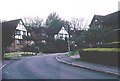
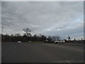
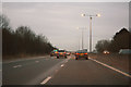
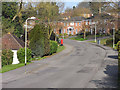
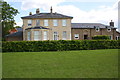
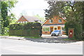
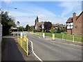
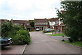
Photos of RG2 9BL
Area Information
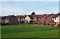
RG2 9BL is a small, densely populated residential cluster in England, covering just 4.3 hectares and home to 1362 residents. Its compact size means it is a tightly knit area, with a high population density of 31,532 people per square kilometre. This postcode is characterised by a mix of housing types, though the data suggests a predominance of homes, likely family-oriented properties. Daily life here is shaped by proximity to essential services, including retail outlets and rail networks. The area’s appeal lies in its accessibility: major railway stations like Reading and Earley are within practical reach, offering connections to broader regional transport. Nearby, Crosfields School provides an independent education option, catering to families seeking alternative schooling. While the community is small, it is served by a range of amenities, from supermarkets to commuter rail links, making it a practical choice for those prioritising convenience and connectivity. The median age of 47 suggests a stable, mature population, with many residents in their prime working years. For buyers, RG2 9BL offers a snapshot of suburban living with a focus on accessibility and established infrastructure.
- Area Type
- Postcode
- Area Size
- 4.3 hectares
- Population
- 1362
- Population Density
- 3903 people/km²
RG2 9BL’s property market is defined by a 56% home ownership rate, indicating that nearly half of the area’s homes are owner-occupied, while the remainder are likely rented. The accommodation type is predominantly houses, which may suggest a focus on family homes or larger properties. Given the area’s small size—just 4.3 hectares—housing stock is limited, and buyers should consider the proximity to surrounding areas for more options. The high population density, combined with the predominance of houses, could mean competition for properties, particularly for those seeking larger living spaces. For buyers, the mix of ownership and rental properties may present opportunities, though the small area size means the immediate surroundings are critical for additional choices. The presence of nearby rail links and amenities may also influence property values, appealing to those prioritising connectivity over expansive land.
House Prices in RG2 9BL
Showing 20 properties
Energy Efficiency in RG2 9BL
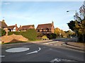
Living in RG2 9BL offers access to a range of retail and transport amenities within practical reach. Nearby shops include Tesco Reading, Co-op Whitley, and M&S Lower Earley SF, providing everyday convenience for grocery shopping and retail needs. The area’s rail network, with stations such as Earley and Reading, ensures easy access to broader regional transport, supporting both daily commutes and weekend travel. While the data does not mention parks or leisure facilities, the proximity to retail and transport hubs suggests a lifestyle focused on practicality and accessibility. For residents, the combination of local shopping and efficient rail links enhances convenience, though those seeking green spaces or recreational amenities may need to explore nearby areas.
Amenities
Schools
The nearest school to RG2 9BL is Crosfields School, an independent institution. Independent schools typically offer alternative educational pathways, often with smaller class sizes and specialised curricula. While no Ofsted rating is provided, the presence of an independent school may attract families seeking non-state education options. However, the data does not include information on other schools in the area, so it is unclear whether state schools are also available. For parents prioritising independent schooling, Crosfields offers a clear advantage, though those requiring state-funded education may need to look beyond the immediate postcode. The school’s presence underscores the area’s appeal to families, though buyers should verify additional educational options in the surrounding region.
| Rank | School | Type | Entry gender | Ages |
|---|
Explore more schools in this area
Go to Schools tabDemographics
The population of RG2 9BL is predominantly adults aged 30–64, with a median age of 47. This indicates a mature, settled community, likely with a strong presence of professionals and families. Home ownership stands at 56%, suggesting a balance between owner-occupied properties and rental stock. The accommodation type is primarily houses, which may reflect a preference for larger living spaces in this area. The predominant ethnic group is White, though no specific data on diversity or deprivation is provided. The high proportion of middle-aged residents could imply a stable local economy, with many individuals in long-term employment. However, the lack of specific data on household composition or income levels means broader conclusions about quality of life remain limited. The area’s demographics suggest a community focused on stability, with a mix of homeowners and renters navigating the challenges of a small, densely populated postcode.
Household Size
Accommodation Type
Tenure
Ethnic Group
Religion
Household Composition
Age
Household Deprivation
NS-SEC
Explore more demographic insights in this area
Go to Demographics tabPlanning
Planning Constraints
- Flood RiskPremium
- Ramsar Wetland SitesPremium
- Area of Outstanding Natural BeautyPremium
- Protected Nature ReservePremium
- Protected WoodlandPremium