Area Overview for RG2 8HJ
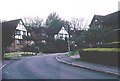
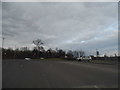
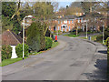
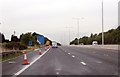
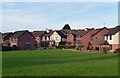
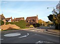
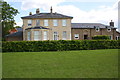
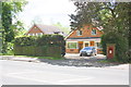
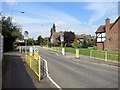
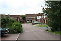
Photos of RG2 8HJ


Area Information
RG2 8HJ is a compact residential postcode in England, covering just 3.9 hectares and home to 1,765 people. Its high population density of 45,507 people per square kilometre reflects a tightly packed community, typical of small urban clusters. The area is defined by its proximity to key amenities, including major retail hubs like Tesco Reading and rail links such as Earley and Reading stations. Daily life here is shaped by its location, offering easy access to nearby towns and services. With a median age of 47 and a population skewed towards adults aged 30–64, the community is largely composed of established residents, many of whom own their homes. This demographic suggests a stable, family-oriented environment where most properties are houses rather than flats. The area’s small size means residents are close to essential services, though the density may influence the pace of life. For those seeking a quiet, well-connected neighbourhood with practical amenities, RG2 8HJ offers a blend of convenience and residential character.
- Area Type
- Postcode
- Area Size
- 3.9 hectares
- Population
- 1765
- Population Density
- 6055 people/km²
RG2 8HJ is predominantly an owner-occupied area, with 72% of homes owned by residents rather than rented. The accommodation type is primarily houses, which is unusual for a small postcode but aligns with the area’s compact, residential nature. This suggests a market focused on family homes rather than apartments or flats. The small size of the area—just 3.9 hectares—means the housing stock is limited, and the high population density implies that properties are closely spaced. For buyers, this presents a challenge: the immediate surroundings offer few new developments, and the existing stock may be highly sought after. The high home ownership rate indicates strong local attachment, which could influence property values and availability. Buyers should consider the area’s constraints, as expansion is unlikely, and competition for homes may be fierce.
House Prices in RG2 8HJ
Showing 47 properties
| Address | Type | Beds | Baths | Last Sale Price | Last Sale Date | |
|---|---|---|---|---|---|---|
| 50 Winton Road, Reading, RG2 8HJ | Semi-detached | 3 | 1 | £350,000 | Oct 2025 | |
| 64 Winton Road, Reading, RG2 8HJ | house | - | - | £415,000 | Mar 2025 | |
| 39 Winton Road, Reading, RG2 8HJ | Semi-detached | 2 | 1 | £400,000 | Feb 2024 | |
| 54 Winton Road, Reading, RG2 8HJ | Semi-detached | 3 | 1 | £370,000 | Jan 2024 | |
| 49 Winton Road, Reading, RG2 8HJ | Bungalow | 2 | 1 | £365,000 | Dec 2023 | |
| 43 Winton Road, Reading, RG2 8HJ | Semi-detached | 3 | 1 | £410,000 | Oct 2022 | |
| 84 Winton Road, Reading, RG2 8HJ | Bungalow | 2 | - | £341,500 | Dec 2021 | |
| 38 Winton Road, Reading, RG2 8HJ | house | 4 | - | £395,000 | Sep 2021 | |
| 21 Winton Road, Reading, RG2 8HJ | house | 3 | - | £352,500 | Jun 2021 | |
| 37 Winton Road, Reading, RG2 8HJ | house | - | - | £390,000 | Oct 2020 |
Energy Efficiency in RG2 8HJ
Living in RG2 8HJ offers access to a range of nearby amenities, including five retail outlets such as Tesco Reading, Co-op Whitley, and M&S Lower Earley SF. These shops provide essential services and convenience for daily errands. The area’s rail network, with stations like Earley and Reading, connects residents to broader regional opportunities, whether for work, education, or leisure. While the postcode itself is small, its proximity to larger towns means residents can enjoy a wider array of dining, entertainment, and cultural options beyond the immediate vicinity. The presence of multiple retail and transport hubs suggests a practical, accessible lifestyle, where essentials are within walking distance or a short journey. This balance of local convenience and regional connectivity shapes a lifestyle that is both efficient and adaptable to different needs.
Amenities
Schools
| Rank | School | Type | Entry gender | Ages |
|---|
Explore more schools in this area
Go to Schools tabDemographics
The population of RG2 8HJ is predominantly adults aged 30–64, with a median age of 47. This suggests a community of middle-aged residents, likely including families and professionals. Home ownership is high at 72%, with houses being the primary accommodation type, indicating a stable, long-term resident base. The predominant ethnic group is White, reflecting the broader demographic trends in the region. The area’s population density of 45,507 people per square kilometre is exceptionally high, which may influence the character of daily life, fostering a close-knit community but also potentially limiting space for new developments. This density, combined with the age profile, points to a neighbourhood where most residents are established, with fewer young families or transient populations. The data does not indicate significant deprivation, but the high home ownership rate and age distribution suggest a relatively mature, settled community.
Household Size
Accommodation Type
Tenure
Ethnic Group
Religion
Household Composition
Age
Household Deprivation
NS-SEC
Explore more demographic insights in this area
Go to Demographics tabPlanning
Planning Constraints
- Flood RiskPremium
- Ramsar Wetland SitesPremium
- Area of Outstanding Natural BeautyPremium
- Protected Nature ReservePremium
- Protected WoodlandPremium