Area Overview for RG2 8HQ
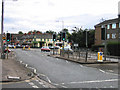
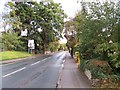
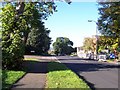
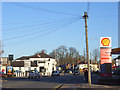
Photos of RG2 8HQ
Area Information
RG2 8HQ is a compact residential cluster in England, covering just 2.1 hectares and home to 1,362 residents. Its high population density of 64,938 people per square kilometre reflects a tightly knit community, ideal for those seeking proximity to amenities without sprawling urban sprawl. The area is characterised by a mature demographic, with a median age of 47 and a majority of residents aged between 30 and 64. This suggests a stable, established population, likely comprising families and professionals. The presence of nearby rail stations and retail hubs indicates a well-connected location, balancing residential comfort with accessibility. While the area is small, its strategic positioning near major transport routes and essential services makes it appealing for commuters and those prioritising convenience. The lack of natural constraints like protected woodlands or AONB designations means development is unencumbered, though the area’s size limits expansion. For buyers, RG2 8HQ offers a focused, community-oriented environment with a clear identity shaped by its density and demographics.
- Area Type
- Postcode
- Area Size
- 2.1 hectares
- Population
- 1362
- Population Density
- 3903 people/km²
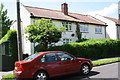
The property market in RG2 8HQ is defined by a 56% home ownership rate, with houses forming the predominant accommodation type. This suggests a focus on owner-occupied homes rather than a rental-heavy market, though the exact proportion of rental properties remains unspecified. The area’s small size—just 2.1 hectares—means the housing stock is limited, potentially creating competition among buyers. The concentration of houses implies a family-friendly environment, with properties likely designed for long-term occupancy. Given the high population density, properties may be smaller or more tightly spaced compared to suburban areas. For buyers, the compact nature of RG2 8HQ means proximity to amenities is a key advantage, though the limited land area may restrict future development. Those seeking a quiet, established residential setting with immediate access to transport and retail should consider the area’s constraints as part of its appeal.
House Prices in RG2 8HQ
Showing 16 properties
| Address | Type | Beds | Baths | Last Sale Price | Last Sale Date | |
|---|---|---|---|---|---|---|
| 8 Egerton Road, Shinfield, RG2 8HQ | Semi-detached | 4 | 2 | £607,500 | Jan 2025 | |
| 3 Egerton Road, Shinfield, RG2 8HQ | Semi-detached | 3 | 2 | £380,000 | Dec 2018 | |
| 7 Egerton Road, Shinfield, RG2 8HQ | Semi-detached | 3 | 2 | £377,000 | Apr 2018 | |
| 14 Egerton Road, Shinfield, RG2 8HQ | Semi-detached | 3 | 1 | £371,000 | Nov 2016 | |
| 4 Egerton Road, Shinfield, RG2 8HQ | Semi-detached | 3 | - | £310,000 | May 2015 | |
| 6 Egerton Road, Shinfield, RG2 8HQ | Bungalow | 3 | - | £210,000 | Dec 2011 | |
| 12 Egerton Road, Shinfield, RG2 8HQ | Semi-detached | 3 | 1 | £240,000 | Jul 2010 | |
| 16 Egerton Road, Shinfield, RG2 8HQ | house | - | - | £215,000 | Feb 2010 | |
| 15 Egerton Road, Shinfield, RG2 8HQ | Bungalow | - | - | £210,000 | Oct 2009 | |
| 10 Egerton Road, Shinfield, RG2 8HQ | Semi-detached | - | - | £275,000 | Jun 2007 |
Energy Efficiency in RG2 8HQ
RG2 8HQ’s lifestyle is shaped by its proximity to essential amenities. Within practical reach are five retail venues, including Tesco Reading, M&S Lower Earley, and Iceland Lower, offering a mix of everyday shopping and convenience. The area’s rail connections—such as Earley and Winnersh Triangle stations—provide easy access to broader networks, enabling quick travel to nearby towns and cities. While the data does not specify parks or leisure facilities, the absence of protected natural areas suggests a focus on urban living. The compact nature of the area means residents can access retail and transport hubs without long commutes, fostering a sense of convenience. The presence of multiple rail stops and retail options indicates a well-serviced environment, though the lack of detailed leisure amenities means buyers should consider whether additional recreational opportunities are available nearby.
Amenities
Schools
The nearest school to RG2 8HQ is Crosfields School, an independent institution. While no Ofsted rating is provided, the presence of an independent school suggests a focus on private education, which may cater to families seeking specific curricula or facilities. The absence of state schools in the immediate vicinity means families must consider travel time or broader regional options. For those prioritising independent education, Crosfields offers a dedicated option, though its capacity and student outcomes remain unquantified in the data. The single school listed reflects the area’s small size, which may limit the diversity of educational choices. Buyers with children should assess whether the school’s offerings align with their needs and whether additional schooling options are accessible nearby.
| Rank | School | Type | Entry gender | Ages |
|---|
Explore more schools in this area
Go to Schools tabDemographics
The community in RG2 8HQ is predominantly composed of adults aged 30 to 64, with a median age of 47. This suggests a mature population, likely with established careers and families. Home ownership stands at 56%, indicating a mix of owner-occupied properties and rentals, though the exact proportion of renters is not specified. The accommodation type is primarily houses, which aligns with the area’s residential character and higher population density. The predominant ethnic group is White, though no further breakdown of diversity is provided. The high population density—64,938 people per square kilometre—implies a compact, efficient use of space, which may influence the availability of larger homes. While the data does not include deprivation metrics, the presence of retail and transport links suggests a baseline level of service provision. For buyers, this demographic profile points to a stable, long-term resident base, which can be a factor in property value trends and community cohesion.
Household Size
Accommodation Type
Tenure
Ethnic Group
Religion
Household Composition
Age
Household Deprivation
NS-SEC
Explore more demographic insights in this area
Go to Demographics tabPlanning
Planning Constraints
- Flood RiskPremium
- Ramsar Wetland SitesPremium
- Area of Outstanding Natural BeautyPremium
- Protected Nature ReservePremium
- Protected WoodlandPremium