Area Overview for RG2 8QE
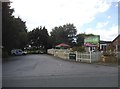
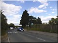
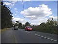
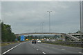
Photos of RG2 8QE
Area Information
RG2 8QE is a compact residential postcode in England, covering just 3,600 square metres and home to 2,270 residents. Its high population density of 630,493 people per square kilometre reflects a tightly knit community, though the area itself is small enough to feel intimate. The postcode is characterised by a mix of houses, with 62% of properties owner-occupied, suggesting a stable, long-term population. Most residents are adults aged 30–64, with a median age of 47, indicating a mature demographic. The area’s proximity to multiple railway stations, including Reading and Earley, ensures easy access to the city and beyond. Broadband quality is exceptional, with a score of 100, while mobile coverage is strong at 82. Safety is a key feature, with low flood risk and a crime score of 75, reflecting a secure environment. Living in RG2 8QE offers a blend of convenience and tranquillity, with amenities within walking distance and minimal environmental constraints. It is an appealing choice for those seeking a well-connected, low-risk neighbourhood with a focus on stability and practicality.
- Area Type
- Postcode
- Area Size
- 3600 m²
- Population
- 2270
- Population Density
- 2510 people/km²
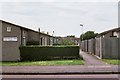
The property market in RG2 8QE is dominated by owner-occupied homes, with 62% of properties in private hands. This suggests a community of long-term residents rather than a rental-heavy area. The accommodation type is predominantly houses, which may indicate a preference for larger, more traditional dwellings compared to flats or apartments. Given the area’s small size and high population density, the housing stock is likely limited, making it a niche market for buyers seeking a specific postcode. The proximity to railway stations, including Reading and Earley, enhances the area’s appeal for commuters, though the compact nature of RG2 8QE means buyers should consider the immediate surroundings for more options. The lack of protected natural areas or planning constraints may also make it easier to adapt properties to individual needs. For those prioritising security and connectivity, the combination of low crime risk and excellent broadband access adds further value to the area’s housing.
House Prices in RG2 8QE
Showing 3 properties
| Address | Type | Beds | Baths | Last Sale Price | Last Sale Date | |
|---|---|---|---|---|---|---|
| 308 Old Whitley Wood Lane, Shinfield, RG2 8QE | Flat | 3 | 1 | £345,800 | May 2024 | |
| 312 Old Whitley Wood Lane, Shinfield, RG2 8QE | house | - | - | £195,000 | Jun 2003 | |
| 310 Old Whitley Wood Lane, Shinfield, RG2 8QE | Detached | - | - | - | - |
Energy Efficiency in RG2 8QE
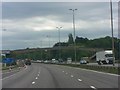
The lifestyle in RG2 8QE is shaped by its proximity to essential amenities, including five retail outlets such as Co-op Whitley, Lidl Beke, and Aldi Unit 6 Gateway Retail Park. These shops provide everyday convenience, from groceries to household essentials, reducing the need for long trips. The area’s rail connections to Reading and Earley further expand access to leisure, dining, and cultural opportunities in the city. While the data does not specify parks or recreational spaces, the absence of protected natural areas suggests a focus on practical living rather than expansive green spaces. The compact layout of the postcode means amenities are within walking distance, fostering a sense of community. The combination of retail options and rail links supports a self-sufficient lifestyle, with minimal reliance on distant services. For residents prioritising convenience and connectivity, RG2 8QE offers a balanced approach to daily living.
Amenities
Schools
The nearest school to RG2 8QE is OneSchool Global UK Reading Primary Campus, an independent institution. This school is part of a broader network of international education providers, suggesting a focus on high-quality, structured learning. The presence of an independent school may attract families seeking alternative educational pathways, though it is the only school listed in the area. The absence of state schools or secondary institutions means prospective buyers should investigate further for comprehensive schooling options. The mix of school types is limited here, but the availability of an independent primary school could be a draw for those prioritising specific curricula or facilities. Families should also consider the broader Reading area for additional educational resources, as local infrastructure may not cater to all age groups within RG2 8QE itself.
| Rank | School | Type | Entry gender | Ages |
|---|
Explore more schools in this area
Go to Schools tabDemographics
The community in RG2 8QE is predominantly composed of adults aged 30–64, with a median age of 47. This suggests a population that is largely settled, with fewer young families or retirees compared to other areas. Home ownership is high at 62%, indicating a strong presence of long-term residents rather than renters. The accommodation type is primarily houses, which aligns with the area’s residential character. The predominant ethnic group is White, though specific data on diversity or deprivation is not provided. The high population density of 630,493 people per square kilometre is notable, though the area’s small size means residents are likely to know their neighbours. This demographic profile suggests a community that values stability and continuity, with a focus on established living rather than transient populations. The age distribution and ownership rates also imply a lower demand for childcare facilities or student housing, which may influence local services and amenities.
Household Size
Accommodation Type
Tenure
Ethnic Group
Religion
Household Composition
Age
Household Deprivation
NS-SEC
Explore more demographic insights in this area
Go to Demographics tabPlanning
Planning Constraints
- Flood RiskPremium
- Ramsar Wetland SitesPremium
- Area of Outstanding Natural BeautyPremium
- Protected Nature ReservePremium
- Protected WoodlandPremium