Area Overview for RG2 8PZ
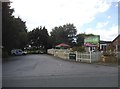
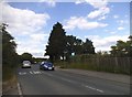
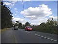
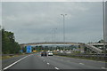
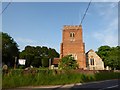
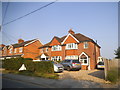
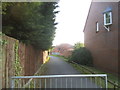
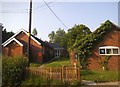
Photos of RG2 8PZ
Area Information
RG2 8PZ is a small, densely populated residential cluster in England, covering just 1.7 hectares yet housing 2,270 people. This compact area, with a population density of 137,335 people per square kilometre, reflects a tightly knit community where proximity to amenities and transport is key. The area’s appeal lies in its accessibility to nearby schools, retail hubs, and rail networks, making it practical for daily life. With a mix of housing types and a strong focus on local infrastructure, RG2 8PZ offers a balance of convenience and residential stability. Its proximity to major railway stations and high broadband quality ensures connectivity for both work and leisure. While the area is small, its strategic location near Reading’s urban core provides residents with easy access to city amenities without the congestion of larger centres. For those prioritising practicality and community cohesion, RG2 8PZ presents a compelling case for living in a well-served, compact postcode.
- Area Type
- Postcode
- Area Size
- 1.7 hectares
- Population
- 2270
- Population Density
- 2510 people/km²
RG2 8PZ is primarily an owner-occupied area, with 62% of homes owned by residents rather than rented. The accommodation type is predominantly houses, which aligns with the area’s family-focused demographic. This housing stock suggests a market where properties are likely to be larger and more suited to long-term occupancy. Given the area’s small size and high population density, the housing stock is limited, which may mean competition for available homes. Buyers should consider the proximity to rail networks and schools as key selling points, as these amenities enhance the area’s appeal. The absence of planning constraints or environmental restrictions further supports a stable property market, though the compact nature of RG2 8PZ means buyers must act decisively to secure a home in this sought-after postcode.
House Prices in RG2 8PZ
Showing 49 properties
| Address | Type | Beds | Baths | Last Sale Price | Last Sale Date | |
|---|---|---|---|---|---|---|
| 10 Drewett Close, Shinfield, RG2 8PZ | Semi-detached | 3 | 1 | £305,000 | Sep 2021 | |
| 4 Drewett Close, Shinfield, RG2 8PZ | Detached | 3 | 1 | £279,950 | Jul 2020 | |
| 21 Drewett Close, Shinfield, RG2 8PZ | Terraced | 3 | 1 | £297,000 | Nov 2019 | |
| 11 Drewett Close, Shinfield, RG2 8PZ | Terraced | 3 | 1 | £290,000 | Oct 2019 | |
| 36 Drewett Close, Shinfield, RG2 8PZ | house | 3 | - | £280,000 | May 2019 | |
| 49 Drewett Close, Shinfield, RG2 8PZ | Maisonette | 2 | 1 | £175,000 | Feb 2019 | |
| 34 Drewett Close, Shinfield, RG2 8PZ | house | 3 | - | £275,000 | Jun 2018 | |
| 9 Drewett Close, Shinfield, RG2 8PZ | Terraced | 3 | 1 | £269,000 | Nov 2017 | |
| 14 Drewett Close, Shinfield, RG2 8PZ | Terraced | 3 | - | £280,000 | Jun 2017 | |
| 20 Drewett Close, Shinfield, RG2 8PZ | Terraced | 3 | - | £280,000 | Jan 2017 |
Energy Efficiency in RG2 8PZ
Living in RG2 8PZ offers access to essential retail and transport hubs within practical reach. The area is served by five retail outlets, including Co-op Whitley, Aldi, and Lidl, ensuring everyday shopping needs are met. These stores provide a range of products, from groceries to household essentials, supporting a convenient lifestyle. Nearby rail stations, such as Reading and Earley, connect residents to broader networks, enabling quick travel to work, leisure, or social activities. While the data does not mention parks or leisure facilities, the proximity to urban centres implies access to larger recreational spaces. The combination of retail, transport, and connectivity fosters a lifestyle that balances practicality with accessibility, making daily routines efficient and stress-free for residents.
Amenities
Schools
The nearest school to RG2 8PZ is OneSchool Global UK Reading Primary Campus, an independent institution. While no Ofsted rating is provided, the presence of an independent school suggests a focus on high-quality education, which is a significant draw for families. The area’s single listed school is a primary campus, indicating that secondary education options may require commuting to nearby towns. For parents prioritising independent schooling, this facility offers a dedicated educational environment. However, the lack of additional schools in the data means families should investigate further for secondary options. The school’s type and location reflect a community where education is a key consideration, though the limited data means buyers should verify availability and suitability for their needs.
| Rank | School | Type | Entry gender | Ages |
|---|
Explore more schools in this area
Go to Schools tabDemographics
The population of RG2 8PZ is predominantly adults aged 30–64, with a median age of 47, reflecting a mature, established community. Home ownership is high at 62%, indicating a stable, long-term resident base. The area is characterised by houses rather than flats, suggesting a family-oriented housing stock. The predominant ethnic group is White, though no further breakdown is provided. The age profile and ownership rates imply a neighbourhood where many residents are in their prime working years, potentially contributing to a steady local economy. With no data on deprivation, the focus remains on the demographic strengths: a low crime score of 75 (level PASS) and a lack of environmental constraints such as flood risk or protected natural areas. This suggests a safe, unencumbered living environment for families and professionals alike.
Household Size
Accommodation Type
Tenure
Ethnic Group
Religion
Household Composition
Age
Household Deprivation
NS-SEC
Explore more demographic insights in this area
Go to Demographics tabPlanning
Planning Constraints
- Flood RiskPremium
- Ramsar Wetland SitesPremium
- Area of Outstanding Natural BeautyPremium
- Protected Nature ReservePremium
- Protected WoodlandPremium