Area Overview for RG2 8PY
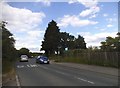
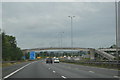
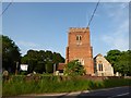
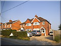
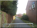
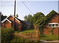
Photos of RG2 8PY


Area Information
RG2 8PY is a small, tightly packed residential postcode area in England, covering just 8,536 square metres. Despite its compact size, it is home to 2,270 people, resulting in a population density of over 265,000 people per square kilometre. This density suggests a closely knit community, where daily life is shaped by proximity to local amenities and transport links. The area is characterised by its mix of housing types, though the data indicates a predominance of homes rather than flats or apartments. Residents here are likely to be familiar with their neighbours, given the high concentration of people in a limited space. The area’s compact nature means it is well served by nearby retail and rail connections, making it practical for those who value convenience. While it lacks expansive green spaces or major landmarks, its strength lies in its accessibility and the presence of essential services within walking or short driving distance. For buyers, RG2 8PY offers a snapshot of suburban living with a focus on practicality and connectivity.
- Area Type
- Postcode
- Area Size
- 8536 m²
- Population
- 2270
- Population Density
- 2510 people/km²
The property market in RG2 8PY is dominated by owner-occupied homes, with 62% of residents living in properties they own. This contrasts with areas where rental demand drives the market, indicating a more stable, long-term buyer base. The accommodation type is primarily houses, which is unusual for a small postcode area and suggests a mix of semi-detached or terraced properties. Given the high population density, the housing stock is likely to be compact, with limited scope for new developments. For buyers, this means the area is not a hotspot for speculative investment but rather a place where properties are held by residents with a vested interest in the local community. The proximity to rail stations and retail amenities may enhance the appeal of homes here, though the small size of the area means buyers should consider the immediate surroundings for more options.
House Prices in RG2 8PY
Showing 23 properties
| Address | Type | Beds | Baths | Last Sale Price | Last Sale Date | |
|---|---|---|---|---|---|---|
| 377 Old Whitley Wood Lane, Shinfield, RG2 8PY | Detached | 3 | 1 | £435,000 | Mar 2025 | |
| 381 Old Whitley Wood Lane, Shinfield, RG2 8PY | Semi-detached | 4 | 1 | £533,000 | Aug 2024 | |
| 359 Old Whitley Wood Lane, Shinfield, RG2 8PY | Semi-detached | 3 | 1 | £370,000 | Mar 2024 | |
| 365 Old Whitley Wood Lane, Shinfield, RG2 8PY | house | - | - | £425,000 | May 2021 | |
| 357 Old Whitley Wood Lane, Shinfield, RG2 8PY | Semi-detached | 3 | 2 | £240,000 | Apr 2018 | |
| 361 Old Whitley Wood Lane, Shinfield, RG2 8PY | Semi-detached | 3 | - | £330,000 | Dec 2017 | |
| 363 Old Whitley Wood Lane, Shinfield, RG2 8PY | house | - | - | £320,000 | Oct 2016 | |
| 353 Old Whitley Wood Lane, Shinfield, RG2 8PY | Semi-detached | 3 | - | £218,000 | Mar 2013 | |
| 351 Old Whitley Wood Lane, Shinfield, RG2 8PY | house | 3 | 1 | £166,500 | May 2010 | |
| 379 Old Whitley Wood Lane, Shinfield, RG2 8PY | house | - | - | £271,000 | Jul 2008 |
Energy Efficiency in RG2 8PY
The lifestyle in RG2 8PY is shaped by its proximity to essential retail and transport hubs. Within practical reach are five retail outlets, including Co-op Whitley, Aldi Unit 6 Gateway Retail Park, and Lidl Whitley. These stores provide everyday shopping convenience, from groceries to household items. The area’s rail connectivity is a significant asset, with five nearby stations offering access to Reading and beyond. While there is no mention of parks or leisure facilities in the data, the retail and transport options suggest a practical, no-frills lifestyle. The compact nature of the area means residents can access necessities quickly, though those seeking expansive recreational spaces may need to venture further afield. The balance of retail and transport makes RG2 8PY suitable for those prioritising convenience over large-scale amenities.
Amenities
Schools
The nearest school to RG2 8PY is OneSchool Global UK Reading Primary Campus, an independent institution. No other schools are listed in the data, so this is the sole educational option within practical reach. As an independent school, it likely operates on a fee-paying model, which may influence its accessibility for families. The absence of state schools or secondary institutions suggests that parents may need to look beyond the immediate area for comprehensive education options. For those prioritising a single school, OneSchool Global provides a dedicated primary education, but families requiring a broader range of educational choices may find the area’s limited school provision a consideration.
| Rank | School | Type | Entry gender | Ages |
|---|
Explore more schools in this area
Go to Schools tabDemographics
The population of RG2 8PY is predominantly adults aged 30–64, with a median age of 47. This suggests a community of established professionals and families, rather than a younger or elderly demographic. Home ownership is strong here, with 62% of residents owning their homes. The accommodation type is primarily houses, indicating a more traditional, low-density housing stock compared to areas with higher apartment occupancy. The predominant ethnic group is White, though no specific data on diversity or minority representation is provided. The high proportion of homeowners and the age profile suggest a stable, long-term resident base. The absence of detailed deprivation data means it is unclear how economic factors might influence quality of life, but the overall profile points to a mature, settled community with a focus on home ownership and family living.
Household Size
Accommodation Type
Tenure
Ethnic Group
Religion
Household Composition
Age
Household Deprivation
NS-SEC
Explore more demographic insights in this area
Go to Demographics tabPlanning
Planning Constraints
- Flood RiskPremium
- Ramsar Wetland SitesPremium
- Area of Outstanding Natural BeautyPremium
- Protected Nature ReservePremium
- Protected WoodlandPremium