Area Overview for RG2 8PF
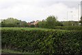
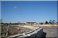
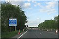
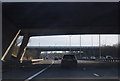
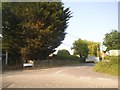
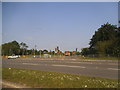
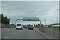
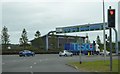
Photos of RG2 8PF
Area Information
RG2 8PF is a small, tightly packed residential cluster in England, covering just 4.9 hectares and home to 1,530 people. Its high population density — 31,427 people per square kilometre — reflects a compact, community-oriented layout. This area is not a sprawling suburb but a focused neighbourhood where daily life is shaped by proximity to key services. Residents benefit from nearby rail links, including Earley, Reading West, and Reading Railway Stations, which connect to major urban hubs. The area’s retail options are modest but practical, with Aldi, Lidl, and Budgens within walking distance. While the postcode is small, it is positioned to offer access to broader infrastructure, making it suitable for those who value convenience without sacrificing a sense of local identity. The demographic profile suggests a mature, stable population, with adults aged 30–64 forming the majority. This makes RG2 8PF a place where established residents, rather than young families or students, dominate the landscape. Its appeal lies in its simplicity: a quiet, well-connected spot with minimal environmental constraints and a low crime risk.
- Area Type
- Postcode
- Area Size
- 4.9 hectares
- Population
- 1530
- Population Density
- 3673 people/km²
The property market in RG2 8PF is characterised by a low home ownership rate of 36%, indicating that the majority of residents are renters rather than homeowners. The accommodation type is predominantly houses, which is unusual for areas with high population density. This suggests that the housing stock is limited in both quantity and variety, with a focus on single-family dwellings. Given the area’s small size — just 4.9 hectares — the number of available properties is constrained, making it unlikely to be a hotspot for property speculation or development. For buyers, this means a limited selection of homes, most of which are owner-occupied. The lack of flats or apartments may also limit options for first-time buyers or those seeking more affordable housing. The market is likely stable but not dynamic, with prices and availability dictated by the small, fixed supply of properties.
House Prices in RG2 8PF
Showing 15 properties
| Address | Type | Beds | Baths | Last Sale Price | Last Sale Date | |
|---|---|---|---|---|---|---|
| 12 Harness Close, Reading, RG2 8PF | house | 3 | - | £330,000 | Jun 2019 | |
| 2 Harness Close, Reading, RG2 8PF | house | - | - | £172,250 | Jul 2010 | |
| 4 Harness Close, Reading, RG2 8PF | Terraced | - | - | £53,500 | Oct 1996 | |
| 14 Harness Close, Reading, RG2 8PF | house | - | - | £54,950 | Jul 1996 | |
| 11 Harness Close, Reading, RG2 8PF | Terraced | - | - | - | - | |
| 1 Harness Close, Reading, RG2 8PF | Terraced | - | - | - | - | |
| 5 Harness Close, Reading, RG2 8PF | house | - | - | - | - | |
| 6 Harness Close, Reading, RG2 8PF | Terraced | - | - | - | - | |
| 3 Harness Close, Reading, RG2 8PF | Terraced | - | - | - | - | |
| 16 Harness Close, Reading, RG2 8PF | house | - | - | - | - |
Energy Efficiency in RG2 8PF
Daily life in RG2 8PF is shaped by its proximity to essential retail and transport hubs. The area’s retail options include Aldi Unit 6 at Gateway Retail Park, Lidl Whitley, and Budgens Three, providing basic shopping needs within walking distance. These stores cater to everyday requirements, though the selection is modest compared to larger retail centres. For transport, the presence of five nearby railway stations — including Earley, Reading West, and Reading — offers frequent services to key destinations. This makes the area ideal for commuters or those who value easy access to public transport. While there are no named parks or leisure facilities in the data, the absence of protected natural areas or planning constraints suggests that the landscape is primarily residential. The lifestyle here is practical and efficient, with limited space for leisure but strong connectivity to broader opportunities.
Amenities
Schools
| Rank | School | Type | Entry gender | Ages |
|---|
Explore more schools in this area
Go to Schools tabDemographics
The community in RG2 8PF is predominantly composed of adults aged 30–64, with a median age of 47. This suggests a population that is largely settled, with fewer young families or retirees compared to other areas. Home ownership is relatively low at 36%, indicating that a significant proportion of residents rent their homes. The accommodation type is primarily houses, which contrasts with areas dominated by flats or apartments. The predominant ethnic group is White, reflecting a homogenous demographic profile. The high population density — 31,427 people per square kilometre — means that the area is intensely populated despite its small size. This density may influence the character of daily life, with limited private space but strong communal access to amenities. The data does not indicate significant deprivation, but the low home ownership rate and high age range suggest a community that may be more transient or reliant on rental markets.
Household Size
Accommodation Type
Tenure
Ethnic Group
Religion
Household Composition
Age
Household Deprivation
NS-SEC
Explore more demographic insights in this area
Go to Demographics tabPlanning
Planning Constraints
- Flood RiskPremium
- Ramsar Wetland SitesPremium
- Area of Outstanding Natural BeautyPremium
- Protected Nature ReservePremium
- Protected WoodlandPremium