Area Overview for RG2 8UB
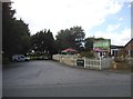
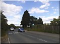
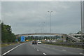
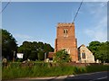
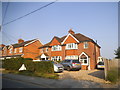
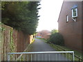
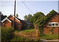
Photos of RG2 8UB

Area Information
RG2 8UB is a compact postcode area in England, covering 7,984 square metres and home to 1,530 residents. Its high population density of 191,629 people per square kilometre reflects a tightly knit residential cluster, where daily life revolves around close-knit interactions and practical living. The area is characterised by its small-scale nature, with homes predominantly in the form of houses, catering to a community of adults aged 30–64, many of whom are established in their careers. Proximity to key transport links, including Earley and Reading railway stations, ensures easy access to nearby towns and cities. Residents benefit from excellent broadband connectivity, rated 100 out of 100, supporting both professional and domestic needs. The area’s low crime risk score of 79 and absence of environmental constraints like protected woodlands or flood zones make it an appealing choice for those prioritising safety and stability. Living in RG2 8UB means balancing a compact, community-focused environment with the convenience of nearby amenities and reliable infrastructure.
- Area Type
- Postcode
- Area Size
- 7984 m²
- Population
- 1530
- Population Density
- 3673 people/km²
The property market in RG2 8UB is defined by its small size and the dominance of houses as the primary accommodation type. With a home ownership rate of 36%, the area is not heavily reliant on rental properties, though the limited number of homes suggests a constrained market. This could mean that buyers seeking properties in RG2 8UB may need to consider nearby areas for more options. The presence of houses rather than flats or apartments indicates a preference for traditional, family-oriented housing. Given the area’s compact nature, property values may be influenced by proximity to transport links and amenities. For buyers, this means a focus on securing one of the available homes, with limited scope for expansion within the postcode itself. The market’s character is shaped by its residents’ established presence and the area’s practical, low-maintenance appeal.
House Prices in RG2 8UB
Showing 16 properties
| Address | Type | Beds | Baths | Last Sale Price | Last Sale Date | |
|---|---|---|---|---|---|---|
| 8 Woodman Close, Reading, RG2 8UB | Terraced | 3 | 2 | £345,000 | Jul 2024 | |
| 5 Woodman Close, Reading, RG2 8UB | house | - | - | £280,000 | Oct 2020 | |
| 16 Woodman Close, Reading, RG2 8UB | house | - | - | £170,000 | Nov 2018 | |
| 12 Woodman Close, Reading, RG2 8UB | Terraced | 4 | 1 | £349,000 | May 2018 | |
| 2 Woodman Close, Reading, RG2 8UB | house | 3 | - | £274,000 | Jun 2016 | |
| 17 Woodman Close, Reading, RG2 8UB | Semi-detached | 4 | 1 | £172,000 | Mar 2003 | |
| 15 Woodman Close, Reading, RG2 8UB | Bungalow | - | - | - | - | |
| 3 Woodman Close, Reading, RG2 8UB | Bungalow | - | - | - | - | |
| 10 Woodman Close, Reading, RG2 8UB | Terraced | - | - | - | - | |
| 9 Woodman Close, Reading, RG2 8UB | Terraced | - | - | - | - |
Energy Efficiency in RG2 8UB
Living in RG2 8UB offers access to essential retail and transport hubs within practical reach. The area’s retail options include Aldi Unit 6 Gateway Retail Park, Co-op Whitley, and Lidl Whitley, providing everyday shopping needs with minimal travel. These stores cater to a range of household requirements, from groceries to household goods. Nearby railway stations, such as Earley and Reading, enhance mobility, connecting residents to broader networks for work, leisure, or socialising. While the area lacks large-scale leisure facilities, its proximity to urban centres compensates with opportunities for dining, culture, and entertainment elsewhere. The compact nature of RG2 8UB means daily life is efficient, with amenities clustered closely. This balance of practicality and connectivity supports a lifestyle that prioritises convenience without sacrificing access to regional resources.
Amenities
Schools
| Rank | School | Type | Entry gender | Ages |
|---|
Explore more schools in this area
Go to Schools tabDemographics
The population of RG2 8UB skews heavily towards adults aged 30–64, with a median age of 47. This suggests a mature, established community, likely with strong ties to local employment and long-term residency. Home ownership rates stand at 36%, indicating that a significant portion of the housing stock is rented, which may reflect the area’s smaller size and limited property diversity. The predominant accommodation type is houses, aligning with the demographic profile of older, settled residents. The predominant ethnic group is White, with no specific data on diversity beyond this. While the area’s population density is exceptionally high, this does not necessarily correlate with deprivation; instead, it points to a focused, self-contained community. The low crime risk score of 79 further supports a stable environment, where residents can expect a predictable and secure lifestyle.
Household Size
Accommodation Type
Tenure
Ethnic Group
Religion
Household Composition
Age
Household Deprivation
NS-SEC
Explore more demographic insights in this area
Go to Demographics tabPlanning
Planning Constraints
- Flood RiskPremium
- Ramsar Wetland SitesPremium
- Area of Outstanding Natural BeautyPremium
- Protected Nature ReservePremium
- Protected WoodlandPremium