Area Overview for RG2 8US
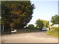
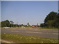
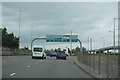
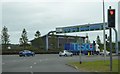
Photos of RG2 8US
Area Information
RG2 8US is a compact residential postcode in England, covering just 6.4 hectares and home to 1986 residents. Its population density is exceptionally high at 30,846 people per square kilometre, reflecting a tightly knit, urbanised cluster. This area is characterised by its proximity to key transport links, with five railway stations within practical reach, including Reading and Earley stations. Daily life here is shaped by its small-scale nature—residents benefit from a mix of retail options, such as Aldi, Lidl, and Co-op, all within the Gateway Retail Park and Whitley areas. The community is predominantly composed of adults aged 30–64, with a median age of 47, suggesting a mature, stable population. While the area lacks natural landscapes or protected sites, its strategic location near major rail networks and high-quality digital connectivity makes it appealing for commuters and those prioritising convenience. Living in RG2 8US means navigating a dense, efficient environment where proximity to services and transport is a defining feature.
- Area Type
- Postcode
- Area Size
- 6.4 hectares
- Population
- 1986
- Population Density
- 2089 people/km²
The property market in RG2 8US is dominated by owner-occupied homes, with 62% of properties owned by residents rather than rented. Houses, not flats or apartments, are the primary accommodation type, suggesting a focus on family homes or single-unit properties. This composition indicates a market where long-term investment is more common than short-term rental activity. Given the area’s small size and high population density, the housing stock is likely limited, with little scope for new developments. Buyers should consider that demand for homes here may be strong, driven by proximity to rail networks and retail amenities. However, the compact nature of RG2 8US means competition for properties could be intense, particularly for those seeking larger homes or specific features. The predominance of owner-occupation also suggests a community with a strong sense of local attachment, which may influence property values and desirability.
House Prices in RG2 8US
Showing 41 properties
| Address | Type | Beds | Baths | Last Sale Price | Last Sale Date | |
|---|---|---|---|---|---|---|
| 35 The Maying, Reading, RG2 8US | house | - | - | - | - | |
| 18 The Maying, Reading, RG2 8US | house | - | - | - | - | |
| 28 The Maying, Reading, RG2 8US | house | - | - | - | - | |
| 42 The Maying, Reading, RG2 8US | house | - | - | - | - | |
| 32 The Maying, Reading, RG2 8US | house | - | - | - | - | |
| 21 The Maying, Reading, RG2 8US | house | - | - | - | - | |
| 36 The Maying, Reading, RG2 8US | house | - | - | - | - | |
| 17 The Maying, Reading, RG2 8US | house | - | - | - | - | |
| 10 The Maying, Reading, RG2 8US | Terraced | - | - | - | - | |
| 6 The Maying, Reading, RG2 8US | house | - | - | - | - |
Energy Efficiency in RG2 8US
Living in RG2 8US offers a blend of practicality and accessibility. The area’s retail options are well-served by Aldi Unit 6 at Gateway Retail Park, Lidl in Whitley, and Co-op Whitley, providing everyday essentials within walking or short driving distance. For transport, five railway stations—including Reading, Reading West, and Earley—offer frequent services to major hubs, making commuting efficient. While the area lacks parks or leisure facilities within the provided data, its compact design ensures residents can access nearby amenities in the surrounding regions. The presence of multiple retail and transport hubs suggests a lifestyle focused on convenience, where daily needs are met without long journeys. This makes RG2 8US suitable for those prioritising proximity to services over expansive natural spaces, though it may not appeal to those seeking large-scale recreational areas.
Amenities
Schools
| Rank | School | Type | Entry gender | Ages |
|---|
Explore more schools in this area
Go to Schools tabDemographics
The community in RG2 8US is predominantly composed of adults aged 30–64, with a median age of 47. This suggests a population skewed towards middle-aged individuals, likely established professionals or families. Home ownership stands at 62%, with houses being the primary accommodation type. The predominant ethnic group is White, indicating a relatively homogenous demographic profile. The high population density—30,846 people per square kilometre—reflects a compact, possibly urbanised settlement where space is limited but services are concentrated. While no specific data on deprivation is provided, the high home ownership rate and mature age profile may imply a stable economic environment. However, the absence of diversity data means the area’s social dynamics remain less defined. For residents, this translates to a community where familiarity and routine are likely key aspects of daily life.
Household Size
Accommodation Type
Tenure
Ethnic Group
Religion
Household Composition
Age
Household Deprivation
NS-SEC
Explore more demographic insights in this area
Go to Demographics tabPlanning
Planning Constraints
- Flood RiskPremium
- Ramsar Wetland SitesPremium
- Area of Outstanding Natural BeautyPremium
- Protected Nature ReservePremium
- Protected WoodlandPremium