Area Overview for RG2 8NG
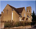
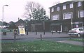
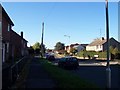
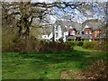
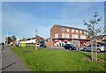
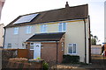
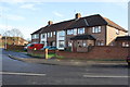
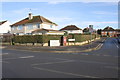
Photos of RG2 8NG
Area Information
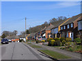
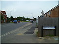
RG2 8NG is a small, densely populated residential cluster in England, covering 4,812 square metres and home to 1,585 residents. Its compact size means the area is tightly knit, with a high population density of 329,410 people per square kilometre. This makes it a place where daily life is shaped by proximity to neighbours and local amenities. The area’s character is defined by its mature demographic, with a median age of 47 and a majority of residents aged 30–64. While it is not a high-density urban centre, its limited size means most needs are met within walking distance. The presence of multiple rail stations, including Earley and Reading Railway Stations, ensures easy access to nearby towns. For those prioritising convenience, the area’s proximity to retail hubs like Co-op Whitley and Tesco Reading adds to its practical appeal. However, the lack of larger public spaces or green areas means the community feel is more intimate than sprawling. Living here demands a balance between proximity and privacy, with the area’s small footprint offering both challenges and opportunities for those seeking a compact, connected lifestyle.
- Area Type
- Postcode
- Area Size
- 4812 m²
- Population
- 1585
- Population Density
- 4419 people/km²
RG2 8NG is a small area where 37% of homes are owner-occupied, suggesting that a significant portion of the housing stock is rented out. The accommodation type is predominantly houses, which is notable for a postcode of this size. This mix implies a blend of older, larger properties and possibly some newer builds, though the exact age of the housing stock is not specified. The low home ownership rate could indicate a rental market dominated by private landlords or housing associations, which may affect property values and availability for buyers. For those considering purchasing, the small area means competition for homes is likely to be intense, with limited scope for expansion. The presence of rail stations nearby, such as Reading and Earley Railway Stations, may appeal to commuters, but the area’s compact nature means buyers must weigh proximity to amenities against the potential for overcrowding. The housing stock’s focus on houses, rather than flats, may also cater to those seeking more space, though the high population density suggests that space is at a premium.
House Prices in RG2 8NG
Showing 11 properties
| Address | Type | Beds | Baths | Last Sale Price | Last Sale Date | |
|---|---|---|---|---|---|---|
| 33 Holberton Road, Reading, RG2 8NG | house | 1 | - | £750,000 | Jun 2025 | |
| 21 Holberton Road, Reading, RG2 8NG | Semi-detached | 3 | - | £275,000 | May 2019 | |
| 29 Holberton Road, Reading, RG2 8NG | house | - | - | £150,000 | Jan 2007 | |
| 15 Holberton Road, Reading, RG2 8NG | Semi-detached | - | - | £55,000 | Jul 1998 | |
| 17 Holberton Road, Reading, RG2 8NG | Semi-detached | - | - | £74,000 | Jun 1998 | |
| 31 Holberton Road, Reading, RG2 8NG | Semi-detached | - | - | £44,000 | May 1997 | |
| 23 Holberton Road, Reading, RG2 8NG | house | - | - | - | - | |
| 27 Holberton Road, Reading, RG2 8NG | house | - | - | - | - | |
| 19 Holberton Road, Reading, RG2 8NG | house | - | - | - | - | |
| 25 Holberton Road, Reading, RG2 8NG | house | - | - | - | - |
Energy Efficiency in RG2 8NG
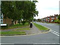
Residents of RG2 8NG have access to a range of local amenities within practical reach. The area is served by five retail outlets, including Co-op Whitley, Lidl Whitley, and Tesco Reading, offering everyday shopping needs. These stores provide convenience for groceries, household items, and other essentials. The presence of multiple rail stations, such as Earley and Reading Railway Stations, enhances connectivity, allowing residents to commute to nearby towns or access broader services. While there is no mention of parks or leisure facilities in the data, the proximity to retail and transport hubs suggests a lifestyle focused on practicality and ease of access. The area’s small size means that daily life is centred around these local amenities, with little need to travel far for basic needs. However, the lack of larger public spaces or recreational areas may limit options for those seeking more expansive leisure activities.
Amenities
Schools
The only school listed near RG2 8NG is Blagdon Nursery School, which provides early education for young children. There are no primary or secondary schools in the data, meaning families with older children may need to look further afield for schooling options. The presence of a nursery school suggests that the area is suitable for young families, but the lack of higher education institutions nearby could be a drawback for those requiring a full range of school facilities. Parents may need to consider commuting to nearby towns or villages for primary and secondary education. While the nursery school offers a local resource, the absence of other schools highlights the need for careful planning when choosing this area for long-term family living.
| Rank | School | Type | Entry gender | Ages |
|---|
Explore more schools in this area
Go to Schools tabDemographics
The community in RG2 8NG is predominantly middle-aged, with a median age of 47 and the largest age group being adults aged 30–64. This suggests a population that is largely settled, with fewer young families or retirees compared to other areas. Home ownership here is relatively low at 37%, indicating a higher proportion of renters than owners. The accommodation type is primarily houses, which is unusual for a small postcode area but may reflect the presence of older, larger properties. The predominant ethnic group is White, with no data provided on other demographics. The high population density—329,410 people per square kilometre—means living spaces are closely packed, which can influence both social dynamics and property values. While there is no explicit data on deprivation, the combination of low home ownership and high density may indicate economic pressures, though this is not directly confirmed. The area’s demographics suggest a stable, established population rather than a rapidly changing one.
Household Size
Accommodation Type
Tenure
Ethnic Group
Religion
Household Composition
Age
Household Deprivation
NS-SEC
Explore more demographic insights in this area
Go to Demographics tabPlanning
Planning Constraints
- Flood RiskPremium
- Ramsar Wetland SitesPremium
- Area of Outstanding Natural BeautyPremium
- Protected Nature ReservePremium
- Protected WoodlandPremium