Area Overview for RG2 8NJ
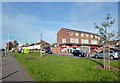
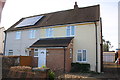
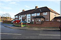
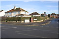
Photos of RG2 8NJ
Area Information
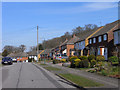
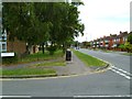
RG2 8NJ is a small, tightly packed residential postcode in England, covering just 3,657 square metres and home to 1,765 people. Despite its compact size, the area has a high population density of 482,603 people per square kilometre, reflecting its role as a focused residential cluster. This is a place where proximity to amenities and transport links is key. The area’s character is defined by its accessibility: within practical reach are multiple railway stations, including Earley and Reading Railway Station, and retail hubs like Co-op Whitley and Tesco Reading. Daily life here is shaped by the balance between residential tranquility and nearby urban convenience. The population, predominantly adults aged 30–64, suggests a community of established residents, many of whom own their homes. With no significant environmental constraints or flood risks, RG2 8NJ offers a straightforward, low-maintenance living environment, ideal for those prioritising safety, connectivity, and proximity to essential services.
- Area Type
- Postcode
- Area Size
- 3657 m²
- Population
- 1765
- Population Density
- 6055 people/km²
RG2 8NJ is a predominantly owner-occupied area, with 72% of residents living in homes they own. The accommodation type is largely houses, which is notable given the postcode’s small size. This suggests a limited but established housing stock, likely characterised by older properties rather than new developments. The high home ownership rate indicates a community of long-term residents, which can stabilise property values and reduce rental demand. For buyers, this means a market focused on existing homes rather than speculative investment. The small area size means the housing stock is finite, so buyers should consider nearby areas for broader options. The absence of flats or newer developments may appeal to those seeking traditional, low-maintenance homes but could limit choice for those needing modern amenities or flexible living arrangements.
House Prices in RG2 8NJ
Showing 7 properties
| Address | Type | Beds | Baths | Last Sale Price | Last Sale Date | |
|---|---|---|---|---|---|---|
| 1 Holberton Road, Reading, RG2 8NJ | Terraced | 3 | 1 | £423,300 | Feb 2024 | |
| 9 Holberton Road, Reading, RG2 8NJ | Semi-detached | 3 | 2 | £380,000 | Jul 2019 | |
| 13 Holberton Road, Reading, RG2 8NJ | Semi-detached | 3 | 1 | £142,000 | Apr 2003 | |
| 7 Holberton Road, Reading, RG2 8NJ | Flat | 1 | 1 | - | - | |
| 3 Holberton Road, Reading, RG2 8NJ | Semi-detached | - | - | - | - | |
| 11 Holberton Road, Reading, RG2 8NJ | house | - | - | - | - | |
| 5 Holberton Road, Reading, RG2 8NJ | house | - | - | - | - |
Energy Efficiency in RG2 8NJ
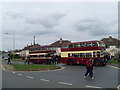
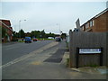
Living in RG2 8NJ offers access to essential retail and transport hubs within short distances. Nearby shops include Co-op Whitley, Tesco Reading, and Lidl Whitley, providing everyday grocery and household needs. The area’s railway stations—Earley, Reading, and Reading West—connect residents to wider networks, enabling easy travel to work, leisure, or shopping. While there is no mention of parks or leisure facilities in the data, the absence of planning constraints like AONB or protected woodlands suggests space for local amenities. The compact nature of the area means daily errands and travel are efficient, though residents may need to venture slightly further for specialist services. The combination of retail, rail, and low environmental restrictions creates a functional, if modest, lifestyle focused on practicality and connectivity.
Amenities
Schools
| Rank | School | Type | Entry gender | Ages |
|---|
Explore more schools in this area
Go to Schools tabDemographics
The community in RG2 8NJ is predominantly composed of adults aged 30–64, with a median age of 47. This suggests a mature, stable population, likely with long-term ties to the area. Home ownership is high, at 72%, with most properties being houses rather than flats. The predominant ethnic group is White, though no specific diversity data is provided. The high home ownership rate indicates a community of long-term residents rather than transient renters, which can contribute to a sense of continuity and local cohesion. The age profile suggests a mix of professionals, families, and retirees, all of whom may prioritise the area’s safety and accessibility. The absence of specific data on deprivation or income levels means the quality of life here cannot be fully assessed, but the low crime risk and lack of environmental constraints imply a generally stable and low-stress environment.
Household Size
Accommodation Type
Tenure
Ethnic Group
Religion
Household Composition
Age
Household Deprivation
NS-SEC
Explore more demographic insights in this area
Go to Demographics tabPlanning
Planning Constraints
- Flood RiskPremium
- Ramsar Wetland SitesPremium
- Area of Outstanding Natural BeautyPremium
- Protected Nature ReservePremium
- Protected WoodlandPremium