Area Overview for RG2 8JZ
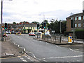
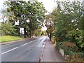
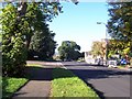
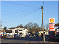
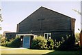
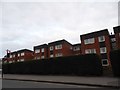
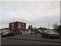
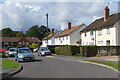
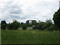
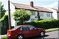
Photos of RG2 8JZ
Area Information
RG2 8JZ is a compact residential postcode in England, covering just 827 square metres and home to 1653 residents. Its high population density of 1,998,267 people per square kilometre reflects a tightly knit community, where proximity to amenities and transport links is a defining feature. This area is ideal for those seeking a balance between urban convenience and a quieter residential setting. The cluster of homes here is relatively small, making it a focused neighbourhood with a distinct character. Daily life is shaped by its accessibility to nearby towns and services, while the absence of major planning constraints means residents can enjoy a straightforward living environment. With no protected natural sites or flood risks, the area offers a stable foundation for homeowners and renters alike. Its compact size ensures that essential services are within easy reach, though the small footprint also means the community is closely connected, fostering a sense of familiarity among residents.
- Area Type
- Postcode
- Area Size
- 827 m²
- Population
- 1653
- Population Density
- 4268 people/km²
The property market in RG2 8JZ is characterised by a 40% home ownership rate, indicating that a significant portion of the housing stock is rented. This suggests a rental market that may cater to both long-term tenants and those seeking temporary accommodation. The accommodation type is predominantly houses, which is unusual for a small postcode area but may reflect the presence of larger, detached properties. For buyers, this means the available homes are likely to be individual residences rather than apartments or shared housing. The small size of the area means the housing stock is limited, and buyers should consider the proximity to nearby towns for additional options. The lack of planning constraints, such as protected sites or flood risks, may make this area attractive for those prioritising straightforward property transactions. However, the lower home ownership rate could indicate a reliance on rental properties, which may affect long-term investment potential.
House Prices in RG2 8JZ
Showing 6 properties
| Address | Type | Beds | Baths | Last Sale Price | Last Sale Date | |
|---|---|---|---|---|---|---|
| Flat 6, Highclere Court, 10 Whitley Wood Road, Reading, RG2 8JZ | Flat | 2 | 1 | - | - | |
| Flat 1, Highclere Court, 10 Whitley Wood Road, Reading, RG2 8JZ | Flat | 1 | 1 | - | - | |
| Flat 3, Highclere Court, 10 Whitley Wood Road, Reading, RG2 8JZ | Flat | - | - | - | - | |
| Flat 4, Highclere Court, 10 Whitley Wood Road, Reading, RG2 8JZ | Flat | - | - | - | - | |
| Flat 5, Highclere Court, 10 Whitley Wood Road, Reading, RG2 8JZ | Flat | - | - | - | - | |
| Flat 2, Highclere Court, 10 Whitley Wood Road, Reading, RG2 8JZ | Flat | - | - | - | - |
Energy Efficiency in RG2 8JZ
The lifestyle in RG2 8JZ is shaped by its proximity to a range of amenities, including retail and transport hubs. Within practical reach are five retail venues, such as Tesco Reading, M&S Lower Earley, and Iceland Lower, offering everyday shopping needs. These stores provide convenience for residents, reducing the need to travel further for groceries or household essentials. The area’s rail connections are equally significant, with five nearby stations, including Earley and Reading, ensuring easy access to urban centres and employment opportunities. While the data does not mention parks or leisure facilities, the absence of planning constraints suggests that open spaces or recreational areas may be available nearby. The compact nature of the postcode means that daily life is centred around these key amenities, creating a self-contained environment where residents can access shopping, transport, and work-related services without lengthy commutes.
Amenities
Schools
The Ridgeway Primary School is the only named school within proximity to RG2 8JZ, offering primary education with a good Ofsted rating. This single school serves the immediate community, providing a reliable option for families with young children. The absence of secondary schools in the data suggests that residents may need to travel to nearby towns for further education, though the primary school’s quality rating indicates a strong foundation for early learning. The school’s presence supports the area’s appeal to families, particularly those prioritising accessible education for younger children. However, the lack of additional schools, such as secondary or specialist institutions, means that families should plan for commuting to larger centres for comprehensive schooling. The good rating at The Ridgeway Primary School is a positive factor, but the limited educational infrastructure beyond primary level may be a consideration for some buyers.
| Rank | School | Type | Entry gender | Ages |
|---|
Explore more schools in this area
Go to Schools tabDemographics
The population of RG2 8JZ skews towards adults aged 30–64, with a median age of 47. This suggests a mature, established community, likely with families and long-term residents. Home ownership stands at 40%, indicating a mix of owner-occupied properties and rental stock. The predominant accommodation type is houses, which aligns with the area’s residential character. The majority of residents identify as White, reflecting the broader demographic trends in the region. While no specific data on deprivation is provided, the age profile and housing stock suggest a stable, middle-income demographic. The absence of detailed diversity metrics means the community’s composition is largely homogeneous, though this may change as the area evolves. The relatively high proportion of adult residents implies a focus on settled living rather than transient populations, which can contribute to a cohesive neighbourhood dynamic.
Household Size
Accommodation Type
Tenure
Ethnic Group
Religion
Household Composition
Age
Household Deprivation
NS-SEC
Explore more demographic insights in this area
Go to Demographics tabPlanning
Planning Constraints
- Flood RiskPremium
- Ramsar Wetland SitesPremium
- Area of Outstanding Natural BeautyPremium
- Protected Nature ReservePremium
- Protected WoodlandPremium