Area Overview for RG2 8JA
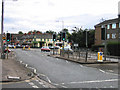
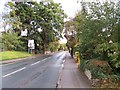
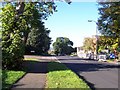
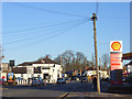
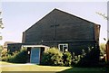
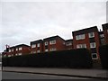
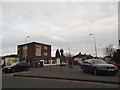
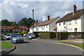
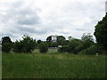
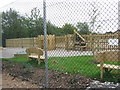
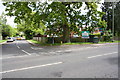
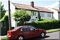
Photos of RG2 8JA
Area Information
RG2 8JA is a compact postcode area in England, covering 5,812 square metres and home to 1,653 residents. Its population density of 284,425 people per square kilometre reflects a tightly knit community, where proximity to services and transport is a defining feature. This area is characterised by its residential focus, with homes forming the predominant accommodation type. Daily life here is shaped by the balance between local amenities and nearby connectivity. The area’s small footprint means residents are likely to know their neighbours, though the high density may influence the pace of life. With no major natural constraints or planning restrictions, RG2 8JA offers a straightforward living environment. Its strategic location near rail networks and retail hubs makes it appealing for those prioritising convenience. However, the median age of 47 and the prevalence of adults aged 30–64 suggest a community with established routines, where family homes and long-term residency are common. For buyers, this area presents a blend of practicality and accessibility, though its size means the housing stock is limited to a small cluster of properties.
- Area Type
- Postcode
- Area Size
- 5812 m²
- Population
- 1653
- Population Density
- 4268 people/km²
The property market in RG2 8JA is dominated by houses, with 40% of residents owning their homes. This suggests a mix of owner-occupied and rental properties, though the relatively low home ownership rate indicates that renting is more prevalent. Given the area’s small size, the housing stock is limited, which may make it challenging for buyers seeking a wide selection. The focus on houses rather than flats or apartments could appeal to families or those prioritising space. However, the compact nature of the postcode means that properties are likely to be closely spaced, potentially limiting options for those seeking larger plots or specific layouts. For buyers, this area is best suited to those comfortable with a smaller market and willing to consider proximity to amenities over expansive living areas. The lack of planning constraints or environmental restrictions may also make it easier to navigate the purchasing process compared to areas with protected sites or natural beauty designations.
House Prices in RG2 8JA
Showing 15 properties
| Address | Type | Beds | Baths | Last Sale Price | Last Sale Date | |
|---|---|---|---|---|---|---|
| 2 Whitley Wood Road, Reading, RG2 8JA | Terraced | 3 | 1 | £325,000 | Mar 2023 | |
| 18 Whitley Wood Road, Reading, RG2 8JA | house | - | - | £415,000 | Mar 2021 | |
| 32 Whitley Wood Road, Reading, RG2 8JA | Flat | - | - | £157,000 | Jun 2019 | |
| 8 Whitley Wood Road, Reading, RG2 8JA | Terraced | 3 | 1 | £312,500 | Aug 2018 | |
| 14 Whitley Wood Road, Reading, RG2 8JA | Semi-detached | 3 | - | £373,000 | Dec 2016 | |
| 32A Whitley Wood Road, Reading, RG2 8JA | Maisonette | 2 | 1 | £205,000 | Oct 2016 | |
| 30 Whitley Wood Road, Reading, RG2 8JA | Flat | 1 | 1 | £177,000 | Sep 2016 | |
| 16 Whitley Wood Road, Reading, RG2 8JA | house | 2 | 1 | £278,000 | Jul 2013 | |
| 4 Whitley Wood Road, Reading, RG2 8JA | house | 2 | - | £145,000 | Dec 2006 | |
| 30A Whitley Wood Road, Reading, RG2 8JA | Maisonette | 2 | 1 | £130,000 | Jun 2005 |
Energy Efficiency in RG2 8JA
RG2 8JA offers a range of nearby amenities within practical reach, including retail outlets such as Tesco Reading, M&S Lower Earley SF, and Iceland Lower. These shops provide essential services and convenience for daily errands, reducing the need for long trips to larger centres. The area’s rail connectivity further enhances its appeal, with stations like Earley and Reading offering links to broader networks. While the data does not mention parks or leisure facilities, the presence of multiple retail and transport options suggests a lifestyle focused on accessibility and practicality. The compact nature of the area means amenities are closely grouped, which can be both a benefit and a limitation—residents may find it easy to access services but have fewer options for expansive recreational spaces. This makes RG2 8JA ideal for those prioritising convenience over sprawling natural landscapes.
Amenities
Schools
The Ridgeway Primary School is the only school explicitly listed near RG2 8JA, offering primary education with an Ofsted rating of ‘good’. This provides families with a locally available option for younger children, though no secondary schools are mentioned in the data. The presence of a primary school with a positive rating is a key consideration for parents prioritising proximity to education. However, the absence of secondary school information means families may need to look further afield for secondary education, which could impact the area’s appeal for those with older children. The single school listed suggests a focused but limited educational landscape, where parents might need to supplement with private schooling or travel to nearby towns for comprehensive education.
| Rank | School | Type | Entry gender | Ages |
|---|
Explore more schools in this area
Go to Schools tabDemographics
The population of RG2 8JA skews towards adults aged 30–64, with a median age of 47. This suggests a community of established professionals and families, rather than a mix of younger or older residents. Home ownership is relatively low at 40%, indicating that a majority of residents rent their homes. The accommodation type is predominantly houses, which may appeal to those seeking more space or privacy compared to flats. The predominant ethnic group is White, reflecting a homogenous demographic profile. With no data on deprivation levels, it is unclear how economic factors might influence quality of life, but the high population density of 284,425 people per square kilometre implies that space is at a premium. This could affect everything from housing affordability to the availability of communal areas. The absence of detailed diversity statistics means the community’s social fabric is not fully quantified, but the data underscores a focus on stability and long-term residency.
Household Size
Accommodation Type
Tenure
Ethnic Group
Religion
Household Composition
Age
Household Deprivation
NS-SEC
Explore more demographic insights in this area
Go to Demographics tabPlanning
Planning Constraints
- Flood RiskPremium
- Ramsar Wetland SitesPremium
- Area of Outstanding Natural BeautyPremium
- Protected Nature ReservePremium
- Protected WoodlandPremium