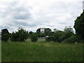
Area Overview for RG2 8HP
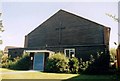
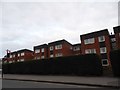
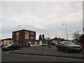
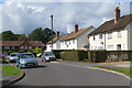
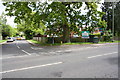
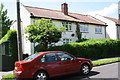
Photos of RG2 8HP
Area Information
RG2 8HP is a compact residential postcode in England, covering just 2,765 square metres and home to 1,362 residents. Its high population density—nearly 493,000 people per square kilometre—reflects its small, tightly clustered nature. This area is defined by its proximity to essential services and transport links, making it practical for daily life. The community is predominantly middle-aged, with a median age of 47, and households are largely owner-occupied, with 56% of homes owned by residents. The area’s housing stock is primarily composed of houses, suggesting a mix of family homes and long-term residents. While it lacks large-scale amenities, its immediate surroundings offer practical access to retail, rail networks, and schools. For those prioritising convenience over space, RG2 8HP provides a compact, functional living environment with minimal commute times to nearby towns. However, its small size means it is best suited for those seeking a quiet, established neighbourhood rather than a sprawling suburban setting.
- Area Type
- Postcode
- Area Size
- 2765 m²
- Population
- 1362
- Population Density
- 3903 people/km²
The property market in RG2 8HP is characterised by a high proportion of owner-occupied homes, with 56% of properties owned by residents. This suggests a stable, long-term housing market rather than a transient rental-focused area. The predominant accommodation type is houses, which are more common than flats or apartments. Given the area’s small size, the housing stock is limited, and the market is likely to be competitive for buyers. The concentration of houses may appeal to families seeking space, though the compact nature of RG2 8HP means proximity to amenities is key. Buyers should consider the area’s proximity to rail networks and retail hubs, which enhance its practicality. However, the small size of the postcode means that property values and availability may be influenced more by nearby towns than by local factors alone.
House Prices in RG2 8HP
Showing 36 properties
| Address | Type | Beds | Baths | Last Sale Price | Last Sale Date | |
|---|---|---|---|---|---|---|
| 6, Downham Court, Shinfield Road, Shinfield, RG2 8HP | Flat | 2 | 1 | £173,000 | Dec 2025 | |
| 8, Downham Court, Shinfield Road, Shinfield, RG2 8HP | Flat | - | - | £175,000 | Jan 2024 | |
| 33, Downham Court, Shinfield Road, Shinfield, RG2 8HP | Flat | - | - | £176,000 | Sep 2021 | |
| 4, Downham Court, Shinfield Road, Shinfield, RG2 8HP | Flat | - | - | £190,000 | Aug 2021 | |
| 13, Downham Court, Shinfield Road, Shinfield, RG2 8HP | Flat | 2 | 1 | £200,000 | Jul 2021 | |
| 34, Downham Court, Shinfield Road, Shinfield, RG2 8HP | Flat | - | - | £195,000 | Jul 2021 | |
| 14, Downham Court, Shinfield Road, Shinfield, RG2 8HP | Flat | - | - | £179,000 | Sep 2020 | |
| 24, Downham Court, Shinfield Road, Shinfield, RG2 8HP | Flat | 2 | 1 | £179,500 | Feb 2020 | |
| 25, Downham Court, Shinfield Road, Shinfield, RG2 8HP | Flat | 2 | 1 | £180,000 | Feb 2020 | |
| 35, Downham Court, Shinfield Road, Shinfield, RG2 8HP | Flat | 2 | 1 | £192,000 | Sep 2019 |
Energy Efficiency in RG2 8HP
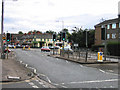
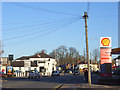
Living in RG2 8HP offers access to a range of practical amenities within short distances. Retail options include Tesco Reading, M&S Lower Earley SF, and Iceland Lower, providing everyday shopping needs. The area’s rail stations—Earley, Winnersh Triangle, and Reading—offer frequent services to nearby towns, making commuting or day trips convenient. While there are no named parks or leisure facilities in the data, the presence of retail and transport hubs suggests a lifestyle focused on utility and connectivity. The compact nature of the area means residents can access essentials without long journeys, though larger-scale leisure options may require travel to nearby centres. The mix of retail and transport infrastructure supports a functional, community-oriented daily life.
Amenities
Schools
The nearest school to RG2 8HP is Crosfields School, an independent institution. Independent schools typically charge fees and may cater to specific educational philosophies or specialisms. While the data does not provide an Ofsted rating, the presence of a single school suggests a limited choice for families. For those prioritising independent education, Crosfields offers an alternative to state schools, though its accessibility and quality would require further investigation. The absence of other schools in the immediate area means families may need to consider commuting to nearby towns for additional options. The school’s type reflects the area’s demographic profile, with a focus on adult residents who may be more likely to seek private education for their children.
| Rank | School | Type | Entry gender | Ages |
|---|
Explore more schools in this area
Go to Schools tabDemographics
The population of RG2 8HP is skewed towards adults aged 30–64, with a median age of 47. This suggests a mature, stable community with a focus on long-term residency. Home ownership is relatively high at 56%, indicating a strong presence of family homes and fewer rental properties. The predominant accommodation type is houses, which aligns with the area’s older demographic and lower population density. The ethnic composition is predominantly White, though no specific data on diversity or deprivation is provided. The age profile implies a community with established careers and families, potentially with fewer young children or retirees compared to other areas. This demographic mix may influence local services and amenities, which are tailored to adult needs rather than those of younger or older residents. The high home ownership rate also suggests a degree of financial stability among residents.
Household Size
Accommodation Type
Tenure
Ethnic Group
Religion
Household Composition
Age
Household Deprivation
NS-SEC
Explore more demographic insights in this area
Go to Demographics tabPlanning
Planning Constraints
- Flood RiskPremium
- Ramsar Wetland SitesPremium
- Area of Outstanding Natural BeautyPremium
- Protected Nature ReservePremium
- Protected WoodlandPremium