Area Overview for RG2 8JB
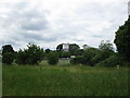
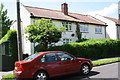
Photos of RG2 8JB
Area Information
RG2 8JB is a compact residential postcode area in England, covering just 1.8 hectares and home to 1,653 residents. Its high population density of 94,381 people per square kilometre reflects a tightly knit community, though the area remains small enough to feel intimate. The postcode is a mix of family homes and other accommodation types, with a median age of 47 and a majority of residents aged between 30 and 64. This suggests a stable, mature population, likely with established careers and family ties. Daily life here is shaped by proximity to local amenities, with nearby shops, rail links, and schools. While the area is not large, its strategic location near major transport routes and retail hubs offers convenience. Residents benefit from excellent broadband connectivity and accessible rail stations, making it a practical choice for commuters. However, the small size means the character of the area is defined by its immediate surroundings, which blend residential comfort with practical infrastructure. For those seeking a compact, well-connected neighbourhood, RG2 8JB offers a mix of stability and accessibility.
- Area Type
- Postcode
- Area Size
- 1.8 hectares
- Population
- 1653
- Population Density
- 4268 people/km²
The property market in RG2 8JB is characterised by a 40% home ownership rate, suggesting that a majority of properties are rented rather than owner-occupied. This dynamic may indicate a rental market driven by commuters or those seeking short-term housing. The accommodation type is primarily houses, which contrasts with areas dominated by flats or apartments. Given the small area size of 1.8 hectares, the housing stock is limited, potentially making the market competitive for buyers. The presence of houses may appeal to families or those prioritising space, but the compact nature of the postcode means the immediate surroundings are crucial for additional housing options. For buyers, this small area’s property market is likely to be influenced by proximity to amenities and transport links, with limited scope for expansion within the postcode itself.
House Prices in RG2 8JB
Showing 33 properties
| Address | Type | Beds | Baths | Last Sale Price | Last Sale Date | |
|---|---|---|---|---|---|---|
| 26 Tamarisk Avenue, Reading, RG2 8JB | Semi-detached | 4 | 2 | £530,000 | Feb 2025 | |
| 19 Tamarisk Avenue, Reading, RG2 8JB | house | - | - | £530,000 | Aug 2024 | |
| 6 Tamarisk Avenue, Reading, RG2 8JB | Semi-detached | 4 | 2 | £575,000 | Jul 2024 | |
| 25 Tamarisk Avenue, Reading, RG2 8JB | Detached | 4 | 2 | £640,000 | Jun 2024 | |
| 7 Tamarisk Avenue, Reading, RG2 8JB | Retail | 4 | 1 | £435,000 | Sep 2022 | |
| 3 Tamarisk Avenue, Reading, RG2 8JB | Detached | 3 | 1 | £515,000 | Aug 2022 | |
| 4C Tamarisk Avenue, Reading, RG2 8JB | Retail | 3 | 1 | £400,000 | Jun 2022 | |
| 1 Tamarisk Avenue, Reading, RG2 8JB | house | 3 | 1 | £475,000 | Jun 2021 | |
| 4 Tamarisk Avenue, Reading, RG2 8JB | Detached | 3 | 1 | £398,100 | May 2020 | |
| 4B Tamarisk Avenue, Reading, RG2 8JB | Detached | 3 | 1 | £387,500 | Feb 2020 |
Energy Efficiency in RG2 8JB
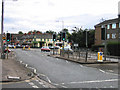
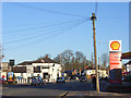
The lifestyle in RG2 8JB is shaped by its proximity to retail and transport hubs. Nearby amenities include Tesco Reading, M&S Lower Earley, and Iceland Lower, offering a range of shopping and dining options within practical reach. The presence of five rail stations, including Earley and Reading, ensures easy access to urban centres for work, leisure, or travel. While the area itself is small, its connectivity to larger retail and transport networks provides convenience. The lack of detailed data on parks or leisure facilities means the full extent of recreational opportunities is unclear, but the available amenities suggest a practical, commuter-focused lifestyle.
Amenities
Schools
The Ridgeway Primary School is the only named school within reach of RG2 8JB, offering primary education with a good Ofsted rating. This provides a reliable option for families with young children, though no secondary schools are listed in the data. The presence of a primary school with a positive rating suggests a focus on early education quality, but parents seeking secondary schooling may need to look beyond the immediate area. The school’s performance could be a key consideration for families prioritising education, though the absence of further details on school capacity or catchment areas means potential limitations remain unexplored.
| Rank | School | Type | Entry gender | Ages |
|---|
Explore more schools in this area
Go to Schools tabDemographics
The community in RG2 8JB is predominantly composed of adults aged 30 to 64, with a median age of 47. This suggests a population focused on middle-aged households, likely with families or long-term careers. Home ownership stands at 40%, which is lower than the national average, indicating a significant proportion of residents rent their homes. The accommodation type is primarily houses, which may reflect a preference for family homes or larger properties. The predominant ethnic group is White, though no data on diversity beyond this is provided. With a population density of nearly 94,000 people per square kilometre, the area is densely populated, which can influence the pace of life and community dynamics. The demographic profile hints at a stable, working-age population, though the lack of specific data on deprivation or income levels means the full picture of quality of life remains partially obscured.
Household Size
Accommodation Type
Tenure
Ethnic Group
Religion
Household Composition
Age
Household Deprivation
NS-SEC
Explore more demographic insights in this area
Go to Demographics tabPlanning
Planning Constraints
- Flood RiskPremium
- Ramsar Wetland SitesPremium
- Area of Outstanding Natural BeautyPremium
- Protected Nature ReservePremium
- Protected WoodlandPremium