Area Overview for RG2 8JT
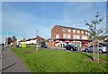
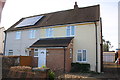
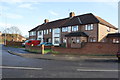
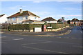
Photos of RG2 8JT
Area Information
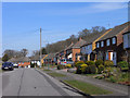
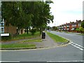
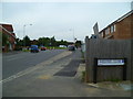
RG2 8JT is a compact residential postcode in England, covering just 3.3 hectares and home to 2,270 residents. Its high population density of 68,284 people per square kilometre reflects a tightly knit community, with homes clustered closely together. This area is distinct for its practical scale—small enough to feel intimate yet well-connected to surrounding districts. Daily life here is shaped by proximity to essential services, with shops, rail links, and schools within practical reach. The median age of 47 suggests a mature demographic, with many residents in their 30s to 60s. While the area lacks sprawling green spaces, its focus on accessibility and infrastructure makes it appealing for those prioritising convenience. The absence of major environmental constraints, such as protected woodlands or flood zones, adds to its liveability. For buyers, RG2 8JT offers a snapshot of suburban England, where home ownership is prevalent and community ties are strong. Its compact nature means residents are likely to know their neighbours, and the area’s safety record, with a crime score of 75, reinforces its appeal as a stable, low-risk location.
- Area Type
- Postcode
- Area Size
- 3.3 hectares
- Population
- 2270
- Population Density
- 2510 people/km²
RG2 8JT is a predominantly owner-occupied area, with 62% of homes owned by residents rather than rented. This suggests a stable property market where long-term investment is common. The accommodation type is exclusively houses, which is unusual for a small postcode but indicates a focus on family homes and private living. The compact size of the area means the housing stock is limited, with no indication of high-rise or apartment blocks. For buyers, this presents both opportunities and constraints: the area is likely to have a consistent demand for homes, but the small footprint may mean competition for available properties. The lack of rental properties also implies that the local economy may not rely heavily on transient populations. Buyers should consider the proximity to rail links and retail amenities as key selling points, given the area’s limited internal infrastructure.
House Prices in RG2 8JT
Showing 44 properties
| Address | Type | Beds | Baths | Last Sale Price | Last Sale Date | |
|---|---|---|---|---|---|---|
| 35 Anson Crescent, Shinfield, RG2 8JT | Semi-detached | 3 | 1 | £360,000 | Aug 2023 | |
| 31 Anson Crescent, Shinfield, RG2 8JT | house | - | - | £298,000 | May 2021 | |
| 39 Anson Crescent, Shinfield, RG2 8JT | Semi-detached | 3 | 1 | £310,000 | Mar 2020 | |
| 12 Anson Crescent, Shinfield, RG2 8JT | Maisonette | 2 | 1 | £152,000 | Jan 2020 | |
| 5 Anson Crescent, Shinfield, RG2 8JT | Semi-detached | 2 | 1 | £277,000 | Dec 2018 | |
| 21 Anson Crescent, Shinfield, RG2 8JT | Terraced | 3 | - | £209,950 | Nov 2014 | |
| 17 Anson Crescent, Shinfield, RG2 8JT | house | - | - | £200,000 | Sep 2013 | |
| 41 Anson Crescent, Shinfield, RG2 8JT | Semi-detached | - | - | £189,995 | Sep 2005 | |
| 34 Anson Crescent, Shinfield, RG2 8JT | Semi-detached | - | - | £143,000 | May 2004 | |
| 38 Anson Crescent, Shinfield, RG2 8JT | house | 3 | - | £160,000 | Dec 2003 |
Energy Efficiency in RG2 8JT
Living in RG2 8JT offers access to essential retail and transport hubs. Nearby shops include Co-op Whitley, Lidl Whitley, and Tesco Reading, providing a range of grocery and convenience options. The presence of multiple rail stations—Earley, Reading, and Reading West—ensures easy access to the city and beyond, supporting both daily commutes and weekend excursions. While the area lacks detailed information on parks or leisure facilities, its proximity to retail and transport infrastructure suggests a practical, service-oriented lifestyle. The compact size of the postcode means amenities are within walking or short driving distance, reducing the need for long trips. This focus on accessibility and convenience aligns with the area’s demographic profile, catering to families and professionals who value efficiency.
Amenities
Schools
The nearest school to RG2 8JT is the OneSchool Global UK Reading Primary Campus, an independent institution. This school type typically caters to families seeking alternative education models, though no Ofsted rating is provided in the data. The presence of an independent school suggests a community that prioritises educational choice, though the absence of state schools or secondary institutions may limit options for older children. Families with young children may find this a suitable match, but those requiring a broader range of educational providers may need to look further afield. The lack of multiple schools in the area means parents must consider commuting or enrolling their children in nearby districts.
| Rank | School | Type | Entry gender | Ages |
|---|
Explore more schools in this area
Go to Schools tabDemographics
The population of RG2 8JT is predominantly adults aged 30–64, with a median age of 47. This suggests a community of established professionals, families, and retirees, all contributing to a balanced social fabric. Home ownership is high at 62%, indicating a stable housing market where most residents are long-term occupants rather than renters. The accommodation type is primarily houses, which aligns with the area’s residential character and likely contributes to a quieter, more private lifestyle. The predominant ethnic group is White, reflecting broader regional trends. While no specific deprivation data is provided, the high home ownership rate and low crime score imply a relatively affluent and secure environment. The absence of significant diversity data means the community’s cultural composition remains less defined, but the age profile suggests a focus on family-oriented living and intergenerational stability.
Household Size
Accommodation Type
Tenure
Ethnic Group
Religion
Household Composition
Age
Household Deprivation
NS-SEC
Explore more demographic insights in this area
Go to Demographics tabPlanning
Planning Constraints
- Flood RiskPremium
- Ramsar Wetland SitesPremium
- Area of Outstanding Natural BeautyPremium
- Protected Nature ReservePremium
- Protected WoodlandPremium