Area Overview for RG2 8JU
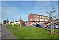
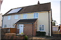
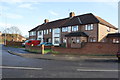
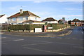
Photos of RG2 8JU
Area Information
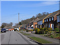
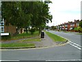
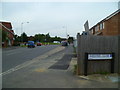
RG2 8JU is a compact residential postcode in England, covering 6,618 square metres and home to 2,270 residents. Its high population density of 342,983 people per square kilometre reflects a tightly knit community, where homes are closely spaced and daily life is shaped by proximity to amenities. This area is defined by its mix of established housing and practical living, with a median age of 47 and a majority of residents aged 30–64. The presence of railway stations like Reading and Earley, alongside shops such as Tesco and Lidl, ensures convenience for both commuters and families. While it lacks sprawling green spaces, its compact nature means essentials are within easy reach. For those seeking a balance between urban accessibility and a quieter residential setting, RG2 8JU offers a focused environment with a strong sense of local identity.
- Area Type
- Postcode
- Area Size
- 6618 m²
- Population
- 2270
- Population Density
- 2510 people/km²
RG2 8JU is a predominantly owner-occupied area, with 62% of residents owning their homes. The accommodation type is primarily houses, not flats or apartments, which is typical of a suburban or semi-rural postcode. This suggests a housing stock suited to families or individuals seeking more space and privacy than a high-density urban area. The small size of the postcode—just 6,618 square metres—means the property market is limited in scale, with homes likely to be closely located to local amenities such as shops and rail stations. For buyers, this implies a focus on proximity to essential services rather than expansive estates. The high home ownership rate also indicates a stable market, where properties may hold value due to the area’s established character and limited supply.
House Prices in RG2 8JU
Showing 14 properties
| Address | Type | Beds | Baths | Last Sale Price | Last Sale Date | |
|---|---|---|---|---|---|---|
| 4 Anson Walk, Shinfield, RG2 8JU | Semi-detached | 3 | 1 | £385,000 | Oct 2024 | |
| 14 Anson Walk, Reading, RG2 8JU | Semi-detached | 2 | - | £240,000 | Mar 2017 | |
| 9 Anson Walk, Shinfield, RG2 8JU | Semi-detached | - | - | - | - | |
| 3 Anson Walk, Shinfield, RG2 8JU | house | - | - | - | - | |
| 10 Anson Walk, Shinfield, RG2 8JU | Semi-detached | - | - | - | - | |
| 7 Anson Walk, Shinfield, RG2 8JU | house | - | - | - | - | |
| 1 Anson Walk, Shinfield, RG2 8JU | house | - | - | - | - | |
| 8 Anson Walk, Shinfield, RG2 8JU | house | - | - | - | - | |
| 2 Anson Walk, Shinfield, RG2 8JU | house | - | - | - | - | |
| 6 Anson Walk, Shinfield, RG2 8JU | house | - | - | - | - |
Energy Efficiency in RG2 8JU
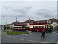
Residents of RG2 8JU have access to a range of nearby amenities, including five retail outlets such as Co-op Whitley, Lidl Whitley, and Tesco Reading. These shops provide everyday essentials, reducing the need for long trips to larger centres. The area’s proximity to multiple railway stations—such as Reading and Reading West—enhances mobility, whether for commuting or weekend travel. While there is no mention of parks or leisure facilities in the data, the compact layout ensures that daily needs are met within walking or short driving distance. The mix of retail and transport options contributes to a practical, convenience-focused lifestyle, ideal for those prioritising accessibility over expansive recreational spaces.
Amenities
Schools
The nearest school to RG2 8JU is OneSchool Global UK Reading Primary Campus, an independent institution. Independent schools often offer smaller class sizes and tailored education, though no Ofsted rating is provided in the data. The presence of a single school type suggests a limited choice for families, but the proximity to Reading’s broader educational infrastructure—such as secondary schools in the town—may compensate. For parents prioritising independent education, this school could be a key consideration. However, the data does not include additional schools or ratings, so prospective families should explore further details about the school’s curriculum and performance.
| Rank | School | Type | Entry gender | Ages |
|---|
Explore more schools in this area
Go to Schools tabDemographics
The population of RG2 8JU is predominantly adults aged 30–64, with a median age of 47. This suggests a community of established professionals and families, rather than a mix of younger or older demographics. Home ownership is high at 62%, indicating a stable, long-term resident base. The area is primarily composed of houses, not flats or apartments, which aligns with the demographic profile of older, settled households. The predominant ethnic group is White, though no specific data on diversity or deprivation is provided. The high population density—over 340,000 people per square kilometre—means the area is densely populated, which can influence local services and social dynamics. This density, combined with the age profile, suggests a mature, low-turnover community focused on stability and convenience.
Household Size
Accommodation Type
Tenure
Ethnic Group
Religion
Household Composition
Age
Household Deprivation
NS-SEC
Explore more demographic insights in this area
Go to Demographics tabPlanning
Planning Constraints
- Flood RiskPremium
- Ramsar Wetland SitesPremium
- Area of Outstanding Natural BeautyPremium
- Protected Nature ReservePremium
- Protected WoodlandPremium