Area Overview for RG2 8BP
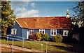
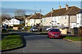
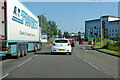
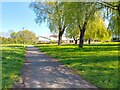
Photos of RG2 8BP


Area Information
RG2 8BP is a small, tightly packed residential cluster in England, covering just 2299 square metres and home to 1434 people. With a population density of 623,719 people per square kilometre, this area is highly compact, suggesting a mix of closely spaced homes and shared spaces. The community here is predominantly composed of adults aged 30 to 64, reflecting a mature, stable demographic. Daily life is likely characterised by a quiet, established rhythm, with residents benefiting from proximity to key amenities. The area’s small size means it is likely integrated into nearby towns, offering access to broader services without the need for long commutes. For those considering living in RG2 8BP, the high population density and mature age profile suggest a community that values convenience and familiarity, though the limited space may mean a focus on shared resources and local connections. The absence of major environmental constraints, such as protected woodlands or flood zones, adds to the area’s practical appeal for homebuyers seeking a manageable, low-risk environment.
- Area Type
- Postcode
- Area Size
- 2299 m²
- Population
- 1434
- Population Density
- 2212 people/km²
The property market in RG2 8BP is dominated by owner-occupied homes, with 63% of residents owning their properties. This suggests a market that is more focused on long-term residency than short-term rental activity. The accommodation type is primarily houses, which is notable for a small postcode area and may indicate a mix of semi-detached or terraced homes. Given the high population density, the housing stock is likely to be tightly packed, with limited space for expansion. For buyers, this means the area offers a stable, established market with a clear preference for homeownership. However, the small size of the postcode may limit the variety of properties available, requiring buyers to consider nearby areas for more options. The predominance of houses also implies that the area may cater to families or individuals seeking more space than typical flats. Prospective buyers should note that the market is not heavily influenced by rental demand, making it a potentially secure choice for those prioritising ownership over flexibility.
House Prices in RG2 8BP
Showing 5 properties
| Address | Type | Beds | Baths | Last Sale Price | Last Sale Date | |
|---|---|---|---|---|---|---|
| Flat C, Hartland Court, Hartland Road, Reading, RG2 8BP | Flat | 2 | 1 | - | - | |
| Flat D, Hartland Court, Hartland Road, Reading, RG2 8BP | Flat | 2 | 1 | - | - | |
| Flat A, Hartland Court, Hartland Road, Reading, RG2 8BP | Block of Flats | 5 | 3 | - | - | |
| Flat B, Hartland Court, Hartland Road, Reading, RG2 8BP | Flat | - | - | - | - | |
| Flat E, Hartland Court, Hartland Road, Reading, RG2 8BP | Flat | - | - | - | - |
Energy Efficiency in RG2 8BP
Living in RG2 8BP offers access to a range of nearby amenities, including retail and transport hubs. Within practical reach are supermarkets such as Lidl Whitley, Aldi Unit 6 Gateway Retail Park, and Co-op Whitley, providing essential shopping options for daily needs. The area is also well-connected to rail services, with stations like Reading West, Reading, and Earley offering direct links to major cities and employment centres. These transport links enhance the area’s appeal, allowing residents to commute efficiently or access broader services without relying on a car. While the data does not specify parks or leisure facilities, the proximity to retail and rail suggests a lifestyle that balances convenience with accessibility. The presence of multiple retail outlets indicates a community that values ease of access to everyday essentials, while the rail stations support a dynamic, connected lifestyle. For those prioritising practicality, RG2 8BP delivers a mix of local convenience and broader connectivity.
Amenities
Schools
| Rank | School | Type | Entry gender | Ages |
|---|
Explore more schools in this area
Go to Schools tabDemographics
The population of RG2 8BP is predominantly adults aged 30 to 64, with a median age of 47. This suggests a community of middle-aged residents, many of whom may be in their peak earning years or nearing retirement. Home ownership is strong, with 63% of residents owning their homes, a figure that indicates a stable, long-term presence in the area. The accommodation type is primarily houses, which aligns with the higher proportion of owner-occupied properties compared to rental markets. The predominant ethnic group is White, though no specific data on diversity or minority representation is provided. The high population density—623,719 people per square kilometre—implies a compact, possibly multi-generational living arrangement, though the exact composition of household types is not detailed. This demographic profile suggests a community that prioritises stability, with residents likely invested in local amenities and services. The lack of specific data on deprivation or income levels means these factors remain unexplored in this context.
Household Size
Accommodation Type
Tenure
Ethnic Group
Religion
Household Composition
Age
Household Deprivation
NS-SEC
Explore more demographic insights in this area
Go to Demographics tabPlanning
Planning Constraints
- Flood RiskPremium
- Ramsar Wetland SitesPremium
- Area of Outstanding Natural BeautyPremium
- Protected Nature ReservePremium
- Protected WoodlandPremium