Area Overview for RG2 8AA
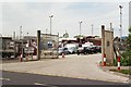
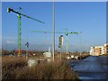
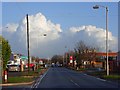
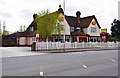
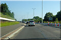
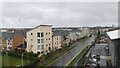
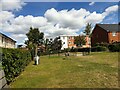
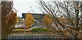
Photos of RG2 8AA
Area Information
RG2 8AA is a small, densely populated residential cluster in England, spanning just 1.6 hectares and home to 1,434 residents. Its compact size means it is a tightly knit community, with a population density of 91,175 people per square kilometre. This area is characterised by a mature demographic, with a median age of 47 and a majority of residents aged between 30 and 64. Daily life here is shaped by proximity to key amenities, including five retail outlets such as Lidl Whitley, Aldi Whitley, and Co-op Whitley, which provide essential shopping options. The area’s strategic location near multiple railway stations—Reading West, Reading, and Earley—offers strong connectivity to nearby towns and cities. While the population is predominantly White and home ownership is high at 63%, the area’s compact nature means residents share a shared sense of community. Living in RG2 8AA involves navigating a small, high-density environment with limited green space but ample access to retail and transport, making it suitable for those prioritising convenience over expansive living spaces.
- Area Type
- Postcode
- Area Size
- 1.6 hectares
- Population
- 1434
- Population Density
- 2212 people/km²
The property market in RG2 8AA is defined by a high rate of home ownership—63% of properties are owner-occupied—suggesting a stable, long-term resident base. The area is predominantly composed of houses, which contrasts with regions where flats or apartments dominate. This makes RG2 8AA more suited to families or individuals seeking traditional housing rather than rental-focused or transient populations. The compact size of the area—just 1.6 hectares—means the housing stock is limited, and buyers should consider the small scale of the neighbourhood when evaluating property availability. The high population density indicates that properties are likely to be closely spaced, with little scope for expansion. For those seeking a home in this area, the focus is on securing one of the existing houses, as the market is not geared towards new builds or rental properties.
House Prices in RG2 8AA
Showing 42 properties
| Address | Type | Beds | Baths | Last Sale Price | Last Sale Date | |
|---|---|---|---|---|---|---|
| 23 Corinne Close, Reading, RG2 8AA | Semi-detached | 3 | 1 | £365,000 | Dec 2024 | |
| 5 Corinne Close, Reading, RG2 8AA | house | - | - | £355,000 | Aug 2023 | |
| 7 Corinne Close, Reading, RG2 8AA | house | - | - | £377,500 | Sep 2022 | |
| 1 Corinne Close, Reading, RG2 8AA | house | - | - | £385,000 | Aug 2022 | |
| 6 Corinne Close, Reading, RG2 8AA | Retail | 3 | 1 | £385,000 | Aug 2022 | |
| 1A Corinne Close, Reading, RG2 8AA | Retail | 3 | 1 | £415,000 | Jul 2022 | |
| 31 Corinne Close, Reading, RG2 8AA | house | 3 | 1 | £320,000 | Mar 2019 | |
| 22 Corinne Close, Reading, RG2 8AA | Terraced | 3 | 1 | £315,000 | Feb 2019 | |
| 12 Corinne Close, Reading, RG2 8AA | Semi-detached | 3 | 1 | £310,000 | Nov 2018 | |
| 30 Corinne Close, Reading, RG2 8AA | Terraced | 3 | 1 | £325,000 | Oct 2018 |
Energy Efficiency in RG2 8AA
Living in RG2 8AA offers access to a range of essential amenities within close proximity. The area is served by five retail outlets, including Lidl Whitley, Aldi Whitley, and Co-op Whitley, ensuring residents have easy access to groceries and everyday shopping. Nearby railway stations—Reading West, Reading, and Earley—provide reliable public transport options, connecting the area to broader regional networks. While the data does not specify parks or leisure facilities, the presence of multiple retail and transport hubs suggests a practical, convenience-focused lifestyle. The compact nature of the area means amenities are tightly clustered, reducing travel time for daily needs. However, the lack of detailed information on green spaces or recreational facilities indicates that residents may need to look slightly further afield for leisure activities.
Amenities
Schools
| Rank | School | Type | Entry gender | Ages |
|---|
Explore more schools in this area
Go to Schools tabDemographics
The community in RG2 8AA is predominantly composed of adults aged 30 to 64, with a median age of 47. This suggests a population that is largely established, with many residents likely in their prime working years or nearing retirement. Home ownership is strong, with 63% of properties owned by residents, indicating a stable housing market. The area is dominated by houses rather than flats, reflecting a preference for traditional family homes. The predominant ethnic group is White, though no specific data on diversity or deprivation levels is provided. The high population density—91,175 people per square kilometre—means the area is intensely populated, which can influence the pace of daily life and the availability of private space. For buyers, this demographic profile suggests a community focused on stability, with a mature population that may prioritise established infrastructure and proximity to services over newer developments.
Household Size
Accommodation Type
Tenure
Ethnic Group
Religion
Household Composition
Age
Household Deprivation
NS-SEC
Explore more demographic insights in this area
Go to Demographics tabPlanning
Planning Constraints
- Flood RiskPremium
- Ramsar Wetland SitesPremium
- Area of Outstanding Natural BeautyPremium
- Protected Nature ReservePremium
- Protected WoodlandPremium