Area Overview for RG2 8AB
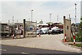
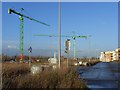
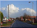
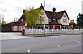
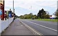
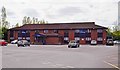
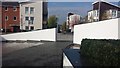
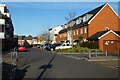
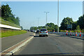
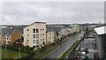
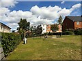
Photos of RG2 8AB

Area Information
RG2 8AB is a small, tightly packed residential area in England, covering just 9,623 square metres and home to 1,434 people. Its high population density of 149,013 people per square kilometre reflects a compact, closely knit community. This postcode area is characterised by its proximity to key transport links, with multiple railway stations within practical reach, including Reading West, Reading, and Earley. Daily life here is shaped by its proximity to retail hubs such as Lidl Whitley and Aldi Unit 6 Gateway Retail Park, offering residents easy access to essential shopping. The area’s demographic profile suggests a mature population, with a median age of 47 and a strong presence of adults aged 30–64. This suggests a community focused on stability, with many residents likely to be homeowners. While the area is small, its strategic location near major transport routes and retail amenities makes it appealing for those prioritising convenience and connectivity. However, its limited size means it is not suited to those seeking expansive living spaces, though the compact nature may be a plus for those valuing a tight-knit, manageable environment.
- Area Type
- Postcode
- Area Size
- 9623 m²
- Population
- 1434
- Population Density
- 2212 people/km²
RG2 8AB is a predominantly owner-occupied area, with 63% of residents owning their homes. The accommodation type is exclusively houses, which is unusual in many urban areas where flats and apartments dominate. This suggests a housing stock tailored to family homes or larger properties, rather than smaller, more transient units. Given the area’s small size and high population density, the property market is likely to be limited in scale, with few new developments. The high home ownership rate indicates a stable market, but buyers should consider the area’s compact nature, which may restrict availability of properties. The focus on houses may appeal to those seeking more space, though the proximity to transport links and retail amenities could offset the lack of expansive living areas. For buyers, this area is best suited to those prioritising a settled, owner-occupied environment over a rental market.
House Prices in RG2 8AB
Showing 30 properties
| Address | Type | Beds | Baths | Last Sale Price | Last Sale Date | |
|---|---|---|---|---|---|---|
| 25 Hartland Road, Reading, RG2 8AB | Semi-detached | 3 | 1 | £314,000 | Dec 2021 | |
| 21 Hartland Road, Reading, RG2 8AB | house | - | - | £275,000 | Apr 2021 | |
| Breezes, Hartland Road, Reading, RG2 8AB | house | - | - | £290,000 | May 2017 | |
| Milford, Hartland Road, Reading, RG2 8AB | Semi-detached | 4 | 2 | £152,000 | Nov 2010 | |
| 33 Hartland Road, Reading, RG2 8AB | house | - | - | £160,000 | Aug 2009 | |
| 27 Hartland Road, Reading, RG2 8AB | Semi-detached | - | - | £118,000 | Jun 2003 | |
| Castleton, Hartland Road, Reading, RG2 8AB | house | - | - | £159,950 | Mar 2003 | |
| 35 Hartland Road, Reading, RG2 8AB | house | - | - | £137,500 | Dec 2002 | |
| 3 Hartland Road, Reading, RG2 8AB | house | - | - | £72,950 | Feb 1998 | |
| 37 Hartland Road, Reading, RG2 8AB | house | - | - | £64,995 | Nov 1997 |
Energy Efficiency in RG2 8AB
Living in RG2 8AB offers access to a range of practical amenities within close proximity. The area is served by five retail outlets, including Lidl Whitley, Co-op Whitley, and Aldi Unit 6 Gateway Retail Park, ensuring residents have easy access to groceries and everyday shopping. While the area’s small size means it lacks large-scale leisure or entertainment facilities, its rail connections to Reading and Earley provide access to broader urban amenities. The presence of multiple railway stations also enhances convenience for commuters and those seeking to explore nearby towns. The compact nature of the area means daily life is efficient, with minimal travel required for essentials. However, the limited local amenities suggest that residents may need to travel slightly further for more specialised services or leisure activities.
Amenities
Schools
| Rank | School | Type | Entry gender | Ages |
|---|
Explore more schools in this area
Go to Schools tabDemographics
The population of RG2 8AB is predominantly composed of adults aged 30–64, with a median age of 47. This indicates a mature, settled community with a strong presence of middle-aged residents. Home ownership is high at 63%, suggesting a stable housing market where many residents are long-term property owners. The accommodation type is primarily houses, which contrasts with areas dominated by flats or apartments. The predominant ethnic group is White, reflecting a lack of ethnic diversity in the area. While the data does not provide specific figures on deprivation, the high home ownership rate and mature age profile may suggest a community with established financial security. However, the absence of detailed diversity metrics means the full demographic picture remains incomplete. The area’s population density, combined with its age profile, points to a community where family-oriented living and long-term residency are common.
Household Size
Accommodation Type
Tenure
Ethnic Group
Religion
Household Composition
Age
Household Deprivation
NS-SEC
Explore more demographic insights in this area
Go to Demographics tabPlanning
Planning Constraints
- Flood RiskPremium
- Ramsar Wetland SitesPremium
- Area of Outstanding Natural BeautyPremium
- Protected Nature ReservePremium
- Protected WoodlandPremium