Area Overview for RG2 7LY
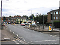
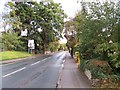
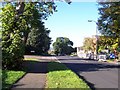
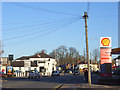
Photos of RG2 7LY
Area Information
RG2 7LY is a compact residential postcode in England, covering just 1.0 hectare and home to 1,653 people. Its high population density of 158,568 people per square kilometre reflects a tightly knit community, likely centred around a mix of housing types. The area’s small size suggests a focused, localised character, with residents likely relying on nearby amenities for daily needs. With a median age of 47 and a majority of adults aged 30–64, the community leans towards established families and professionals. The presence of The Ridgeway Primary School, rated 'good' by Ofsted, hints at a family-oriented environment. Proximity to multiple railway stations and retail outlets like Tesco Reading and Co-op Whiteknights offers practical connectivity. While the area lacks natural constraints like protected woodlands or AONB designations, its compact nature means residents are close to both urban conveniences and potential green spaces. Living here balances density with accessibility, though the moderate crime risk score of 34/100 suggests awareness of standard security measures is advisable.
- Area Type
- Postcode
- Area Size
- 1.0 hectares
- Population
- 1653
- Population Density
- 4268 people/km²
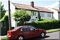
RG2 7LY’s property market is shaped by its small size and high density. With 40% of residents owning their homes, the area is not dominated by owner-occupation, suggesting a notable rental market. The accommodation type is primarily houses, which is atypical for a compact postcode but may indicate a blend of semi-detached or terraced housing. This mix could appeal to buyers seeking family homes with space, though the limited area size means housing stock is likely constrained. Proximity to multiple railway stations and retail hubs may enhance the area’s desirability for commuters. However, the small footprint of RG2 7LY means buyers should consider nearby areas for larger properties. The lack of planning constraints like protected woodlands or AONB designations may simplify development, but the moderate crime risk score of 34/100 suggests buyers should weigh security considerations.
House Prices in RG2 7LY
Showing 31 properties
| Address | Type | Beds | Baths | Last Sale Price | Last Sale Date | |
|---|---|---|---|---|---|---|
| 18 Sycamore Road, Reading, RG2 7LY | Terraced | 3 | 1 | £335,000 | Mar 2025 | |
| 22 Sycamore Road, Reading, RG2 7LY | house | 1 | 1 | £370,000 | Sep 2022 | |
| 52 Sycamore Road, Reading, RG2 7LY | Semi-detached | 3 | 1 | £320,000 | May 2019 | |
| 40 Sycamore Road, Reading, RG2 7LY | Semi-detached | 3 | 1 | £316,000 | Oct 2018 | |
| 24 Sycamore Road, Reading, RG2 7LY | Semi-detached | 3 | - | £269,950 | Jun 2014 | |
| 4 Sycamore Road, Reading, RG2 7LY | house | 1 | 1 | £138,000 | May 2014 | |
| 56 Sycamore Road, Reading, RG2 7LY | house | - | - | £183,000 | Mar 2011 | |
| 26 Sycamore Road, Reading, RG2 7LY | Maisonette | 1 | 1 | £238,000 | Aug 2010 | |
| 42 Sycamore Road, Reading, RG2 7LY | Semi-detached | 3 | 1 | £171,000 | Jun 2010 | |
| 54 Sycamore Road, Reading, RG2 7LY | house | - | - | £212,000 | Mar 2010 |
Energy Efficiency in RG2 7LY
The lifestyle in RG2 7LY is shaped by its proximity to essential amenities. Retail options include major supermarkets like Tesco Reading and Co-op Whiteknights, ensuring convenience for grocery shopping. The area’s railway stations—Earley, Reading, and Reading West—provide easy access to commuting routes and regional hubs. While the data does not mention parks or leisure facilities, the absence of planning constraints like protected woodlands or AONB designations suggests potential for local green spaces. The presence of The Ridgeway Primary School adds to the community feel, fostering a family-oriented environment. The compact nature of the area means residents are likely within walking or short driving distance of shops, transport, and services, contributing to a practical, accessible lifestyle.
Amenities
Schools
The Ridgeway Primary School is the only named school in the RG2 7LY area, serving as a key educational resource for local families. Rated 'good' by Ofsted, it provides a reliable foundation for primary education. The absence of secondary schools or other educational institutions within the postcode means families may need to look to nearby areas for secondary schooling. This could be a consideration for parents prioritising a comprehensive school network. However, the proximity to major railway stations like Reading and Earley may offset this by enabling easy access to larger educational hubs. The single school in the area underscores the importance of nearby communities for broader educational options, though the 'good' rating at The Ridgeway offers a reassuring start for younger children.
| Rank | School | Type | Entry gender | Ages |
|---|
Explore more schools in this area
Go to Schools tabDemographics
The population of RG2 7LY is predominantly adults aged 30–64, with a median age of 47. This suggests a mature community, likely with a mix of long-term residents and families. Home ownership rates stand at 40%, indicating a significant proportion of residents rent their homes, which may reflect the area’s smaller size and potential demand for rental properties. The accommodation type is primarily houses, which is unusual for a high-density postcode but may indicate a mix of semi-detached or terraced housing. The predominant ethnic group is White, with no data provided on other demographics. The area’s age profile and ownership figures suggest a stable, settled population, though the 40% rental rate could imply a transient element. The absence of specific deprivation data means quality of life factors like access to services and transport must be inferred from the available amenities and connectivity scores.
Household Size
Accommodation Type
Tenure
Ethnic Group
Religion
Household Composition
Age
Household Deprivation
NS-SEC
Explore more demographic insights in this area
Go to Demographics tabPlanning
Planning Constraints
- Flood RiskPremium
- Ramsar Wetland SitesPremium
- Area of Outstanding Natural BeautyPremium
- Protected Nature ReservePremium
- Protected WoodlandPremium