Area Overview for RG2 7JE
Photos of RG2 7JE


Area Information
RG2 7JE is a compact postcode area in England, covering just 4,409 square metres and home to 1,708 residents. Its high population density — 387,404 people per square kilometre — suggests a tightly packed residential cluster, likely centred around a core of homes with limited surrounding space. This small area is typical of urban or semi-urban settings where housing is concentrated. Daily life here is likely shaped by proximity to local amenities, with residents relying on nearby shops, transport links, and community services. The area’s size means it is not sprawling, and its residents are likely to know their neighbours well. While the data does not specify historical or cultural context, the demographics and infrastructure suggest a mature, settled community. For homebuyers, RG2 7JE offers a blend of convenience and compact living, though its limited size may mean fewer green spaces or expansion potential. The postcode’s small footprint also means it is likely to be served by a handful of key local services, which residents can access without long commutes.
- Area Type
- Postcode
- Area Size
- 4409 m²
- Population
- 1708
- Population Density
- 2841 people/km²
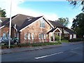
RG2 7JE is predominantly an owner-occupied area, with 64% of residents living in homes they own. The accommodation type is largely houses, which is unusual in many urban areas where flats or apartments dominate. This suggests a community of homeowners living in single-family homes, potentially appealing to families or those seeking more space. The area’s small size means the housing stock is limited, and buyers should consider the compact nature of the postcode. The focus on houses may indicate a preference for traditional, detached or semi-detached properties, which could be more suitable for long-term residency than rental properties. However, the lack of data on property prices or availability means it is unclear whether this is a buyer’s market or one with limited options. For those considering purchase, the area’s high home ownership rate and house-centric stock may reflect a stable, established community with less turnover.
House Prices in RG2 7JE
Showing 4 properties
| Address | Type | Beds | Baths | Last Sale Price | Last Sale Date | |
|---|---|---|---|---|---|---|
| 6 Cressingham Road, Reading, RG2 7JE | Bungalow | - | - | £485,000 | Mar 2021 | |
| 8 Cressingham Road, Reading, RG2 7JE | Bungalow | 2 | 1 | £400,000 | Aug 2016 | |
| Church Hall, Tyndale Baptist Church, 2-4 Cressingham Road, Reading, RG2 7JE | commercial | - | - | - | - | |
| 8A Cressingham Road, Reading, RG2 7JE | Semi-detached | 3 | 1 | - | - |
Energy Efficiency in RG2 7JE
Residents of RG2 7JE have access to a range of retail and transport amenities within practical reach. Nearby shops include Tesco Reading, Co-op Whiteknights, and Aldi Whitley, offering a mix of supermarket and local retail options. These stores provide convenience for everyday shopping, from groceries to household essentials. The area’s rail network is well-served by five stations, including Earley, Reading, and Reading West, which connect to broader regional transport routes. While the data does not mention parks or leisure facilities, the presence of multiple retail and transport hubs suggests a focus on practicality and accessibility. The compact nature of the area may mean that residents rely heavily on these centralised amenities, which can foster a sense of community. However, the lack of specific details on green spaces or recreational areas means that lifestyle options beyond shopping and transport are not defined in the data.
Amenities
Schools
The nearest school to RG2 7JE is Leighton Park School, an independent institution. Independent schools are typically fee-paying and may offer smaller class sizes, specialist facilities, or particular educational philosophies. However, the data does not provide an Ofsted rating for this school, so its quality cannot be assessed from the provided information. Families seeking state education would need to look beyond the immediate area, as no other schools are listed in the data. The presence of a single independent school may indicate that the area is served by a limited range of educational options, which could be a consideration for parents. For those prioritising private education, Leighton Park School could be a key draw, but its suitability would depend on individual needs and the school’s reputation, which is not detailed here.
| Rank | School | Type | Entry gender | Ages |
|---|
Explore more schools in this area
Go to Schools tabDemographics
The population of RG2 7JE has a median age of 47, with the majority of residents falling into the 30-64 age range. This suggests a community of middle-aged adults, many of whom may be in their prime working years or nearing retirement. Home ownership is high at 64%, indicating that most residents live in properties they own rather than rent. The predominant accommodation type is houses, which aligns with the area’s higher ownership rates and suggests a focus on family homes. The predominant ethnic group is White, though the data does not provide further breakdowns of diversity. The high population density — 387,404 people per square kilometre — implies that the area is intensely populated, which can influence local services and infrastructure. However, no specific data on deprivation or socioeconomic status is provided, so it is not possible to assess how this density affects quality of life beyond the figures given.
Household Size
Accommodation Type
Tenure
Ethnic Group
Religion
Household Composition
Age
Household Deprivation
NS-SEC
Explore more demographic insights in this area
Go to Demographics tabPlanning
Planning Constraints
- Flood RiskPremium
- Ramsar Wetland SitesPremium
- Area of Outstanding Natural BeautyPremium
- Protected Nature ReservePremium
- Protected WoodlandPremium