Area Overview for RG2 7DT
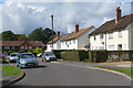
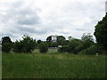
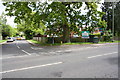
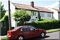
Photos of RG2 7DT
Area Information
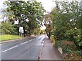
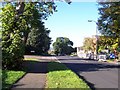
RG2 7DT is a small residential postcode area in England, covering just 1.5 hectares and home to 1,708 residents. Its compact size means it is a tightly knit community, with a population density of 117,236 people per square kilometre. This area is characterised by a predominance of houses, reflecting a stable, owner-occupied demographic. The median age of 47 suggests a mature population, with the majority of residents falling within the 30-64 age range. Daily life here is shaped by proximity to essential services, including retail hubs and rail links, which connect residents to nearby towns and cities. The area’s small footprint means it is ideal for those seeking a quiet, established neighbourhood with easy access to urban amenities. With no significant environmental constraints or flood risks, RG2 7DT offers a practical, low-maintenance living environment. Its appeal lies in its balance of residential tranquillity and connectivity, making it a viable choice for families and professionals alike.
- Area Type
- Postcode
- Area Size
- 1.5 hectares
- Population
- 1708
- Population Density
- 2841 people/km²
The property market in RG2 7DT is dominated by owner-occupied homes, with 64% of residents owning their properties. The area’s housing stock consists primarily of houses, which are more common than flats or apartments. This suggests a market tailored to families and individuals preferring private, standalone residences. Given the area’s small size, the number of available properties is likely limited, making it a niche market for buyers seeking specific characteristics such as proximity to schools or transport. The high home ownership rate indicates a stable market with lower turnover, which may be attractive to investors seeking long-term value. However, buyers should consider the area’s compact nature, as opportunities for expansion or development are constrained. The focus on houses also means that rental properties are less prevalent, potentially reducing competition for tenants.
House Prices in RG2 7DT
Showing 23 properties
| Address | Type | Beds | Baths | Last Sale Price | Last Sale Date | |
|---|---|---|---|---|---|---|
| 168 Shinfield Road, Reading, RG2 7DT | Semi-detached | 4 | 1 | £579,000 | Jul 2025 | |
| 158 Shinfield Road, Reading, RG2 7DT | Semi-detached | 3 | 1 | £450,000 | May 2023 | |
| 156 Shinfield Road, Reading, RG2 7DT | Semi-detached | 3 | 1 | £455,000 | Aug 2019 | |
| 192 Shinfield Road, Reading, RG2 7DT | Semi-detached | 3 | - | £360,000 | Dec 2017 | |
| 188 Shinfield Road, Reading, RG2 7DT | Detached | 3 | 1 | £540,000 | Jun 2017 | |
| 170 Shinfield Road, Reading, RG2 7DT | house | - | - | £380,000 | Aug 2013 | |
| 152 Shinfield Road, Reading, RG2 7DT | Semi-detached | 4 | - | £425,000 | May 2013 | |
| 162 Shinfield Road, Reading, RG2 7DT | house | 3 | - | £330,000 | Aug 2011 | |
| 174 Shinfield Road, Reading, RG2 7DT | Detached | 1 | 1 | £560,000 | Mar 2011 | |
| 140 Shinfield Road, Reading, RG2 7DT | house | 4 | - | £315,000 | Aug 2010 |
Energy Efficiency in RG2 7DT
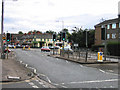
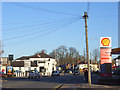
Living in RG2 7DT offers access to a range of nearby amenities, including retail outlets such as Tesco Reading, Co-op Whiteknights, and Asda Lower. These shops provide everyday convenience, reducing the need for long trips to larger centres. The area’s rail stations—Earley, Reading, and Reading West—connect residents to wider networks, enabling easy access to cultural, leisure, and professional opportunities. While the data does not mention parks or leisure facilities, the proximity to rail links suggests potential for weekend excursions or access to larger recreational areas. The compact nature of the area means that daily errands and travel are efficiently managed within a short radius. The mix of retail and transport options contributes to a lifestyle that balances local convenience with urban connectivity, making it practical for residents with varied needs.
Amenities
Schools
The nearest school to RG2 7DT is Leighton Park School, an independent institution. While no Ofsted rating is provided, the presence of an independent school may appeal to families prioritising private education. The area’s small size means it is unlikely to have multiple schools within walking distance, so families may need to consider travel times or additional schooling options. The absence of state schools in the immediate vicinity suggests that residents may rely on nearby towns for public education. For those valuing independent schooling, Leighton Park School offers a dedicated option, though its specific academic performance or facilities are not detailed in the data. Parents should evaluate the school’s reputation and accessibility independently to align with their priorities.
| Rank | School | Type | Entry gender | Ages |
|---|
Explore more schools in this area
Go to Schools tabDemographics
The community in RG2 7DT is predominantly composed of adults aged 30-64, with a median age of 47. This suggests a mature, settled population, likely with established careers and families. Home ownership stands at 64%, indicating a strong presence of long-term residents. The area is largely composed of houses, reflecting a preference for single-family living over flats or apartments. The predominant ethnic group is White, with no specific data provided on other demographics. The high proportion of owner-occupied homes and the age profile suggest a community focused on stability and long-term residency. The absence of detailed diversity statistics means the area’s social composition is not fully quantified, but the data highlights a cohesive, middle-aged demographic. This profile may appeal to those seeking a low-deprivation environment with minimal turnover.
Household Size
Accommodation Type
Tenure
Ethnic Group
Religion
Household Composition
Age
Household Deprivation
NS-SEC
Explore more demographic insights in this area
Go to Demographics tabPlanning
Planning Constraints
- Flood RiskPremium
- Ramsar Wetland SitesPremium
- Area of Outstanding Natural BeautyPremium
- Protected Nature ReservePremium
- Protected WoodlandPremium