Area Overview for RG2 7DX
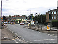
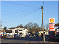
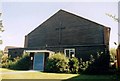
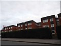
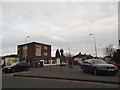
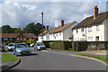
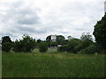
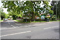
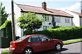
Photos of RG2 7DX
Area Information
RG2 7DX is a compact postcode area in England, covering just 5 hectares with a population of 1708 people. This small residential cluster is densely populated, with 33,923 people per square kilometre, reflecting a tightly knit community. The area is characterised by its proximity to essential services and transport links, making it practical for daily life. Residents benefit from nearby retail options, including major supermarkets like Tesco Reading and Asda Lower, and multiple railway stations such as Earley and Reading, which connect to broader networks. The demographic profile suggests a mature population, with the median age at 47, and a focus on family-oriented living. While the area lacks natural or protected landscapes, its safety and connectivity make it appealing for those prioritising convenience over rural scenery. The absence of environmental constraints, such as Ramsar wetlands or Areas of Outstanding Natural Beauty, means development is unrestricted, though this also means the area is more urban in character. For buyers seeking a compact, well-served neighbourhood with strong digital connectivity and low crime rates, RG2 7DX offers a pragmatic choice.
- Area Type
- Postcode
- Area Size
- 5.0 hectares
- Population
- 1708
- Population Density
- 2841 people/km²
The property market in RG2 7DX is dominated by owner-occupied homes, with 64% of residents owning their properties. The accommodation type is primarily houses, which suggests a focus on family homes rather than flats or apartments. This makes the area more attractive to buyers seeking spacious, long-term living solutions. Given the high population density and small area size, the housing stock is likely to be limited, with properties concentrated in a compact cluster. The absence of rental market data means it is unclear whether the area has a significant proportion of tenants, but the high home ownership rate implies a stable, settled population. For buyers, this means competition for properties could be fierce, and the market may be more geared toward those prioritising ownership over rental flexibility. The proximity to retail and transport hubs further enhances the appeal of the area for those valuing convenience over expansive living spaces.
House Prices in RG2 7DX
Showing 50 properties
| Address | Type | Beds | Baths | Last Sale Price | Last Sale Date | |
|---|---|---|---|---|---|---|
| 24 Devonshire Park, Reading, RG2 7DX | Detached | 6 | 4 | £1,300,000 | Jan 2025 | |
| 36 Devonshire Park, Reading, RG2 7DX | house | 3 | 2 | £510,000 | Jul 2023 | |
| 49 Devonshire Park, Reading, RG2 7DX | Terraced | 3 | 2 | £385,000 | Jun 2022 | |
| 11 Devonshire Park, Reading, RG2 7DX | house | - | - | £1,020,000 | Jun 2021 | |
| 2 Devonshire Park, Reading, RG2 7DX | house | - | - | £740,000 | Nov 2020 | |
| 12 Devonshire Park, Reading, RG2 7DX | Detached | 5 | 3 | £810,000 | Sep 2020 | |
| 9 Devonshire Park, Reading, RG2 7DX | Detached | 5 | 3 | £875,000 | Dec 2019 | |
| 39 Devonshire Park, Reading, RG2 7DX | Semi-detached | 3 | - | £310,000 | Nov 2019 | |
| 19 Devonshire Park, Reading, RG2 7DX | Detached | 5 | 1 | £788,000 | Jun 2018 | |
| 43 Devonshire Park, Reading, RG2 7DX | Flat | - | - | £242,000 | Feb 2018 |
Energy Efficiency in RG2 7DX
Living in RG2 7DX offers access to a range of retail and transport amenities within practical reach. The area is served by five retail outlets, including major supermarkets like Tesco Reading, Co-op Whiteknights, and Asda Lower, ensuring residents have nearby options for groceries and daily essentials. The presence of multiple railway stations, such as Earley and Reading, enhances connectivity, making it easier to travel for work, leisure, or shopping. While the data does not mention parks or leisure facilities, the proximity to urban centres likely means additional recreational options are available nearby. The combination of retail convenience and reliable transport links contributes to a lifestyle that balances practicality with accessibility, supporting both daily needs and broader mobility.
Amenities
Schools
The nearest school to RG2 7DX is Leighton Park School, an independent institution. While no Ofsted rating is provided, the presence of an independent school suggests the area may attract families seeking alternative or selective education options. However, the data does not include state schools or other educational institutions, so the full range of schooling options is unclear. For families prioritising independent education, Leighton Park School could be a significant draw. However, those relying on state-funded schools may need to look beyond the immediate area. The absence of additional schools in the data means the educational landscape here is limited to this single option, which could be a consideration for prospective buyers with children.
| Rank | School | Type | Entry gender | Ages |
|---|
Explore more schools in this area
Go to Schools tabDemographics
The community in RG2 7DX is predominantly composed of adults aged 30–64, with a median age of 47. This suggests a stable population with established careers and families. Home ownership is high at 64%, indicating a strong presence of long-term residents. The accommodation type is primarily houses, which aligns with the area’s residential character. The predominant ethnic group is White, though no specific data on diversity or minority populations is provided. The high population density of 33,923 people per square kilometre means the area is intensely populated, which could influence the pace of life and availability of space. While no deprivation data is available, the low crime risk score of 80 suggests a relatively safe environment. The demographic profile points to a mature, settled community, which may appeal to buyers seeking stability and a low-risk environment for living and raising families.
Household Size
Accommodation Type
Tenure
Ethnic Group
Religion
Household Composition
Age
Household Deprivation
NS-SEC
Explore more demographic insights in this area
Go to Demographics tabPlanning
Planning Constraints
- Flood RiskPremium
- Ramsar Wetland SitesPremium
- Area of Outstanding Natural BeautyPremium
- Protected Nature ReservePremium
- Protected WoodlandPremium