Area Overview for RG2 7DS
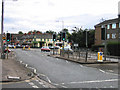
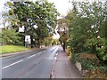
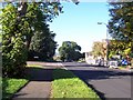
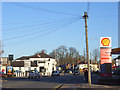
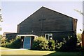
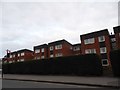
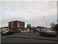
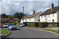
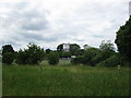
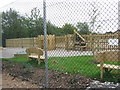
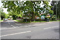
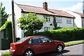
Photos of RG2 7DS
Area Information
RG2 7DS is a compact residential postcode in England, covering 9,756 square metres and home to 1,708 residents. Its population density of 175,075 people per square kilometre reflects a tightly knit community, where homes are closely spaced but still offer a sense of privacy. The area is a small cluster of properties, predominantly houses, which suggests a stable, long-term residential character. Living here means being part of a mature demographic, with a median age of 47 and a majority of residents aged between 30 and 64. This suggests a community rooted in family life and professional stability. The proximity to retail hubs like Tesco Reading and rail stations such as Earley and Reading ensures daily convenience, while the low crime risk and absence of environmental constraints make it a practical choice for buyers seeking a secure, well-connected location. Its compact size means amenities are within easy reach, but the area’s character is defined by its balance of accessibility and quiet residential appeal.
- Area Type
- Postcode
- Area Size
- 9756 m²
- Population
- 1708
- Population Density
- 2841 people/km²
RG2 7DS is primarily an owner-occupied area, with 64% of residents owning their homes. The accommodation type is exclusively houses, which is unusual for a small postcode but suggests a focus on single-family living. This configuration may appeal to buyers seeking spacious, private properties in a compact setting. The high home ownership rate indicates a stable market, though the area’s small size means the housing stock is limited. Buyers should consider the proximity to rail networks, including Earley and Reading stations, which enhance connectivity for commuters. The absence of rental properties suggests a community prioritising long-term residency over transient occupancy. For those seeking a home, the mix of houses and limited development potential means properties may be in high demand, particularly for families or professionals requiring a balance of space and convenience.
House Prices in RG2 7DS
Showing 15 properties
| Address | Type | Beds | Baths | Last Sale Price | Last Sale Date | |
|---|---|---|---|---|---|---|
| 181 Shinfield Road, Reading, RG2 7DS | Terraced | 3 | 1 | £387,500 | May 2025 | |
| 177 Shinfield Road, Reading, RG2 7DS | Maisonette | 2 | 1 | £245,500 | Sep 2023 | |
| 185 Shinfield Road, Reading, RG2 7DS | house | - | - | £245,000 | Feb 2016 | |
| 189 Shinfield Road, Reading, RG2 7DS | Terraced | 2 | - | £244,501 | Aug 2015 | |
| 179 Shinfield Road, Reading, RG2 7DS | Terraced | 3 | 1 | £255,000 | Aug 2015 | |
| 191 Shinfield Road, Reading, RG2 7DS | Terraced | 2 | - | £210,000 | Jun 2014 | |
| 197 Shinfield Road, Reading, RG2 7DS | house | - | - | £293,500 | Dec 2013 | |
| 195 Shinfield Road, Reading, RG2 7DS | Terraced | 2 | - | £214,950 | Jul 2007 | |
| 173 Shinfield Road, Reading, RG2 7DS | Flat | 2 | 1 | £148,000 | Oct 2006 | |
| 187 Shinfield Road, Reading, RG2 7DS | house | 2 | 1 | £165,000 | Jul 2006 |
Energy Efficiency in RG2 7DS
RG2 7DS offers a range of amenities within close proximity. Retail options include Tesco Reading, Asda Lower, and M&S Lower Earley SF, providing essential shopping and dining choices. The area’s rail network, with stations like Earley and Reading, ensures easy access to broader regional amenities. While the data does not specify parks or leisure facilities, the compact nature of the postcode suggests a focus on convenience rather than expansive recreational spaces. The presence of multiple retail outlets and transport links contributes to a practical, efficient lifestyle, ideal for those prioritising accessibility over large-scale leisure options. The area’s small size means amenities are tightly clustered, but this also fosters a sense of community where residents can easily access daily necessities without long commutes.
Amenities
Schools
The nearest school to RG2 7DS is Leighton Park School, an independent institution. While no Ofsted rating is provided, the presence of an independent school may indicate a focus on high-quality education for local families. The area’s single school option suggests limited diversity in educational provision, but the independent nature of Leighton Park School could offer specialised curricula or facilities. Families prioritising private education may find this a key draw, though those requiring state-funded options would need to look further afield. The absence of other schools in the data means the area’s educational landscape is narrow, but the existing school’s reputation could influence property desirability.
| Rank | School | Type | Entry gender | Ages |
|---|
Explore more schools in this area
Go to Schools tabDemographics
RG2 7DS has a median age of 47, with the largest age group being adults aged 30–64. This indicates a mature, established community with a strong presence of working-age residents. Home ownership is high, at 64%, suggesting a stable housing market where most residents live in their own homes. The accommodation type is predominantly houses, which aligns with the area’s low population density for a postcode of its size. The predominant ethnic group is White, reflecting a homogenous demographic profile. The high home ownership rate and age distribution suggest a community with long-term residency patterns, where families and professionals coexist. With no data on deprivation levels, the area appears to support a quality of life consistent with its infrastructure and amenities. The absence of protected natural areas or wetlands also implies fewer planning restrictions, which could benefit homeowners looking to make modifications.
Household Size
Accommodation Type
Tenure
Ethnic Group
Religion
Household Composition
Age
Household Deprivation
NS-SEC
Explore more demographic insights in this area
Go to Demographics tabPlanning
Planning Constraints
- Flood RiskPremium
- Ramsar Wetland SitesPremium
- Area of Outstanding Natural BeautyPremium
- Protected Nature ReservePremium
- Protected WoodlandPremium