Area Overview for RG2 7NB
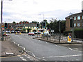
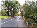
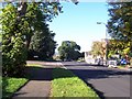
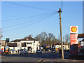
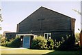
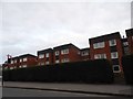
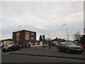
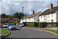
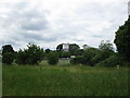
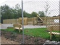
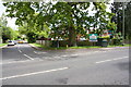
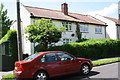
Photos of RG2 7NB
Area Information
RG2 7NB is a small, compact residential area in England, covering 8,626 square metres and home to 1,653 residents. Its high population density—191,641 people per square kilometre—reflects a tightly knit community, with homes clustered closely together. The area is predominantly residential, with a strong presence of family-oriented housing. Daily life here is shaped by its proximity to essential services and transport links, making it convenient for commuters and families alike. The median age of 47 suggests a mature population, with adults aged 30–64 forming the largest demographic group. This creates a stable, established community where many residents have lived for years. The area’s small size means it is easy to navigate, with local amenities and schools within walking or short driving distance. While it lacks large-scale developments, its charm lies in its simplicity and accessibility, appealing to those seeking a quiet, connected lifestyle without the sprawl of bigger towns.
- Area Type
- Postcode
- Area Size
- 8626 m²
- Population
- 1653
- Population Density
- 4268 people/km²
The property market in RG2 7NB is characterised by a 40% home ownership rate, with houses forming the majority of the accommodation stock. This suggests a community where family homes are more prevalent than flats or apartments, catering to those seeking traditional housing. The relatively low home ownership percentage implies that a significant portion of the housing stock may be rented, potentially offering opportunities for buyers looking to invest in a stable, family-oriented area. However, the small size of the postcode—8,626 square metres—means the housing stock is limited, and the immediate surroundings may hold more options. For buyers, this could mean competition for available properties, but the focus on houses may appeal to those prioritising space and privacy. The area’s compact nature also means that proximity to amenities and transport links is a key selling point for potential residents.
House Prices in RG2 7NB
Showing 16 properties
| Address | Type | Beds | Baths | Last Sale Price | Last Sale Date | |
|---|---|---|---|---|---|---|
| 4 Maple Gardens, Reading, RG2 7NB | Semi-detached | 3 | 1 | £415,000 | Jul 2025 | |
| 1 Maple Gardens, Reading, RG2 7NB | house | - | - | £325,000 | Feb 2022 | |
| 15 Maple Gardens, Reading, RG2 7NB | Detached | 6 | 6 | £338,000 | Nov 2020 | |
| 12 Maple Gardens, Reading, RG2 7NB | house | - | - | £305,000 | Mar 2020 | |
| 6 Maple Gardens, Reading, RG2 7NB | Semi-detached | 3 | 1 | £369,950 | Dec 2016 | |
| 3 Maple Gardens, Reading, RG2 7NB | Terraced | 6 | 6 | £245,000 | Oct 2014 | |
| 10 Maple Gardens, Reading, RG2 7NB | Terraced | 3 | - | £186,000 | Jul 2013 | |
| 2 Maple Gardens, Reading, RG2 7NB | Terraced | 3 | 2 | £221,000 | May 2007 | |
| 7 Maple Gardens, Reading, RG2 7NB | house | - | - | £150,000 | Nov 2006 | |
| 9 Maple Gardens, Reading, RG2 7NB | Terraced | 3 | 2 | £78,000 | Aug 1998 |
Energy Efficiency in RG2 7NB
RG2 7NB offers a range of nearby amenities within practical reach, including five retail outlets such as Tesco Reading, Co-op Whiteknights, and Aldi Whitley. These shops provide essential grocery and household services, reducing the need for long trips to larger centres. The area’s rail stations—Earley, Reading, and Reading West—further enhance convenience, linking residents to broader networks for work, leisure, or socialising. While the data does not specify parks or leisure facilities, the presence of retail and transport hubs suggests a lifestyle focused on practicality and connectivity. The compact nature of the area means that daily needs can be met locally, fostering a self-contained community. For those prioritising convenience over large-scale recreational spaces, RG2 7NB’s amenities are well-suited to a straightforward, accessible way of life.
Amenities
Schools
The nearest school to RG2 7NB is The Ridgeway Primary School, which has an Ofsted rating of 'good'. This indicates a reliable educational provision for younger children, though the data does not specify the presence of secondary schools or further education institutions in the immediate vicinity. Families with children may need to look beyond the postcode for secondary schooling, but the primary school’s rating suggests a solid foundation for early education. The availability of a single primary school with a positive rating is a key consideration for prospective buyers, as it reduces the need for long commutes for younger children. However, the absence of detailed information on secondary schools means additional research may be required for families with older children.
| Rank | School | Type | Entry gender | Ages |
|---|
Explore more schools in this area
Go to Schools tabDemographics
The population of RG2 7NB is predominantly adults aged 30–64, with a median age of 47. This indicates a mature, settled community where many residents are likely to be in their peak working years or nearing retirement. Home ownership is at 40%, suggesting a mix of owner-occupied properties and rental homes. The accommodation type is primarily houses, which are more common than flats or apartments in this area. The predominant ethnic group is White, reflecting a homogenous demographic profile. While specific data on deprivation is not provided, the high population density and focus on family housing suggest that the area is well-served by local infrastructure. However, the relatively low home ownership rate may indicate a reliance on rental housing, which could affect long-term stability for some residents. The presence of a single primary school nearby also highlights the area’s focus on family living.
Household Size
Accommodation Type
Tenure
Ethnic Group
Religion
Household Composition
Age
Household Deprivation
NS-SEC
Explore more demographic insights in this area
Go to Demographics tabPlanning
Planning Constraints
- Flood RiskPremium
- Ramsar Wetland SitesPremium
- Area of Outstanding Natural BeautyPremium
- Protected Nature ReservePremium
- Protected WoodlandPremium