Area Overview for PO4 9UA
Photos of PO4 9UA
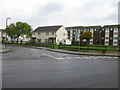
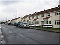
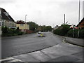
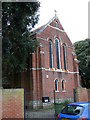
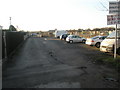
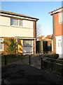
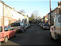
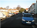
100 photos from this area
Area Information
Key information about the PO4 9UA including its size, population, and administrative classification.
- Area Type
- Postcode
- Area Size
- 2.2 hectares
- Population
- 1816
- Population Density
- 2703 people/km²
House Prices in PO4 9UA
36
Properties
£172,373
Average Sold Price
£36,000
Lowest Price
£395,000
Highest Price
Showing 36 properties
| Address | Type | Beds | Baths | Last Sale Price | Last Sale Date | |
|---|---|---|---|---|---|---|
| 22 Ferry Road, Southsea, PO4 9UA | Flat | 2 | 1 | £225,000 | Dec 2025 | |
| 24 Ferry Road, Southsea, PO4 9UA | Flat | 1 | 1 | £134,000 | Apr 2025 | |
| 34 Ferry Road, Southsea, PO4 9UA | Semi-detached | 3 | 1 | £280,000 | Dec 2023 | |
| 20 Ferry Road, Southsea, PO4 9UA | Flat | - | - | £170,000 | Sep 2023 | |
| 73 Ferry Road, Southsea, PO4 9UA | Terraced | 4 | - | £371,500 | Nov 2022 | |
| 69 Ferry Road, Southsea, PO4 9UA | house | - | - | £395,000 | Feb 2022 | |
| 91 Ferry Road, Southsea, PO4 9UA | Flat | 3 | 1 | £214,995 | Dec 2020 | |
| 18 Ferry Road, Southsea, PO4 9UA | Flat | 3 | - | £135,000 | Feb 2020 | |
| 32 Ferry Road, Southsea, PO4 9UA | Maisonette | 3 | 1 | £210,000 | Jun 2019 | |
| 77 Ferry Road, Southsea, PO4 9UA | Flat | 1 | - | £133,000 | Nov 2017 |
Page 1 of 4
Energy Efficiency in PO4 9UA
Amenities
Schools
| Rank | School | Type | Entry gender | Ages |
|---|
Explore more schools in this area
Go to Schools tabDemographics
Household Size
Family (3-5 people)
most common
Accommodation Type
Flats
most common
Tenure
38
majority
Ethnic Group
White
most common
Religion
N/A
most common
Household Composition
N/A
most common
Age
47
median
Adults (30-64 years)
most common
Household Deprivation
N/A
with no deprivation
NS-SEC
29
in Lower managerial occupations
Explore more demographic insights in this area
Go to Demographics tabPlanning
Planning Constraints
- Flood RiskPremium
- Ramsar Wetland SitesPremium
- Area of Outstanding Natural BeautyPremium
- Protected Nature ReservePremium
- Protected WoodlandPremium