Area Overview for PO4 9UD
Photos of PO4 9UD

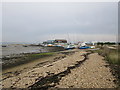

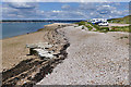
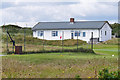

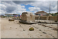
100 photos from this area
Area Information
Key information about the PO4 9UD including its size, population, and administrative classification.
- Area Type
- Postcode
- Area Size
- 5.1 hectares
- Population
- 1816
- Population Density
- 2703 people/km²
House Prices in PO4 9UD
44
Properties
£174,453
Average Sold Price
£50,100
Lowest Price
£300,000
Highest Price
Showing 44 properties
| Address | Type | Beds | Baths | Last Sale Price | Last Sale Date | |
|---|---|---|---|---|---|---|
| 60 Ferry Road, Southsea, PO4 9UD | Flat | - | - | £165,000 | Aug 2025 | |
| 129 Ferry Road, Southsea, PO4 9UD | Terraced | 3 | 1 | £300,000 | Dec 2023 | |
| 109 Ferry Road, Southsea, PO4 9UD | Flat | 2 | 1 | £198,000 | May 2022 | |
| 107 Ferry Road, Southsea, PO4 9UD | Flat | - | - | £130,000 | Mar 2021 | |
| 48 Ferry Road, Southsea, PO4 9UD | Terraced | 4 | 2 | £275,000 | Jan 2021 | |
| 52 Ferry Road, Southsea, PO4 9UD | Semi-detached | 3 | 2 | £268,000 | Aug 2020 | |
| 46 Ferry Road, Southsea, PO4 9UD | Maisonette | 3 | - | £250,000 | Jul 2019 | |
| 119 Ferry Road, Southsea, PO4 9UD | Flat | - | - | £115,000 | Jun 2018 | |
| 113 Ferry Road, Southsea, PO4 9UD | Flat | 1 | 1 | £147,500 | Apr 2018 | |
| 127 Ferry Road, Southsea, PO4 9UD | house | 4 | 2 | £212,000 | Nov 2015 |
Page 1 of 5
Energy Efficiency in PO4 9UD
Amenities
Schools
| Rank | School | Type | Entry gender | Ages |
|---|
Explore more schools in this area
Go to Schools tabDemographics
Household Size
Family (3-5 people)
most common
Accommodation Type
Flats
most common
Tenure
38
majority
Ethnic Group
White
most common
Religion
N/A
most common
Household Composition
N/A
most common
Age
47
median
Adults (30-64 years)
most common
Household Deprivation
N/A
with no deprivation
NS-SEC
29
in Lower managerial occupations
Explore more demographic insights in this area
Go to Demographics tabPlanning
Planning Constraints
- Flood RiskPremium
- Ramsar Wetland SitesPremium
- Area of Outstanding Natural BeautyPremium
- Protected Nature ReservePremium
- Protected WoodlandPremium