Area Overview for PO21 4QT
Photos of PO21 4QT
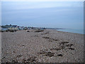
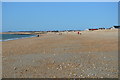
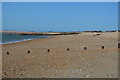
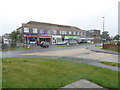
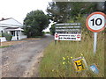
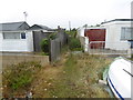

55 photos from this area
Area Information
Key information about the PO21 4QT including its size, population, and administrative classification.
- Area Type
- Postcode
- Area Size
- 8956 m²
- Population
- 1647
- Population Density
- 2359 people/km²
House Prices in PO21 4QT
20
Properties
£214,563
Average Sold Price
£123,000
Lowest Price
£365,000
Highest Price
Showing 20 properties
| Address | Type | Beds | Baths | Last Sale Price | Last Sale Date | |
|---|---|---|---|---|---|---|
| 27 East Mead, Pagham, PO21 4QT | Semi-detached | 2 | 1 | £365,000 | Dec 2020 | |
| 12 East Mead, Pagham, PO21 4QT | Bungalow | 2 | 1 | £282,000 | Sep 2018 | |
| 3 East Mead, Pagham, PO21 4QT | Bungalow | 2 | 1 | £285,000 | Aug 2017 | |
| 10 East Mead, Pagham, PO21 4QT | Semi-detached | 3 | 2 | £290,000 | Jun 2015 | |
| 6 East Mead, Pagham, PO21 4QT | Semi-detached | 2 | 1 | £185,000 | Oct 2012 | |
| 7 East Mead, Pagham, PO21 4QT | Bungalow | 2 | - | £199,950 | May 2012 | |
| 4 East Mead, Pagham, PO21 4QT | Bungalow | 2 | - | £198,500 | Mar 2012 | |
| 5 East Mead, Pagham, PO21 4QT | Bungalow | - | - | £189,000 | Apr 2010 | |
| 9 East Mead, Pagham, PO21 4QT | Semi-detached | 2 | 1 | £180,000 | Dec 2009 | |
| 21 East Mead, Pagham, PO21 4QT | Bungalow | - | - | £150,000 | Apr 2009 |
Page 1 of 2
Energy Efficiency in PO21 4QT
Amenities
Schools
| Rank | School | Type | Entry gender | Ages |
|---|
Explore more schools in this area
Go to Schools tabDemographics
Household Size
Two person
most common
Accommodation Type
Houses
most common
Tenure
92
majority
Ethnic Group
White
most common
Religion
N/A
most common
Household Composition
N/A
most common
Age
47
median
Adults (30-64 years)
most common
Household Deprivation
N/A
with no deprivation
NS-SEC
29
in Lower managerial occupations
Explore more demographic insights in this area
Go to Demographics tabPlanning
Planning Constraints
- Flood RiskPremium
- Ramsar Wetland SitesPremium
- Area of Outstanding Natural BeautyPremium
- Protected Nature ReservePremium
- Protected WoodlandPremium