Area Overview for PO21 4QB
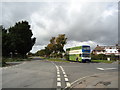
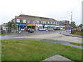
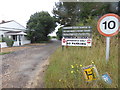
Photos of PO21 4QB


Area Information
Living in PO21 4QB offers a distinct residential experience within England. This specific postcode covers a small residential cluster spanning just 2,625 square metres. Such a limited footprint suggests a tightly knit neighbourhood rather than a sprawling district. With a population of 1,647 residents, the area maintains a manageable scale while remaining part of the wider national network. Daily life here revolves around a concise community where proximity defines the layout. The density stands at 627,375 people per square kilometre, indicating a highly concentrated settlement pattern typical of this specific code. You will find yourself in a location designed for quiet domestic life rather than urban bustle. The environment is defined by its compact nature, ensuring that neighbours are close and local services are nearby. This cluster exists as a specific point within the broader postal grid of England. Consider this area if you prefer a contained living space with clear boundaries. The small area size means travel within the immediate vicinity is quick and straightforward. You gain access to a defined circle of influence without the congestion of larger towns. Everything you need revolves around this central, densely populated micro-locale. It is a place where the community is compact and the identity is focused on direct local interaction. The community in PO21 4QB reflects a mature and stable population. The median age is 47 years, positioning the demographic firmly in the later middle years or early retirement phase. Adults aged between 30 and 64 years represent the most common age range within the area. This profile suggests a neighbourhood favoured by established households rather than families with young children. Home ownership stands at an impressive 92% level. This statistic highlights a deep-rooted sense of place and long-term stability among residents. Very few households rent from the private or social sectors in this specific code. The predominant accommodation type consists of houses, aligning with the preference for standalone homes preferred by this age group. Ethnic diversity shows White as the predominant ethnic group, mirroring broader national patterns in this region. These figures combine to paint a picture of a traditional, settled community. You will encounter a neighbourhood where people have likely lived in their homes for decades. The high ownership rate reduces the turnover of residents, fostering familiarity and local knowledge. Deprivation levels are not explicitly detailed, but the high ownership suggests financial stability among the majority. The demographic picture is consistent with those seeking permanent, comfortable homes in a established setting. The property market in PO21 4QB is overwhelmingly characterised by owner-occupation. With home ownership reaching 92%, the majority of households own their residences outright or are buying them through mortgages. This leaves a very small fraction of the local housing stock available for rent. The predominant accommodation type in this postcode is houses. This means you will primarily encounter detached, semi-detached, or terraced standalone properties rather than flats or apartments. The compact nature of the area, covering only 2,625 square metres, limits the total volume of properties available on the market. Residents have a strong incentive to remain in their local homes, reducing buyer influx. A prospective buyer looking at homes in PO21 4QB should expect a competitive environment where sellers are motivated to keep their families close. The market operates on the premise of permanent residence rather than investment or short-term letting. House types will vary based on the specific layout of the residential cluster, but the focus remains on traditional housing forms. This stability often correlates with higher property values and strong local council involvement in maintenance. If you are considering purchasing, you are entering a market dominated by people who wish to stay put. The lack of rental properties simplifies the market, making it a place for long-term settlement. Buyers can expect a consistent stock of houses that cater to established families. Digital connectivity in PO21 4QB presents a mixed picture for modern living. Mobile coverage scores highly with an index of 84 out of 100. This rating indicates good reliability for calls and messaging while you travel. You can expect robust connection for daily mobile phone usage within the residential cluster. However, fixed broadband quality presents a significant challenge with a score of only 27 out of 100. This low rating suggests poor performance for heavy internet users or those relying on high-speed connections. You may experience slow speeds or frequent interruptions when trying to work from home or stream content. For residents who need to rely on high-bandwidth activities, this level of fixed connectivity could be frustrating. The disparity between strong mobile and weak wired internet defines the digital landscape here. Commuters relying on data-heavy cloud services may find the fixed network insufficient for their needs. While mobile allows you to stay connected on the move, working inside the home will test the limits of current infrastructure. Speeds will likely struggle to meet modern demands for remote professional work. Consider this limitation carefully if your daily routine depends on a stable, fast home internet connection. The area functions well for basic communication but lags behind benchmarks for digital productivity. Residents of PO21 4QB enjoy practical access to a range of nearby amenities within practical reach. Retail options include Co-op Pagham, Tesco Bognor, and Co-op Bognor, ensuring you can source groceries and daily necessities without travelling far. These specific venues provide convenience for the household. Transport links are strong with four railway stations easily accessible. Bognor Regis Railway Station, Chichester Railway Station, and Barnham Railway Station offer regular train services. Travelers can use these hubs to reach broader cities or leisure destinations. Air travel is also possible given the presence of Chichester/Goodwood Airport nearby. This mix of rail and airport facilities supports both business and holiday travel. Daily life benefits from having shops and stations close by. You can run errands at Co-op Pagham or head to Tesco Bognor for larger provisions. The variety of transport nodes ensures you are not isolated from the wider country. Whether you need to catch a train at Barnham or fly from Chichester/Goodwood Airport, the options are clear. These amenities form the backbone of daily convenience for anyone calling this postcode home. Safety and environmental conditions in PO21 4QB present a reassuring profile for residents. The area passes all major environmental planning constraints. There is no coverage of Ramsar wetland sites or Areas of Outstanding Natural Beauty, meaning development is not restricted by these protected designations. No protected nature reserves or woodland cover exists within this specific postcode boundary. This clarity simplifies planning considerations for current and future property owners. Flood risk is minimal with a score of 0, indicating low flood risk coverage. You do not need to worry about water levels threatening your home. Crime risk passes a robust assessment with a safety score of 84 out of 100. This score reflects below-average crime rates compared to similar neighbourhoods. The area is classified as having a lower risk of criminal activity. A safety score of 84 suggests a peaceful environment where most living is worry-free. These passing assessments collectively indicate a secure and legally straightforward location. You can expect a stable environment free from major environmental hazards or high crime concerns. The low flood risk ensures your property remains dry and sound. The high safety score assures you that the local nights are quiet and days are safe. Who typically lives in PO21 4QB? The population consists mainly of adults aged 30 to 64 years, with a median age of 47. This demographic profile indicates a mature community. Home ownership stands at 92%, showing that most residents are long-term homeowners rather than tenants. The majority live in houses, reflecting a preference for traditional family housing over flats. How reliable is the internet and mobile connection? Mobile coverage is strong with a score of 84 out of 100, providing good reliability for communication on the move. However, fixed broadband quality is significantly lower with a score of only 27 out of 100. This means working from home or streaming high-definition content may be difficult due to slow speeds. You should expect poor fixed-line performance despite good mobile signals. What nearby amenities can I use for shopping and travel? Residents have access to three notable retail outlets: Co-op Pagham, Tesco Bognor, and Co-op Bognor. For travel, four railway stations serve the area including Bognor Regis, Chichester, and Barnham Railway Stations. Chichester/Goodwood Airport is also nearby for flying. These facilities are within practical reach for daily shopping and commuting needs. Is PO21 4QB a safe place to live? The area scores 84 out of 100 on crime risk assessments, indicating low crime rates and a safer neighbourhood. It also has zero flood risk and no protected planning constraints like wetlands or woodlands. These factors combine to create a secure environment with minimal environmental or safety concerns for residents.
- Area Type
- Postcode
- Area Size
- 2625 m²
- Population
- 1647
- Population Density
- 2359 people/km²
The property market in PO21 4QB is overwhelmingly characterised by owner-occupation. With home ownership reaching 92%, the majority of households own their residences outright or are buying them through mortgages. This leaves a very small fraction of the local housing stock available for rent. The predominant accommodation type in this postcode is houses. This means you will primarily encounter detached, semi-detached, or terraced standalone properties rather than flats or apartments. The compact nature of the area, covering only 2,625 square metres, limits the total volume of properties available on the market. Residents have a strong incentive to remain in their local homes, reducing buyer influx. A prospective buyer looking at homes in PO21 4QB should expect a competitive environment where sellers are motivated to keep their families close. The market operates on the premise of permanent residence rather than investment or short-term letting. House types will vary based on the specific layout of the residential cluster, but the focus remains on traditional housing forms. This stability often correlates with higher property values and strong local council involvement in maintenance. If you are considering purchasing, you are entering a market dominated by people who wish to stay put. The lack of rental properties simplifies the market, making it a place for long-term settlement. Buyers can expect a consistent stock of houses that cater to established families. Digital connectivity in PO21 4QB presents a mixed picture for modern living. Mobile coverage scores highly with an index of 84 out of 100. This rating indicates good reliability for calls and messaging while you travel. You can expect robust connection for daily mobile phone usage within the residential cluster. However, fixed broadband quality presents a significant challenge with a score of only 27 out of 100. This low rating suggests poor performance for heavy internet users or those relying on high-speed connections. You may experience slow speeds or frequent interruptions when trying to work from home or stream content. For residents who need to rely on high-bandwidth activities, this level of fixed connectivity could be frustrating. The disparity between strong mobile and weak wired internet defines the digital landscape here. Commuters relying on data-heavy cloud services may find the fixed network insufficient for their needs. While mobile allows you to stay connected on the move, working inside the home will test the limits of current infrastructure. Speeds will likely struggle to meet modern demands for remote professional work. Consider this limitation carefully if your daily routine depends on a stable, fast home internet connection. The area functions well for basic communication but lags behind benchmarks for digital productivity. Residents of PO21 4QB enjoy practical access to a range of nearby amenities within practical reach. Retail options include Co-op Pagham, Tesco Bognor, and Co-op Bognor, ensuring you can source groceries and daily necessities without travelling far. These specific venues provide convenience for the household. Transport links are strong with four railway stations easily accessible. Bognor Regis Railway Station, Chichester Railway Station, and Barnham Railway Station offer regular train services. Travelers can use these hubs to reach broader cities or leisure destinations. Air travel is also possible given the presence of Chichester/Goodwood Airport nearby. This mix of rail and airport facilities supports both business and holiday travel. Daily life benefits from having shops and stations close by. You can run errands at Co-op Pagham or head to Tesco Bognor for larger provisions. The variety of transport nodes ensures you are not isolated from the wider country. Whether you need to catch a train at Barnham or fly from Chichester/Goodwood Airport, the options are clear. These amenities form the backbone of daily convenience for anyone calling this postcode home. Safety and environmental conditions in PO21 4QB present a reassuring profile for residents. The area passes all major environmental planning constraints. There is no coverage of Ramsar wetland sites or Areas of Outstanding Natural Beauty, meaning development is not restricted by these protected designations. No protected nature reserves or woodland cover exists within this specific postcode boundary. This clarity simplifies planning considerations for current and future property owners. Flood risk is minimal with a score of 0, indicating low flood risk coverage. You do not need to worry about water levels threatening your home. Crime risk passes a robust assessment with a safety score of 84 out of 100. This score reflects below-average crime rates compared to similar neighbourhoods. The area is classified as having a lower risk of criminal activity. A safety score of 84 suggests a peaceful environment where most living is worry-free. These passing assessments collectively indicate a secure and legally straightforward location. You can expect a stable environment free from major environmental hazards or high crime concerns. The low flood risk ensures your property remains dry and sound. The high safety score assures you that the local nights are quiet and days are safe. Who typically lives in PO21 4QB? The population consists mainly of adults aged 30 to 64 years, with a median age of 47. This demographic profile indicates a mature community. Home ownership stands at 92%, showing that most residents are long-term homeowners rather than tenants. The majority live in houses, reflecting a preference for traditional family housing over flats. How reliable is the internet and mobile connection? Mobile coverage is strong with a score of 84 out of 100, providing good reliability for communication on the move. However, fixed broadband quality is significantly lower with a score of only 27 out of 100. This means working from home or streaming high-definition content may be difficult due to slow speeds. You should expect poor fixed-line performance despite good mobile signals. What nearby amenities can I use for shopping and travel? Residents have access to three notable retail outlets: Co-op Pagham, Tesco Bognor, and Co-op Bognor. For travel, four railway stations serve the area including Bognor Regis, Chichester, and Barnham Railway Stations. Chichester/Goodwood Airport is also nearby for flying. These facilities are within practical reach for daily shopping and commuting needs. Is PO21 4QB a safe place to live? The area scores 84 out of 100 on crime risk assessments, indicating low crime rates and a safer neighbourhood. It also has zero flood risk and no protected planning constraints like wetlands or woodlands. These factors combine to create a secure environment with minimal environmental or safety concerns for residents.
House Prices in PO21 4QB
Showing 5 properties
| Address | Type | Beds | Baths | Last Sale Price | Last Sale Date | |
|---|---|---|---|---|---|---|
| 8 Link Way, Pagham, PO21 4QB | Bungalow | 2 | 1 | £305,000 | Dec 2024 | |
| 2 Link Way, Pagham, PO21 4QB | Bungalow | 2 | 1 | £355,000 | Oct 2023 | |
| 10 Link Way, Pagham, PO21 4QB | Semi-detached | 2 | 1 | £247,620 | Sep 2021 | |
| 4 Link Way, Pagham, PO21 4QB | Bungalow | - | - | £296,250 | May 2021 | |
| 6 Link Way, Pagham, PO21 4QB | Bungalow | - | - | £174,000 | Feb 2004 |
Energy Efficiency in PO21 4QB
Residents of PO21 4QB enjoy practical access to a range of nearby amenities within practical reach. Retail options include Co-op Pagham, Tesco Bognor, and Co-op Bognor, ensuring you can source groceries and daily necessities without travelling far. These specific venues provide convenience for the household. Transport links are strong with four railway stations easily accessible. Bognor Regis Railway Station, Chichester Railway Station, and Barnham Railway Station offer regular train services. Travelers can use these hubs to reach broader cities or leisure destinations. Air travel is also possible given the presence of Chichester/Goodwood Airport nearby. This mix of rail and airport facilities supports both business and holiday travel. Daily life benefits from having shops and stations close by. You can run errands at Co-op Pagham or head to Tesco Bognor for larger provisions. The variety of transport nodes ensures you are not isolated from the wider country. Whether you need to catch a train at Barnham or fly from Chichester/Goodwood Airport, the options are clear. These amenities form the backbone of daily convenience for anyone calling this postcode home. Safety and environmental conditions in PO21 4QB present a reassuring profile for residents. The area passes all major environmental planning constraints. There is no coverage of Ramsar wetland sites or Areas of Outstanding Natural Beauty, meaning development is not restricted by these protected designations. No protected nature reserves or woodland cover exists within this specific postcode boundary. This clarity simplifies planning considerations for current and future property owners. Flood risk is minimal with a score of 0, indicating low flood risk coverage. You do not need to worry about water levels threatening your home. Crime risk passes a robust assessment with a safety score of 84 out of 100. This score reflects below-average crime rates compared to similar neighbourhoods. The area is classified as having a lower risk of criminal activity. A safety score of 84 suggests a peaceful environment where most living is worry-free. These passing assessments collectively indicate a secure and legally straightforward location. You can expect a stable environment free from major environmental hazards or high crime concerns. The low flood risk ensures your property remains dry and sound. The high safety score assures you that the local nights are quiet and days are safe. Who typically lives in PO21 4QB? The population consists mainly of adults aged 30 to 64 years, with a median age of 47. This demographic profile indicates a mature community. Home ownership stands at 92%, showing that most residents are long-term homeowners rather than tenants. The majority live in houses, reflecting a preference for traditional family housing over flats. How reliable is the internet and mobile connection? Mobile coverage is strong with a score of 84 out of 100, providing good reliability for communication on the move. However, fixed broadband quality is significantly lower with a score of only 27 out of 100. This means working from home or streaming high-definition content may be difficult due to slow speeds. You should expect poor fixed-line performance despite good mobile signals. What nearby amenities can I use for shopping and travel? Residents have access to three notable retail outlets: Co-op Pagham, Tesco Bognor, and Co-op Bognor. For travel, four railway stations serve the area including Bognor Regis, Chichester, and Barnham Railway Stations. Chichester/Goodwood Airport is also nearby for flying. These facilities are within practical reach for daily shopping and commuting needs. Is PO21 4QB a safe place to live? The area scores 84 out of 100 on crime risk assessments, indicating low crime rates and a safer neighbourhood. It also has zero flood risk and no protected planning constraints like wetlands or woodlands. These factors combine to create a secure environment with minimal environmental or safety concerns for residents.
Amenities
Schools
| Rank | School | Type | Entry gender | Ages |
|---|
Explore more schools in this area
Go to Schools tabDemographics
The community in PO21 4QB reflects a mature and stable population. The median age is 47 years, positioning the demographic firmly in the later middle years or early retirement phase. Adults aged between 30 and 64 years represent the most common age range within the area. This profile suggests a neighbourhood favoured by established households rather than families with young children. Home ownership stands at an impressive 92% level. This statistic highlights a deep-rooted sense of place and long-term stability among residents. Very few households rent from the private or social sectors in this specific code. The predominant accommodation type consists of houses, aligning with the preference for standalone homes preferred by this age group. Ethnic diversity shows White as the predominant ethnic group, mirroring broader national patterns in this region. These figures combine to paint a picture of a traditional, settled community. You will encounter a neighbourhood where people have likely lived in their homes for decades. The high ownership rate reduces the turnover of residents, fostering familiarity and local knowledge. Deprivation levels are not explicitly detailed, but the high ownership suggests financial stability among the majority. The demographic picture is consistent with those seeking permanent, comfortable homes in a established setting. The property market in PO21 4QB is overwhelmingly characterised by owner-occupation. With home ownership reaching 92%, the majority of households own their residences outright or are buying them through mortgages. This leaves a very small fraction of the local housing stock available for rent. The predominant accommodation type in this postcode is houses. This means you will primarily encounter detached, semi-detached, or terraced standalone properties rather than flats or apartments. The compact nature of the area, covering only 2,625 square metres, limits the total volume of properties available on the market. Residents have a strong incentive to remain in their local homes, reducing buyer influx. A prospective buyer looking at homes in PO21 4QB should expect a competitive environment where sellers are motivated to keep their families close. The market operates on the premise of permanent residence rather than investment or short-term letting. House types will vary based on the specific layout of the residential cluster, but the focus remains on traditional housing forms. This stability often correlates with higher property values and strong local council involvement in maintenance. If you are considering purchasing, you are entering a market dominated by people who wish to stay put. The lack of rental properties simplifies the market, making it a place for long-term settlement. Buyers can expect a consistent stock of houses that cater to established families. Digital connectivity in PO21 4QB presents a mixed picture for modern living. Mobile coverage scores highly with an index of 84 out of 100. This rating indicates good reliability for calls and messaging while you travel. You can expect robust connection for daily mobile phone usage within the residential cluster. However, fixed broadband quality presents a significant challenge with a score of only 27 out of 100. This low rating suggests poor performance for heavy internet users or those relying on high-speed connections. You may experience slow speeds or frequent interruptions when trying to work from home or stream content. For residents who need to rely on high-bandwidth activities, this level of fixed connectivity could be frustrating. The disparity between strong mobile and weak wired internet defines the digital landscape here. Commuters relying on data-heavy cloud services may find the fixed network insufficient for their needs. While mobile allows you to stay connected on the move, working inside the home will test the limits of current infrastructure. Speeds will likely struggle to meet modern demands for remote professional work. Consider this limitation carefully if your daily routine depends on a stable, fast home internet connection. The area functions well for basic communication but lags behind benchmarks for digital productivity. Residents of PO21 4QB enjoy practical access to a range of nearby amenities within practical reach. Retail options include Co-op Pagham, Tesco Bognor, and Co-op Bognor, ensuring you can source groceries and daily necessities without travelling far. These specific venues provide convenience for the household. Transport links are strong with four railway stations easily accessible. Bognor Regis Railway Station, Chichester Railway Station, and Barnham Railway Station offer regular train services. Travelers can use these hubs to reach broader cities or leisure destinations. Air travel is also possible given the presence of Chichester/Goodwood Airport nearby. This mix of rail and airport facilities supports both business and holiday travel. Daily life benefits from having shops and stations close by. You can run errands at Co-op Pagham or head to Tesco Bognor for larger provisions. The variety of transport nodes ensures you are not isolated from the wider country. Whether you need to catch a train at Barnham or fly from Chichester/Goodwood Airport, the options are clear. These amenities form the backbone of daily convenience for anyone calling this postcode home. Safety and environmental conditions in PO21 4QB present a reassuring profile for residents. The area passes all major environmental planning constraints. There is no coverage of Ramsar wetland sites or Areas of Outstanding Natural Beauty, meaning development is not restricted by these protected designations. No protected nature reserves or woodland cover exists within this specific postcode boundary. This clarity simplifies planning considerations for current and future property owners. Flood risk is minimal with a score of 0, indicating low flood risk coverage. You do not need to worry about water levels threatening your home. Crime risk passes a robust assessment with a safety score of 84 out of 100. This score reflects below-average crime rates compared to similar neighbourhoods. The area is classified as having a lower risk of criminal activity. A safety score of 84 suggests a peaceful environment where most living is worry-free. These passing assessments collectively indicate a secure and legally straightforward location. You can expect a stable environment free from major environmental hazards or high crime concerns. The low flood risk ensures your property remains dry and sound. The high safety score assures you that the local nights are quiet and days are safe. Who typically lives in PO21 4QB? The population consists mainly of adults aged 30 to 64 years, with a median age of 47. This demographic profile indicates a mature community. Home ownership stands at 92%, showing that most residents are long-term homeowners rather than tenants. The majority live in houses, reflecting a preference for traditional family housing over flats. How reliable is the internet and mobile connection? Mobile coverage is strong with a score of 84 out of 100, providing good reliability for communication on the move. However, fixed broadband quality is significantly lower with a score of only 27 out of 100. This means working from home or streaming high-definition content may be difficult due to slow speeds. You should expect poor fixed-line performance despite good mobile signals. What nearby amenities can I use for shopping and travel? Residents have access to three notable retail outlets: Co-op Pagham, Tesco Bognor, and Co-op Bognor. For travel, four railway stations serve the area including Bognor Regis, Chichester, and Barnham Railway Stations. Chichester/Goodwood Airport is also nearby for flying. These facilities are within practical reach for daily shopping and commuting needs. Is PO21 4QB a safe place to live? The area scores 84 out of 100 on crime risk assessments, indicating low crime rates and a safer neighbourhood. It also has zero flood risk and no protected planning constraints like wetlands or woodlands. These factors combine to create a secure environment with minimal environmental or safety concerns for residents.
Household Size
Accommodation Type
Tenure
Ethnic Group
Religion
Household Composition
Age
Household Deprivation
NS-SEC
Explore more demographic insights in this area
Go to Demographics tabPlanning
Planning Constraints
- Flood RiskPremium
- Ramsar Wetland SitesPremium
- Area of Outstanding Natural BeautyPremium
- Protected Nature ReservePremium
- Protected WoodlandPremium