Area Overview for OX7 3BY
Photos of OX7 3BY
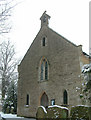
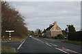
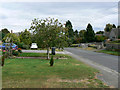
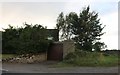
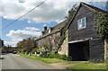
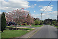
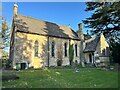
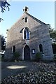
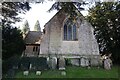

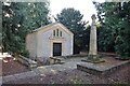
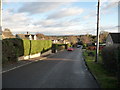
21 photos from this area
Area Information
Key information about the OX7 3BY including its size, population, and administrative classification.
- Area Type
- Postcode
- Area Size
- 9.3 hectares
- Population
- 1153
- Population Density
- 114 people/km²
House Prices in OX7 3BY
23
Properties
£378,001
Average Sold Price
£125,010
Lowest Price
£675,000
Highest Price
Showing 23 properties
| Address | Type | Beds | Baths | Last Sale Price | Last Sale Date | |
|---|---|---|---|---|---|---|
| The Old School, High Street, Finstock, OX7 3BY | Detached | 3 | 1 | £581,000 | Aug 2025 | |
| 28 High Street, Finstock, OX7 3BY | Detached | 5 | 2 | £675,000 | Aug 2024 | |
| 22 High Street, Finstock, OX7 3BY | house | - | - | £640,000 | Jun 2021 | |
| 26 High Street, Finstock, OX7 3BY | Cottage | 2 | 1 | £360,000 | Jan 2020 | |
| Swinbrook Lodge, 20 High Street, Finstock, OX7 3BY | Detached | - | - | £415,000 | Oct 2006 | |
| Home Farm, 11 High Street, Finstock, OX7 3BY | Semi-detached | - | - | £375,000 | Oct 2005 | |
| Cedar Cottage, 9 High Street, Finstock, OX7 3BY | Semi-detached | 2 | 1 | £170,000 | Dec 2002 | |
| Thrift Cottage, 3A High Street, Finstock, OX7 3BY | Detached | - | - | £125,010 | Nov 1997 | |
| Langlands Farm, High Street, Finstock, OX7 3BY | Detached | 5 | 3 | £287,000 | Sep 1997 | |
| 24 High Street, Finstock, OX7 3BY | Semi-detached | - | - | £152,000 | Aug 1997 |
Page 1 of 3
Energy Efficiency in OX7 3BY
Amenities
Schools
| Rank | School | Type | Entry gender | Ages |
|---|
Explore more schools in this area
Go to Schools tabDemographics
Household Size
Two person
most common
Accommodation Type
Houses
most common
Tenure
80
majority
Ethnic Group
White
most common
Religion
N/A
most common
Household Composition
N/A
most common
Age
47
median
Adults (30-64 years)
most common
Household Deprivation
N/A
with no deprivation
NS-SEC
42
in Lower managerial occupations
Explore more demographic insights in this area
Go to Demographics tabPlanning
Planning Constraints
- Flood RiskPremium
- Ramsar Wetland SitesPremium
- Area of Outstanding Natural BeautyPremium
- Protected Nature ReservePremium
- Protected WoodlandPremium